Toggle navigation
Mountains
Routes
Images
Trip Reports
Forum
What's New
People
Areas & Ranges
Articles
Trailheads
Canyons
Huts & Campgrounds
Albums
Logistical Centers
Fact Sheets
Lists
Custom Objects
Gear
Plans & Partners
WELCOME TO SUMMITPOST
SIGN IN
REGISTER
Lone Pine Peak
Additional Parents
Image
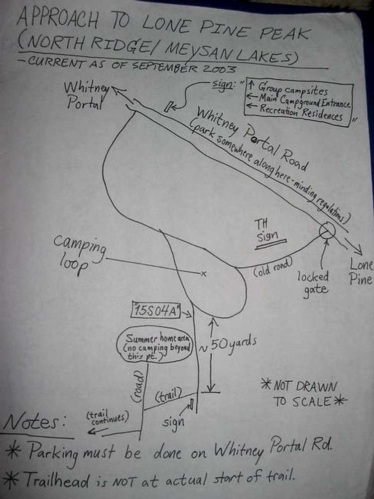
Approach map to Lone Pine...
View High-Resolution Image
Approach map to Lone Pine...
Approach map to Lone Pine Peak- this is presented to climbers in hopes of preventing the wasted time I had in actually getting to the mountain
« PREV
NEXT »
Diggler
on
Oct 24, 2004 10:05 pm
Comments & voting
Other parents
Lat/Lon:
36.56170°N / 118.224°W
Image ID:
75368
2277 Hits
74.01
% Score
4
Votes
Log in to vote
Comments
No comments posted yet.
to post!
Don't have an account?
Lone Pine Peak
(Mountain/Rock)
« PREV
Viewing
#141 of 260
GALLERY
NEXT »
Diggler's Image Gallery
« PREV
Viewing
#477 of 946
GALLERY
NEXT »
×
You need to login in order to vote!
User Name
Password
Remember me
Forgot your password?
Log me out when I close my browser.
Keep me logged in all the time.
sign in as a user
Don't have an account?
Register now for FREE
Rating available
Suggested routes for you
People who climb the same things as you
Comments Available
Create Albums
Register Here


