Toggle navigation
Mountains
Routes
Images
Trip Reports
Forum
What's New
People
Areas & Ranges
Articles
Trailheads
Canyons
Huts & Campgrounds
Albums
Logistical Centers
Fact Sheets
Lists
Custom Objects
Gear
Plans & Partners
WELCOME TO SUMMITPOST
SIGN IN
REGISTER
Eagle Lake Buttress
Additional Parents
Mountaineer's Route
Image
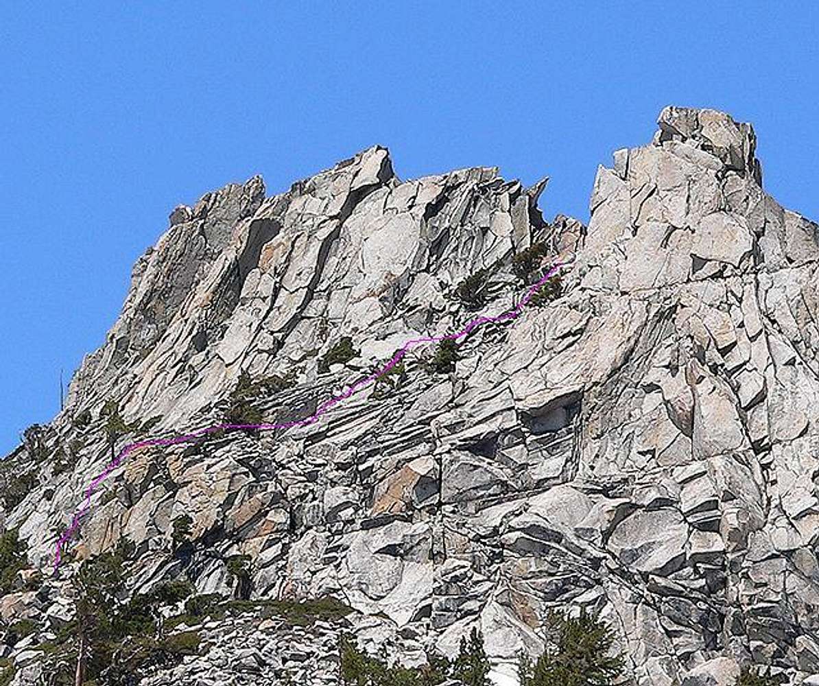
Approximate route leading to...
View High-Resolution Image
Approximate route leading to...
Approximate
route leading to class 4 slabs. Many variations of this route are possible. The summit block is on the right. May 30, 2005.
« PREV
NEXT »
Dave K
on
Jul 6, 2005 1:21 am
Comments & voting
Other parents
Lat/Lon:
38.95030°N / 120.1365°W
Image ID:
113644
6392 Hits
76.02
% Score
7
Votes
Log in to vote
Comments
No comments posted yet.
to post!
Don't have an account?
Eagle Lake Buttress
(Mountain/Rock)
« PREV
Viewing
#9 of 16
GALLERY
NEXT »
Dave K's Image Gallery
« PREV
Viewing
#55 of 114
GALLERY
NEXT »
Mountaineer's Route
(Route)
Loading....
×
You need to login in order to vote!
User Name
Password
Remember me
Forgot your password?
Log me out when I close my browser.
Keep me logged in all the time.
sign in as a user
Don't have an account?
Register now for FREE
Rating available
Suggested routes for you
People who climb the same things as you
Comments Available
Create Albums
Register Here


