|
|
Mountain/Rock |
|---|---|
|
|
39.70240°N / 44.29910°E |
|
|
Turkey |
|
|
Mountaineering |
|
|
Spring, Summer, Fall |
|
|
16854 ft / 5137 m |
|
|
Overview
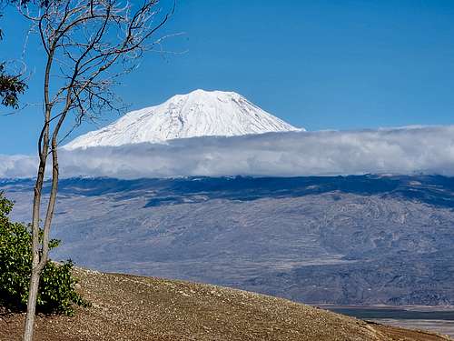
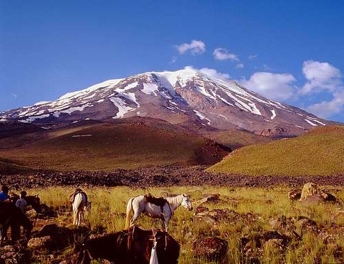
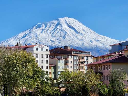
Mount Ararat, or Ağrı Dağı (mountain of pain) as it is often known in Turkey is a huge stratovolcano and the highest mountain in Turkey. For many traditional believers of the Bible Ararat is considered to be the rest place of Noah's Ark after the Great Flood, though the Bible isn't specific on which of the "Mountains of Ararat" the ark is supposed to have landed. Nevertheless, numerous expeditions have been organized to find the ark and you will hear many claims of various groups who have found pieces of the ark. You can even find and visit a boat shaped rock formation (Durupinar) in the hills just north of the mountain that is claimed to be the petrified remains of the ark.
Although the story of the ark is indeed fascinating, it isn’t the only attraction of this mountain. It’s an impressive mountain on its own as it towers far above any other mountain in its vicinity and stands in splendid isolation from other large peaks. If you are lucky enough to have minimal haze on your views from the summit you can see into at least five different countries and allegedly a sixth. The ancient history, ruins (especially at Van and Ani), and culture are all fantastic attractions so I'd plan on staying longer and doing more than just climbing the mountain.
The name Ararat has been in use since at least the 13th century BC and is what the Assyrians called the Uraratu Kingdom and is thought to mean the “mountain of mountains”.
Other ancient names for the mountain are Marsis or Massis (worthy of reverence) to the Armenians and Tanniz from the Semitics.
The name Ağrı for the mountain has been in place for more than 1000 years and some claim that it is a Yakut word for “great god” while others claim that it has roots from the word Ağra which in itself is a corruption of the village of Ahora located on the northeast slopes of the mountain. Now days the Turkish translate for Ağrı is pain, leaving the true meaning behind the word lost in the mists of history.
Locals told me that the Turkish government uses the name Ağrı Dağı to spite the Armenians who call it Ararat, but whether this is just legend or folklore is something I don’t know.
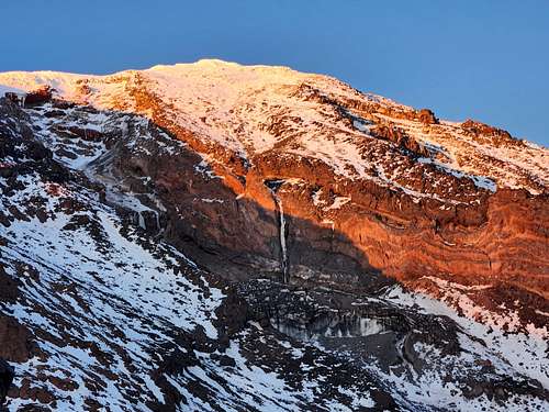
The volcano last erupted in 1840 and although quiet now is not considered to be extinct by any means. The peak has a shrinking icecap and several glaciers.
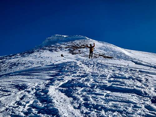
By mountaineering standards, the mountain isn’t a difficult climb for a 5000+ meter peak, but it does have a high failure rate and does seem to attract its share of beginner mountaineers.
Since the peak sits next to the sensitive border of Turkey, Iran, Azerbaijan, and Armenia, independent climbing is not allowed, and all climbers must go with an organized group. On the plus side this tends to be a lot less expensive than it is in a lot of other countries.
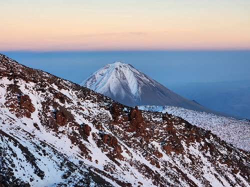
The most impressive side of the mountain and the side that has much more glaciation is the north side, but it is currently closed as it Ararat’s little sister peak known as Little Ararat or Küçük Ağrı Dağı.
The mountain was first climbed in 1829 after many failed attempts. Now days (at least when the mountain is open) Ararat is climbed very often despite the pseudo adventure/history shows that make it look like a difficult expedition where everything goes wrong and few ever reach the summit.
Elevations commonly listed for the mountain are 5137 meters (16,854 feet), 5165 meters (16.946 feet), and 5185 meters (17,011 feet). The figure 5137 is probably the most accurate and it is possible that some of the other surveyed elevations were accurate when the mountain had a larger ice cap.
Getting There
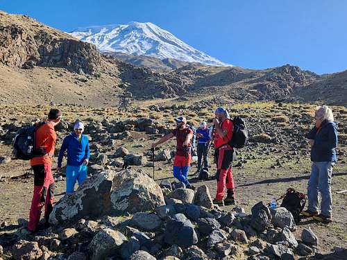
As mentioned, independent climbs of Mount Ararat are not allowed, so pretty much everyone meets in Doğubayazıt.
Shuttle buses meet at all flights to Ağrı and Iğdır so getting to Doğubayazıt is easy. Ağrı and Iğdır both have regular flights from Istanbul. Overland travel is possible as well, but takes much longer.
Once in Doğubayazıt it's about an hour or so get to the trailhead whcih is located near Çevirme Village. It is possible to drive to or at least very close to Camp I as well, but nearly everyone walks this section which aids in acclimatization.
Routes Overview
As of 2023 only the South Route is open, but historically other routes have been used.
South Route
As of 2023, this is currently the only route open to climbing Mount Ararat. It is also the easiest route on the mountain and can be crowded from early July to early September. Ice axes are usually not needed during the standard climbing season, but crampons and poles should be considered mandatory.
The route is usually done in four or five days, but can be done in as little as three for the acclimatized.
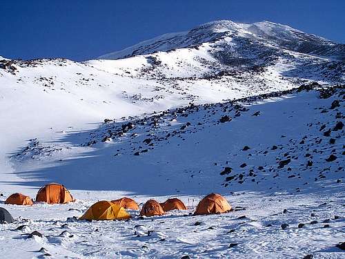
Day 1 is usually started near Çevirme Village at 2150 meters elevation, but now days high clearance vehicles can be driven to Camp I from a road from the south. Most people walk the trail from near Çevirme Village which is a good idea for acclimatization. Camp I is at 3200-3300 meters, depending on where you camp. The hike to camp usually takes 3-5 hours and is at at pretty gentle grade.
Day 2 is usually used as an acclimatization day hiking to or towards Camp II.
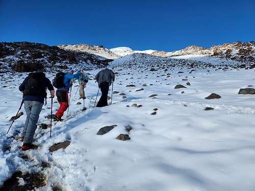
Day 3 is usually used to hike from Camp I to Camp II. In season, horses can carry gear to Camp II. Camp II is at 4100-4200 meters depending on where you camp. If all the campsites are full, sometimes a lower camp is used. The hike from Camp I to Camp II takes most climbers 3-4 hours and is steeper than the previous day.
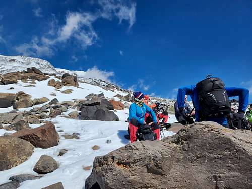
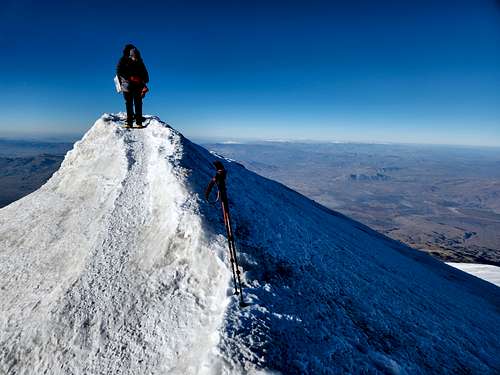
Day 4 is usually spent on the ascent and descent. Sometimes an extra day is spent on the descent. The glacier (which is retreating rather rapidly) currently begins at about 4850 meters at which point crampons are needed.
Southeast Route
This route offers a less crowded alternative to the South Route, but is currently closed (2023). If it does reopen, this might be an attractive route to take since it would make a nice combination with a climb of Little Ararat (also closed as of 2023). The route begins at the village of Güngören (200 meters) and camps used are at 3500 and 4300 meters.
North Route
For mountaineers this is a more interesting route than the south side of the mountain, but it is currently closed (2023). If it does reopen, the route starts at Iğdır Korhan Plateau and has two camps, one at 3400 meters and one at 4250 meters. Mules can reach 3700 meters, but no higher.
Unlike the southern routes, a rope and ice axe are mandatory for a safe ascent. Most climbers take 4-5 days on this route.
Red Tape
Since this is a sensitive border region with Iran and Amermenia, no independent climbing is allowed and all climbers must go with an approved outfitter. There are many outfitters that can organize the climb from Doğubayazıt. Pay attention to their online reviews before choosing a company. Most operating on the mountain are reliable. They will arrange your permit for you. I went with Two Ararat since they were the only operator doing climbs in October, but there are other reliable companies around as well. As of 2023, permission was easy to get, even with short notice as long as you use a guiding company.
Camping
Since you are required to take a guide, all camping arrangements will be made for you.
Please make sure your guiding service leaves a clean campsite as trash is a problem at the campsites, especially Camp II.
In July, August, and early September, a -10C (14F) sleeping bag is recommended. You will need a warmer bag in other seasons. Mak
When to Climb
Early July through early September is the normal climbing season and also the most crowded.
June can be good but is wetter than July and August. September can also have good weather and conditions, but by the middle of the month the weather has a less chance of being clear and the weather is noticeably colder.
Next to spring, October is the wettest time of year, but ascents can be made then and that’s when I climbed the mountain. It is cold then though. Currently, no outfitters seem to do the climb after mid-October.
March and April are increasingly popular for skiing and have the best ski conditions. Go prepared for cold weather then.
Things start to warm up in May, but it’s the wettest month so go prepared for possible snow and bad weather. This is still a pretty dry area though, so climbs are still possible then.
From mid-October through February it seems all the outfitters have pulled off the mountain, but you may be able to organize a private group. Obviously, going this time of year requires a higher level of experience.