
|
|
Mountain/Rock |
|---|---|
|
|
33.76310°N / 110.9499°W |
|
|
Gila |
|
|
Spring, Fall |
|
|
6652 ft / 2028 m |
|
|
Overview
Asbestos Point is located in the Sierra Ancha Mountains east of Roosevelt Lake. It is very accessible and offers an excellent day hike. It can easily be combined with nearby Zimmerman Point 6,871’, which isn’t prominent on its own, but has a USGS benchmark. Zimmerman Point is located at 33.7640°N, 110.9346°W.
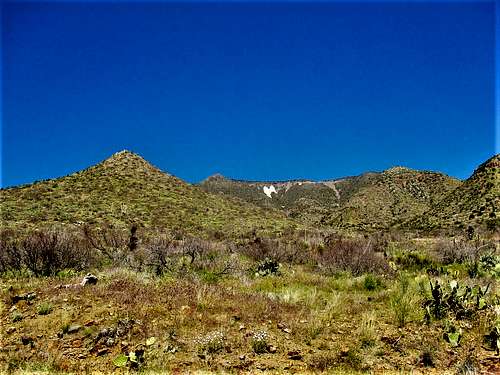
Asbestos Point is so-named because of an asbestos mine that opened in 1915 and was ultimately closed during the early 1960s. A white slide of rock nearly 500’ high is located below the summit, and is visible for many miles around, making the mountain distinctive.
The base of the forest road up to Asbestos Point is about 1h 45 minutes from Mesa, Arizona and at least two hours from downtown Phoenix. However, despite being a decent drive from the Phoenix metro area, the area definitely sees traffic. Visitors rarely visit Asbestos Point itself. The road veers to the right about 300 yards from the summit, so hikers need to get off the road there and walk through the woods. The summit itself requires a short, but steep bushwhack up the last 80’.
If done carefully – as explained below – one can add Zimmerman Point with a little over 1 ½ miles of additional hiking with some low-to-moderate bushwhacking.
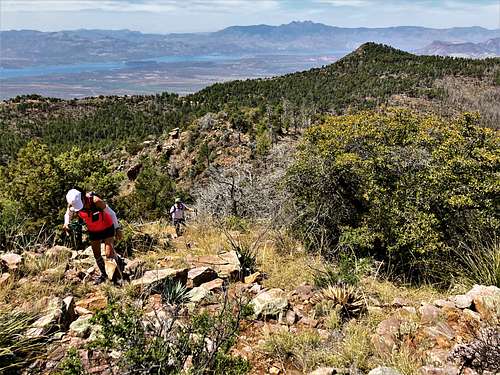
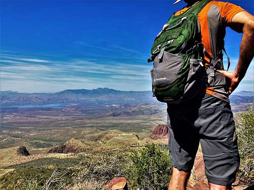
Despite only having a prominence of a little over 300’, Asbestos Point offers spectacular views, including unobstructed views of Roosevelt Lake and the surrounding mountain range. The Sierra Ancha Range is a lot prettier than nearby ranges, which terraced mountainsides and colorful rocks.
The best time to hike into the Sierra Ancha Range is spring and fall. Snowfall may occur during winter months, and it can get pretty cold. Summers can be oppressively hot. March-May and October-November are the best times.
Getting There
From Phoenix, get on US 60 East which goes through Mesa, then Apache Junction, after which it becomes more rural and continues towards the town of Globe. Before entering Globe, take AZ-188 North for about 14 ½ miles to AZ-288. Continue for 18.5 miles north to FR 489. You can either park on FR 489 or just park at a couple pull outs on AZ-288 just before reaching FR 489. FR 489 gets pretty rough, although 2WD can make it up to the first pull-out options.
Another option from North Scottsdale or North Phoenix is to take the Beeline Highway north, and then south on AZ-188 to Roosevelt Lake and then to AZ-288. The drive can be done as a loop. However, unless you live in Fountain Hills, the shortest route is via US 60 East.
Route Information
From the start of FR 489, it is about 3 miles to the road to Asbestos Point. The road passes some waterfalls, which may or may not be flowing depending on precipitation levels. There is plenty of evidence of mining activity along the way. Finally, the road comes out towards an edge with an overlook to Roosevelt Lake.
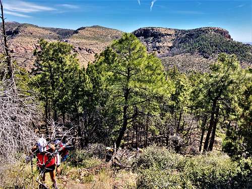
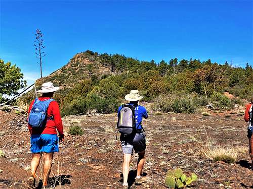
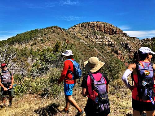
Just before the edge, there are a couple side roads. One to the left going uphill and one to the right relatively flat. Take the road to the right. It curves around and goes to the top of the ridgeline. It soon opens up, and there is a very clear view of Asbestos Point. Continue up the road until it veers to the right. Get off the road and go straight into the forest and head towards the right side of the summit. It is easier to go through the forest than straight up to the summit because there is less brush. When visiting in April 2022, a fire that occurred in 2021 appeared to have thinned the forest a bit, with the only challenge being some fallen trees. However, even with growth, the route through the forest is relatively open.
Once at the base of the summit, it is pretty steep, but short. Only 80’ of gain is required to reach the summit. There is a kind of steep zig-zagging game trail mitigating the steepness.
Once at the summit, enjoy the spectacular views. There is nearly 2,000’ of gain from the bottom of the road to the summit and about 3 ½ miles of distance one way. It is a little over half a mile from the turn off from FR 489 to the summit.
Zimmerman Point
If wanting to add Zimmerman Point, return to the saddle and take the road going uphill. It swings around for about half a mile and ends at a viewpoint with Zimmerman Point front and center in view.
Drop into the forest and head up to the base of a hillside. It is 280’ to the top of the hillside, at which point, it drops down about 10’ to a saddle. Granted, you may go up and over not at the exact top. Like with Asbestos Point, you can approach from the forested portion that might be slightly more open. Ultimately, the brush isn’t that bad, and it depends on how much growth there is at the time.
To reach the summit, it is another 175’ and the summit is on the right edge.
Over the course of the ascent, there is an old fence that you may cross over. However, it isn’t an obstacle, and easy to just stay to the left of it the whole way up.
On the descent, if you have GPS, you can follow back to FR 489 instead of the saddle. That will save at least ¾ of a mile than if going back the way you came.
Zimmerman Point adds an additional 575’ of gain to the hike.
Red Tape
There is no red tape of note. The trailhead and the land are within Sierra Ancha Wilderness, which is National Forest land.
Camping
There is primitive camping in the Sierra Ancha Wilderness. A few campsites are located on the way to Aztec Peak and there are campsites adjacent to AZ-288 north of Asbestos Point. There are spots to camp along FR 489, but no amenities.
External Links
Scott Surgent Trip Report: http://www.surgent.net/highpoints/az/range/asbestos.html
Hike Arizona: https://hikearizona.com/decoder.php?ZTN=15804