Overview
Ashdown Gorge sits to the west of
Cedar Breaks National Monument in southwestern Utah. The many creeks that drain the huge amphitheater of Cedar Breaks join to create the 3 mile long Ashdown Gorge near Route 14 to the east of Cedar City, UT. Many sources talk about Ashdown Gorge as a one way hike from Rattlesnake Trailhead to the north of Cedar Breaks to Route 14. Such a one way hike requires a car shuttle and most of it falls outside of Ashdown Gorge. What I have described here is a hike from Route 14 up Ashdown Gorge into Rattlesnake Creek Gorge and Lake Creek Gorge to dead end at two beautiful waterfalls.
If you plan to do this hike, you better be ready to wet your legs and feet. You will be crossing the stream countless times. I did the hike in early September when the water was not cold and was generally no more than 12 inches deep. All I needed were shorts, a pair of old gym shoes and hiking poles. The hiking poles were in my opinion essential. If the water is colder or deeper, the hike will obviously become much more difficult. Do not go into the gorge if there is any chance of precipitation/snowmelt in or upstream of the gorge. You will have little chance of surviving a flash flood should it occur.
I had thought of continuing up Ashdown Creek (instead of going into Rattlesnake Gorge) to reach the bottom of Cedar Breaks Amphitheater but given the distance and the likely bushwhacking needed, I suspected that this might be best done as an overnight backpacking trip.
Flanigan Arch is supposedly visible from Ashdown Gorge. Unfortunately, I did not see it.
![Ashdown Gorge]() Map
Map |
Getting There
Please note that Route 14 does not have a direct exit off of I-15.
In Cedar City, Utah go to Exit 57 and turn onto Route 130 (South main St.) north (east). Follow this road roughly 2 miles to near downtown Cedar City and turn east onto Route 14. Drive Route 14 around 8 miles east and look for a dirt pull-off on the left (north) side of the road. There is plenty of room to park. This area was the site of a massive landslide in 2011.
Some sources talk about a dirt road that goes down to reach the creek. If such a road ever existed, it has likely been wiped out by the 2011 landslide.
The Hike
My GPS did not work in this gorge. Instead of distances, I will mention my hiking times.
| Place | Elevation | Hiking Time |
| Route 14 | 7200 ft | - |
| Stream | 7050 ft | - |
| Ashdown/Rattlesnake Creek Split | 7380 ft | 1:50 hrs |
| Rattlesnake/Lake Creek Split | 7580 ft | 0:30 hrs |
| Lake Creek Waterfall | 7600 ft | approx. 5 minutes |
| Rattlesnake Creek Waterfall | 7600 ft | approx. 5 minutes |
| Total Roundtrip | - | 4:45 hrs |
| Total vertical uphill | 700 ft | - |
Where you parked on Route 14 is 150 ft above the stream. You may actually have to go down a little before you can see the stream.
To the east, Point 8736 ft and to the north Point 8445 ft will be visible.
![Point 8736 ft]() Point 8736 ft
Point 8736 ft | ![Point 8445 ft]() Point 8445 ft
Point 8445 ft |
Go down the slope to reach the stream. You will be descending down the debris field from 2011 landslide (When I was there in 2013, the debris was mostly soft dirt mixed with boulders).
Almost immediately, you will likely have to cross the stream. Turn east and follow the stream uphill. You can look back to see the road above.
![Route 14]() Route 14
Route 14 |
The remains of old crashed vehicles may be visible.
![Old crashed car]() Crashed vehicle
Crashed vehicle |
For the first 0.75 miles or so the canyon is fairly wide. Maps show two small streams coming in from the right. At both junctions go left.
You will soon enter the narrows.
The canyon will then open up. A monolith known as Tom’s Head will come to view. This marks the junction of Ashdown Creek on the right with Rattlesnake Creek on the left.
![Toms Head]() Toms Head
Toms Head |
Turn left, enter the canyon of Rattlesnake Creek and follow it uphill.
After half an hour you will reach another split, Lake Creek on the left and Rattlesnake Creek on the right. Hike up the canyon of Lake Creek just a few minutes to dead end at this waterfall. You can potentially go in the alcove behind the waterfall.
![Lake Creek Waterfall]() Lake Creek Waterfall
Lake Creek Waterfall |
Go back to the junction and hike up the Rattlesnake Canyon a few more minutes.
You will soon reach this waterfall.
![Rattlesnake Creek Waterfall]() Rattlesnake Creek Waterfall
Rattlesnake Creek Waterfall |
Red Tape
No fees or permits needed for day hikes. Ashdown Gorge is a designated wilderness.
Weather Forecast
See the forecast for the nearby
Cedar City.
External Links
http://www.clubtread.com/routes/Route.aspx?Route=1001.

 Map
Map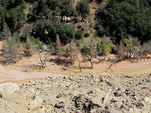
 Point 8736 ft
 Point 8445 ft
 Route 14
 Crashed vehicle


 Toms Head


 Lake Creek Waterfall


 Rattlesnake Creek Waterfall