
|
|
Mountain/Rock |
|---|---|
|
|
48.86670°N / 121.74213°W |
|
|
Whatcom |
|
|
5763 ft / 1757 m |
|
|
Overview
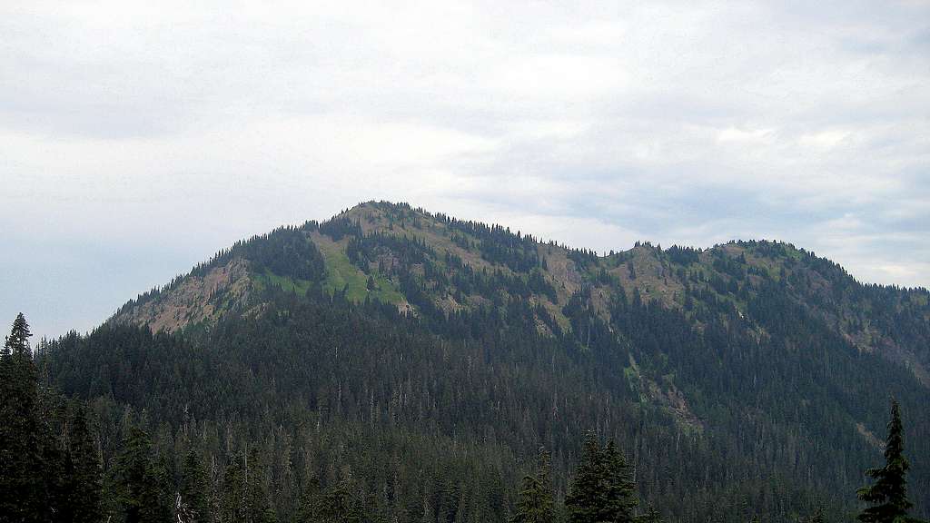
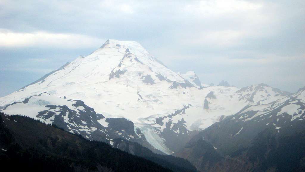
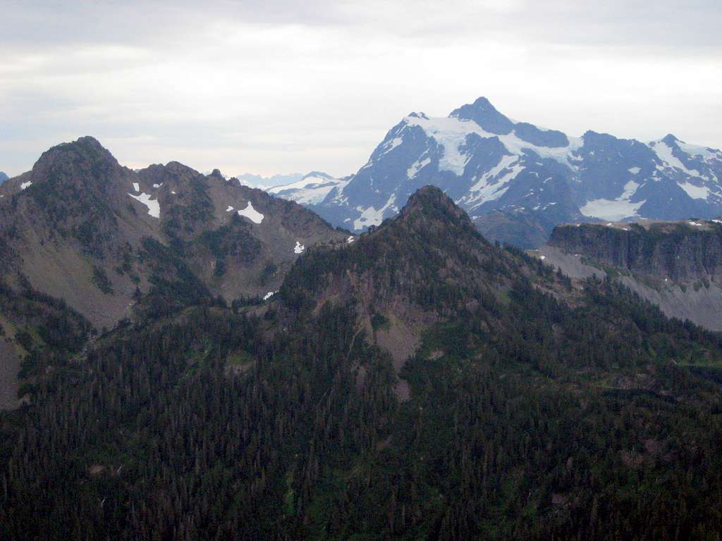
Barometer Mountain is a 5763' (1063' prom.) peak located seven miles northeast of Mount Baker, and 2.6 miles northwest of Artist Point. While not a particularly attractive mountain visually, it does have the distinction of being one of three peaks (along with Mount Herman and Mount Ann) in the Artist Point area to have more than 1000' of prominence.
I will be perfectly honest: I cannot with a clear conscience strongly recommend Barometer Mountain as a stand alone objective. For significantly less effort, one could ascend any one of a half dozen other peaks in the area that offer superior views. Having said that, it may have just enough prominence to tempt local peakbaggers, and it may be just the ticket for those with extra time in their day allowing for a '2fer'.
Getting There
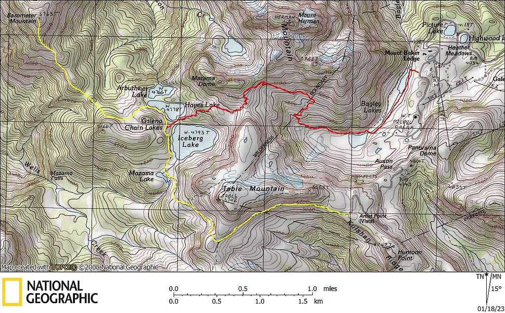
Barometer Mountain can be approached from the Bagley Lakes trailhead, or preferably, the Artist Point trailhead if the road is open. Note that these two trailheads mark the ends of Trail 682, which forms the 6.7 mile Chain Lakes Loop. For both trailheads, simply follow the Mount Baker Highway (SR542) to it's end. From Interstate 5, SR 542 begins at Exit 255. For those approaching from points south, it may be advantageous (and shorter) to cut across via SR20 at Burlington to SR9, then follow SR9 north to rejoin SR542 near Deming.
The Bagley Lakes trailhead is located on the west side of a counterclockwise, one-mile loop that encircles Picture Lake and vicinity. For the Artist Point trailhead, locate the side road just beyond the Bagley Lakes trailhead, and follow it 2.6 miles to the end. Please note that the road to Artist Point is closed for much of the year, particularly in heavy snow years.
Route
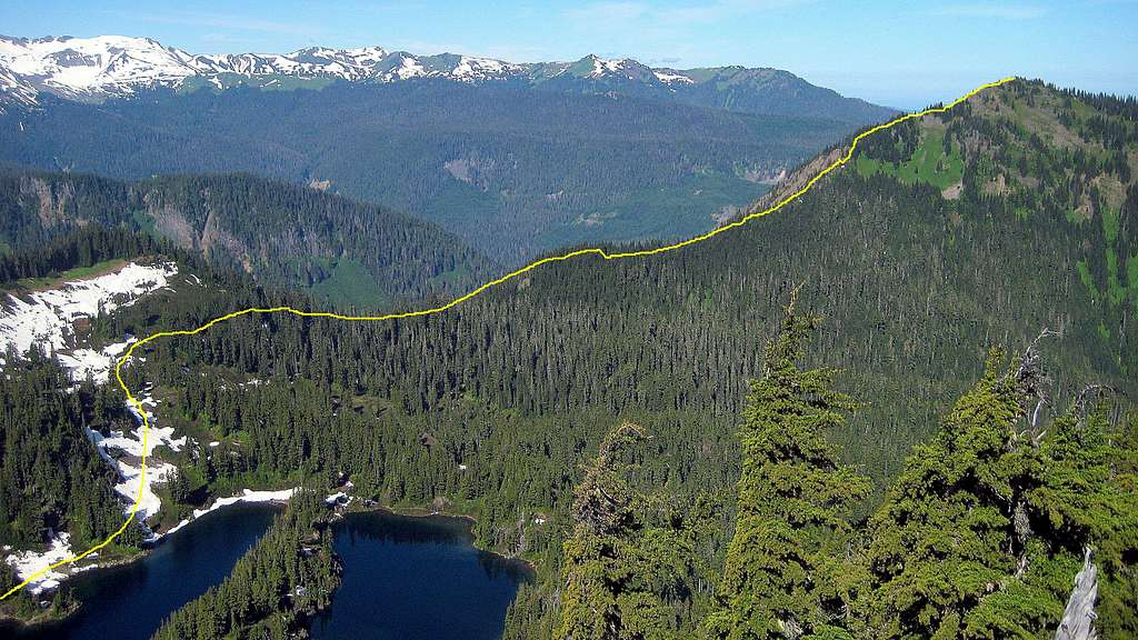
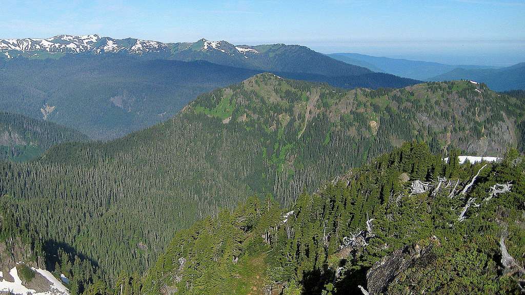
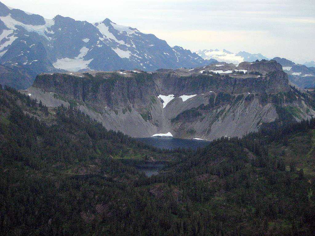
Assuming you made it to the Artist Point trailhead, follow trail 682 for 1.2 miles to it's junction with Trail 683 (Ptarmigan Ridge Trail). Stay right, and continue on Trail 682 for 1.5 miles (losing over 400' of elevation in the process). At this point, you will be on the northwest side of Iceberg Lake (est. 4860'). From this point, a side trail will lead northwest along the south shore of Hayes Lake. Alternatively, one could hike from the Bagley Lakes trailhead approximately four miles to arrive at this same point. Note that this approach adds additional distance and elevation gain, but may be necessary if the road to Artist Point is closed.
Hike northwest along the south shore of Hayes Lake (ignoring the turnoff to Galena Camp) for approximately 1/4 mile, at which point you will see an open talus slope leading southwest.
From this point, travel southwest approximately 1/4 mile (gaining roughly 100' in the process), then turn right and begin a near level traverse to join Barometer Mountain's Southeast Ridge.
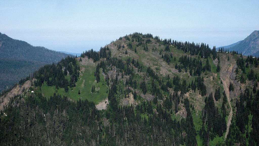
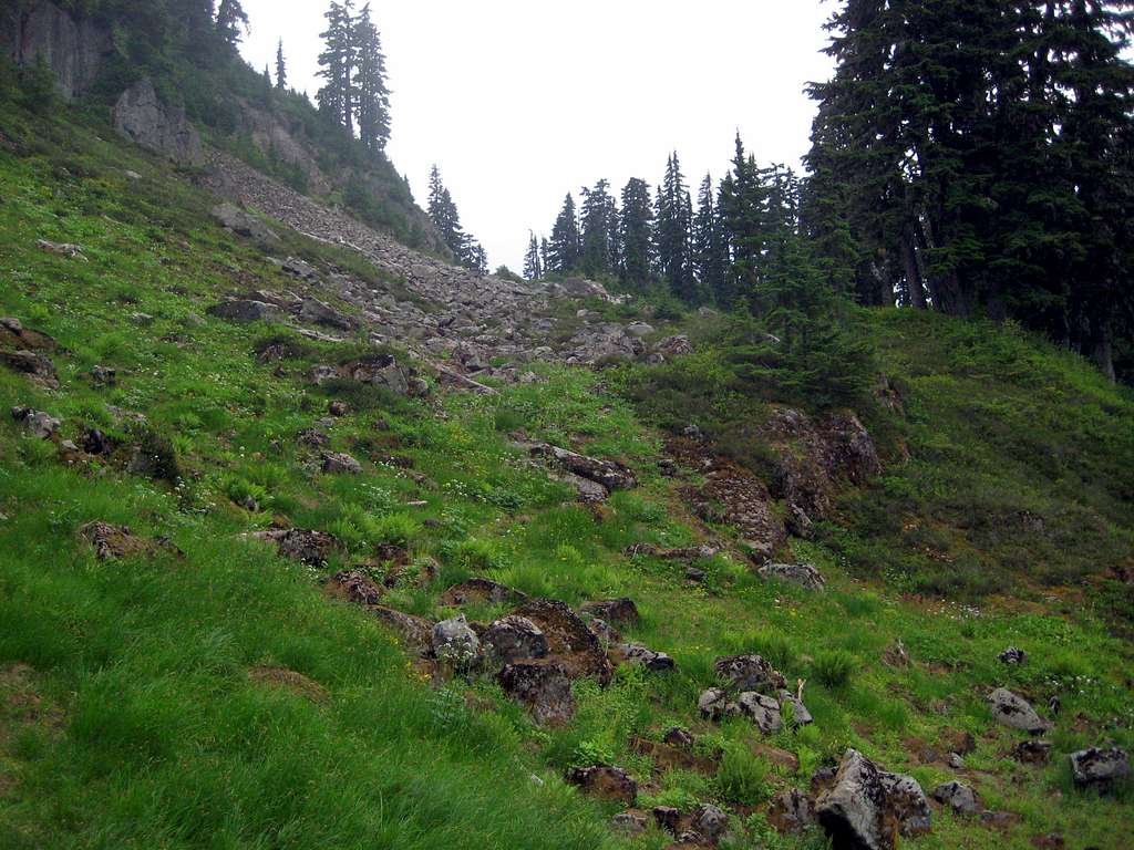
While the traverse and initial ridge crest will present a little brush (I'll give it a 3 out of 10 on the Cascade bushwhacking scale), by the time you reach the 4700' saddle (about 0.7 SE of the summit) you should begin to notice a fairly well-defined and helpful game trail. Between 4700' and 5000', the game trail will be primarily on the left (southwest) side of the ridge. At about 5000', as you begin to start noticing steeper terrain directly ahead, it will be necessary to turn right, and scramble straight up to about 5200' to rejoin the crest of the Southeast Ridge. A little bit of rocky scrambling will be encountered between 5200' and 5400', but nothing that is too difficult or exposed.
A little more rocky scrambling will be encountered from 5600' to the summit area, but again, nothing harder than class 2.
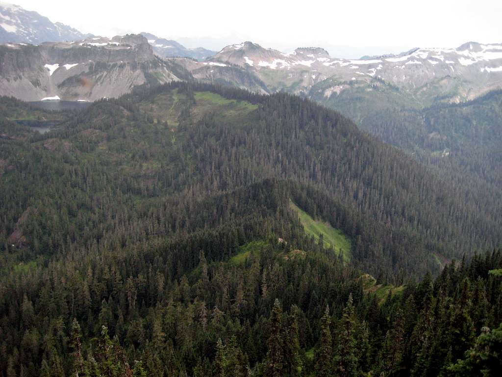
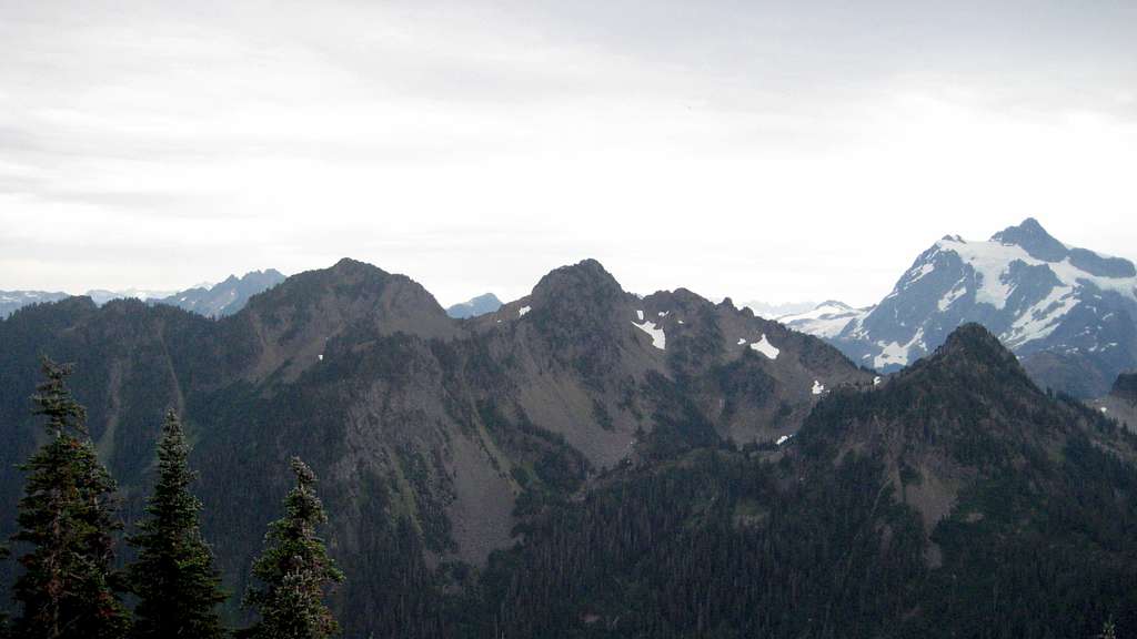
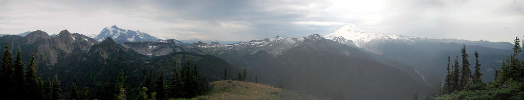
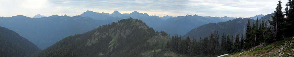
Despite a few scrubby trees at the summit, Barometer Mountain is well-positioned for nice views. Unfortunately for us, a poorly timed rain squall spoiled the overall quality of our summit photos. If you happen to have some better summit pics in your possession, please feel free to add them to the gallery. Note that you will have to visit two different locations at the summit to take in the full 360 degree view, but the distance between these two points is less than 100'.
Red Tape
A Northwest Forest Pass will be required for both the Bagley Lakes trailhead and the Artist Point trailhead.
When to Climb
Because the Mount Baker Highway is plowed in the winter, one can access this area year round. Please use common sense as it relates to avalanche conditions for winter and early spring activities in this area.
Camping
There are a number of camping locations located along the Mount Baker Highway for those wishing to car camp in this area. There are also a large number of possible camping locations at any of the four lakes encountered on the Chain Lakes Loop.