Getting Over Baxter Pass
After a night’s rest at Lone Pine’s Dow Villa, I followed Paul Fretheim with the East Side Sierra Shuttle to the Sawmill Pass Trailhead parking area at 6:30 in the morning. It was a monsoonal, cloudy day — one that had replaced seriously smoky conditions of only a few days previous. The plan was to leave my vehicle at Sawmill where I’d exit the park in one week after entering Kings Canyon over Baxter Pass.
Baxter, like Sawmill, is one of four Eastern Sierra high desert passes entering Sequoia Kings Canyon. The highest of the four, Baxter Pass crests at ~12,300 feet in elevation with a trailhead beginning at 6,030 feet. I find the high-desert passes a better way to acclimate relative to the more popular eastern sierra alternatives with trailhead elevations closer to 9,000 feet. Baxter does have a reputation for being one of the more difficult park entrances given the 6,300 feet of elevation gain and a poorly maintained trail that can be spotty in places. It is also the only high-desert pass not recommended for stock travel.
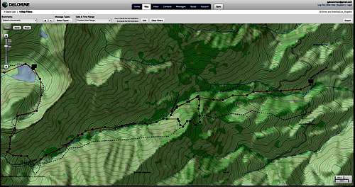
After Paul's drop off, I was on my way by 7:45 A.M. I had 10 miles separating the trailhead from a planned campsite near the shores of Baxter Lake. Conservatively, I estimated the first campsite could be reached in seven hours under a full pack (53 pounds). The plan was to spend two nights in Baxter Lake Basin acclimating and resting, two nights in Sixty Lakes Basin, followed by two more at Window Peak Lake, and a day-seven Sawmill Pass exit. I had never visited Sixty Lakes and looked forward to exploring the area. In 2012, I did visit Window Peak and looked forward to revisiting what is a uniquely pristine and beautiful location.
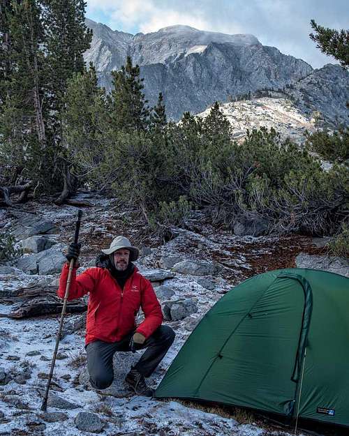
Using a Delorme PN-60w GPS preloaded with waypoints utilizing Topo North America software, I assumed any fading trails here or there would be easily overcome. However, I was soon to understand that the mapping software loaded into my GPS showed a trail that no longer existed or possibly never existed. So when the time came to confirm my location, I was not inclined to doubt my GPS. I had thought that I was navigating just fine only to find the GPS indicated a location well below the intended trail as defined by Topo North America mapping software. I surmised the current trail was one for day hikers enjoying a creek-side day hike. Under a cloud of frustration and confusion, I set about climbing and backtracking for some two to three hours in what became an effort in futility… stumbling at times in extremely steep, off-trail terrain, dislocating my left index finger, and suffering stinging nettle burns... I finally concluded something was clearly amiss and my GPS waypoints could not be relied upon. I had been laboring for nearly five hours only to reach 8,500 feet! In a misguided attempt to find what was a phantom trail, I had wasted a great deal of energy ascending and then descending an additional 2000 feet only to accomplish a time-consuming circle. To make matters more frustrating, after ducking under fallen trees, climbing around off-trail boulders and attempting to dodge the stinging nettles encountered on each additional creek crossing, I had lost my sunglasses and wristwatch. I had effectively been chasing my tail. I was hurt, burned, and feared what I had gotten myself into. I was about ready to give up. Stubbornly determined, I labored on and did well to make the intended camp destination after 11 hours, testing the limits of my endurance. With nightfall nipping at my heels, I began suffering from severe indigestion. After squeezing in a lakeside sponge bath (talk about goose bumps!), I erected my tent and prepared a hot meal just in time for the first wave of nausea to hit. Four times I vomited. That night’s mac-n-cheese dinner was to become tomorrow’s breakfast. The vomiting did relieve what was becoming an increasingly painful case of indigestion. Exhausted, I slipped under the cover of tent and sleeping bag before stumbling into a restless and sleepless night.
![Chasing my Tail]() Ouch!
Ouch!
One noteworthy observation regarding Baxter Pass is the uniquely stark beauty encountered upon entering its western side not far beyond the summit. The shear 1,000-foot cliffs formed by the ridges defining Mount Baxter are of a rust red and black color. In the light of dusk, a glowing beauty transformed the landscape that easily penetrated the fog of my exhausted state. Under the right conditions, photographing the west side of Baxter would make for an outstanding landscape composition… maybe another trip?
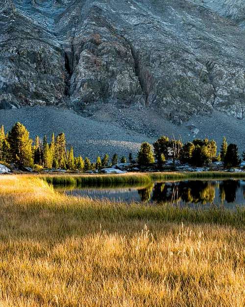
![Baxter to Sawmill 4]() Baxter Lake Basin
Baxter Lake BasinSixty Lakes Basin
The remainder of my stay went smoothly. Two nights in Sixty Lake Basin became three. I had the perfect campsite with fantastic views. Landscape photography is always a primary objective, but I also enjoyed an incredible visitation by no less than ten Mountain Bighorn Sheep. The sheep had walked into an area where I was resting and admiring the landscape when I looked up to see them pass by without them being aware of my presence. I counted all 10 as they passed beyond a granite outcrop leaving me spell bound and mumbling. To my amazement, the mumbling brought them back to investigate. It was an incredible encounter with all ten of them crowded together in a tight bunch starring at me from a distance of about 40 feet for 10 or 15 seconds before trotting off in the direction from where they had come. What a photograph it would have made had my equipment been set and ready. It was the
single most exciting wildlife encounter I’ve ever experienced in SEKI. It was awesome!
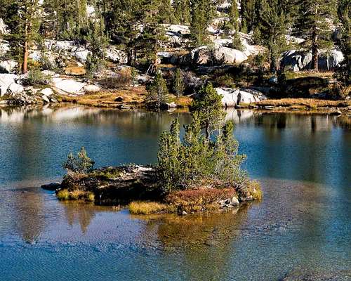
Sixty Lake Basin
![Sawmill to Baxter 1]() Sixty Lake Basin
Sixty Lake BasinHeaded Home
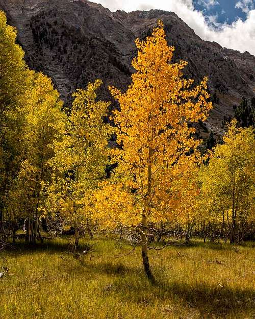
Skipping the originally planned Window Peak campsite, I instead opted for a final night alongside Woods Lake below Sawmill Pass on day six. The itinerary change would bode better for dividing what was roughly 26 miles remaining between Sixty Lakes and my vehicle. The Sawmill-Pass exit on day 7 was met with morning snowfall and one of the season’s first significant cold fronts. I enjoyed splashes of a golden autumn on the east side along with stormy skies enveloping Owens Valley. Although I can’t claim any great success in terms of “fine art” landscape photography, I can mark Baxter pass off what is becoming a short list of must-see locations surrounded in the beauty of Sequoia and Kings Canyon National Park.
![Baxter to Sawmill 3]() Woods Lake Basin
Woods Lake Basin![Baxter to Sawmill 6]() Sawmill Meadow
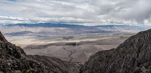
Sawmill Meadow![Baxter to Sawmill 5]() As I continued descending from Sawmill Pass after luxuriating in all of the beautiful fall color, I was soon surrounded by high desert. I setup my tripod to capture this panorama of Owens Valley on what was a pleasant stormy day... the best weather to stay cool while negotiating high-desert terrain.
As I continued descending from Sawmill Pass after luxuriating in all of the beautiful fall color, I was soon surrounded by high desert. I setup my tripod to capture this panorama of Owens Valley on what was a pleasant stormy day... the best weather to stay cool while negotiating high-desert terrain. Afterword
I had a fun observation one night, one of those “Wow” moments during the second night in Sixty Lakes. I had timed the trip for a new moon. The stars were intense, the Milky Way looked like a giant cavern. You’d get dizzy craning upside down to see its vastness. Then I saw a flashing red and white light far up in the sky. Not sure at times if it was a plane or a satellite, I watched it cover the visible sky above me for some five or ten minutes. Once out of sight, I pondered the lack of sound when the rumble started. It was amazing; the distant jet was out of sight before I could hear it. No longer do I hunt the skies for distant planes when I hear one while hiking SEKI.
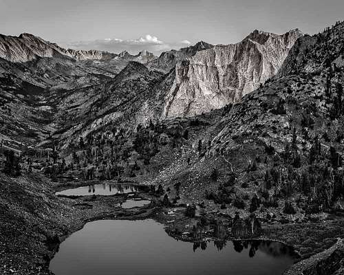
![Kings Canyon]() Fin Dome is midway into the scene with its upper reaches below the horizon. It marks the entrance into Sixty Lakes Basin.
Fin Dome is midway into the scene with its upper reaches below the horizon. It marks the entrance into Sixty Lakes Basin.
Comments
No comments posted yet.