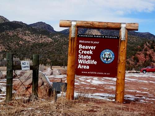
![Beaver Creek Loop Trailhead]() Beaver Creek State Wildlife Area
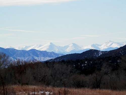
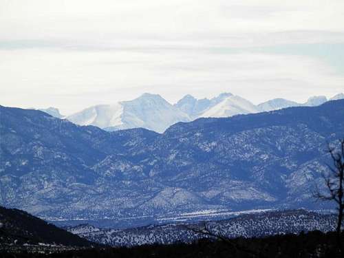
Beaver Creek State Wildlife AreaBeaver Creek State Wildlife Area is a 2228 acre area set aside for hiking, hunting and fishing. It is adjoined to the east by the much larger Table Mountain State Trust Land. There are several large information boards at the trailhead with hiking and camping information, as well as local regulations. There are no fees to use the area and there are no facilities in the area. Wildlife is abundant including deer, big horn sheep, turkey and rabbit. Views from the trail are spectacular, especially from the top of Powerline Trail where the Wet Mountains and Sangre De Cristos are visible. Due to the mild winters in the Arkansas Valley, Beaver Creek State Wildlife Area is usable nearly all year round.
Getting There
From Canon City, Colorado, take U.S. Hwy 50 4 miles east to Phantom Canyon Road/Hwy 67; left on Phantom Canyon Road 1.6 miles to CR123; right on CR123 .2 miles to CR132/Upper Beaver Creek Road; left on CR132 10.7 miles to Beaver Creek State Wildlife Area parking (end of road). Road is periodically maintained and parking is usually accessible by car.
Trails
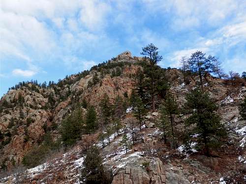
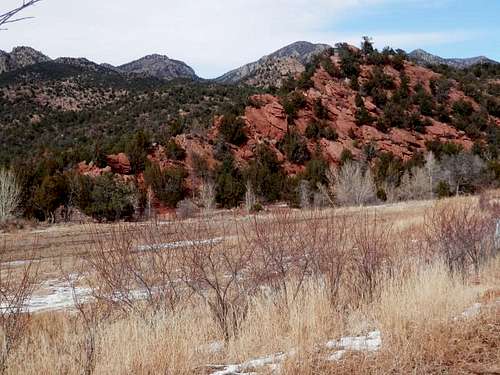
![Beaver Creek Loop]() Stunning Rock Formations and Points
Stunning Rock Formations and PointsThe trail system in Beaver Creek State Wildlife Area includes the Beaver Creek Trail, the Trail Gulch Trail, the Powerline Trail and the Beaver Creek Loop, which is composed of all three. The easiest way to hike the loop is counter-clockwise. From the trailhead, travel approximately .75 miles to the Beaver Creek Trail/Trail Gulch Trail fork. Stay to the right at the sign ("Beaver Creek") and remain on Trail Gulch Trail until you reach Powerline Trail. Powerline Trail is well marked. It begins to ascend immediately and climbs to 7436 ft. before descending to East Beaver Creek. Pictures from Powerline Trail are a must. From East Beaver Creek, travel downstream until Beaver Creek Trail is picked up again, returning to trailhead. Total loop is 6.9 miles.
External Links
http://wildlife.state.co.us/landwater/statewildlifeareas/pages/swa.aspx
http://ndismaps.nrel.colostate.edu/propertyfinder/index.aspx?keyword=public&value=Beaver%20Creek%20SWA
http://wildlife.state.co.us/SiteCollectionDocuments/DOW/Maps/RulesRegs/StateTrustMaps/TABLE_MTN_1of2.pdf
http://wildlife.state.co.us/SiteCollectionDocuments/DOW/Maps/RulesRegs/StateTrustMaps/TABLE_MTN_2of2.pdf
Photos
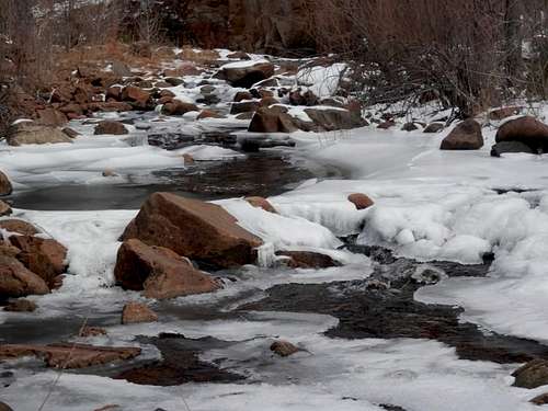
![Beaver Creek State Wildlife Area]() Beaver Creek in Winter
Beaver Creek in Winter![Beaver Creek State Wildlife Area]() Sangres from Beaver Creek Loop
Sangres from Beaver Creek Loop![Beaver Creek State Wildlife Area]() View from Trailhead
View from Trailhead

 12199 Hits
 71.16% Score
 2 Votes