
|
|
Mountain/Rock |
|---|---|
|
|
37.16141°N / 113.61959°W |
|
|
Download GPX » View Route on Map |
|
|
Washington |
|
|
Scrambling |
|
|
Spring, Summer, Fall, Winter |
|
|
3550 ft / 1082 m |
|
|
Overview
Beck Hill is one of the dominant landmarks in the western St. George (Ivins, Santa Clara) area. It is visible from UT 18, Snow Canyon Parkway, the Paradise Rim/Chuckwalla areas and more. It is an aesthetically pleasing, nicely symmetrical peak with a distinct, steep-sided black summit. It is a moderately challenging climb, with steep, exposed class 3 and 4 scrambling to reach the diminutive, satisfying summit. It can be approached from many directions, with the Cougar Cliffs area surely providing the quickest route. This is a great peak for a couple of hours of fun peak-bagging. Should definitely be on any local climbers list.
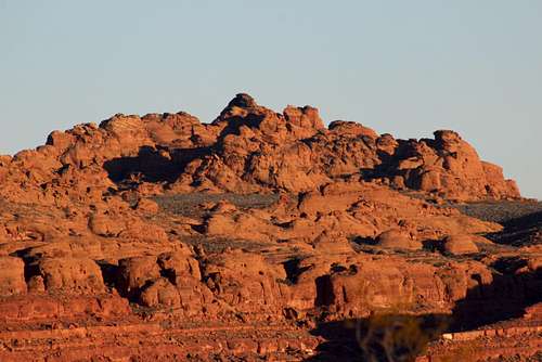
Beck Hill
Getting There
The easiest, most expeditious route to the peak would be to park at the Cougar Cliffs climbing/rappelling area on Highway 18 north of St. George. To find Cougar Cliffs, from the junction of Bluff Street and St. George Blvd, drive north on Bluff Street (which becomes UT 18 just past Snow Canyon Parkway) for just under four miles to the Cougar Cliffs, which will be in your left. Park here, walk down to the crags and then traverse northwest until an easy descent can be made to the bottom of the cliffs. From here it is an easy walk to the base of Beck Hill and the east face.
Another option, albeit longer, begins at the Chuckwalla Trailhead. To find the Chuckwalla Trailhead, drive around two miles north on Bluff, until just past the overpass at the intersection with Snow Canyon Parkway. Turn left and park in the large parking area. From here, head northwest on the Chuckwalla Trail, passing both the Chuckwalla and Turtle Rock climbing areas. Continue past several trail junctions until you are hiking the Beck Hill Trail. Despite the length, this is a pleasant hike through the desert. At about 1.8 miles, a long wooden fence will appear. The unofficial, but well-trodden trail that leads away from the Beck Hill Trail just before the beginning of the fence. Head north , the northwest on this trail for approximately half a mile, passing several washes en route. At the half-mile mark, look for a large boulder on the left. The trail up the east face begins here.
Google Maps directions to the Cougar Cliffs and the Chuckwalla Trail
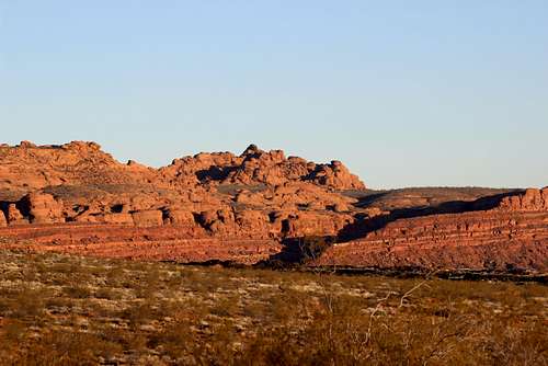
Beck Hill
Routes
North Slot Canyons (coming soon)
Red Tape
None. Just park and go.
When to Climb
Spring, fall and winter are best. Like all the crags in the greater St. George area, summertime is the absolute worst season to climb, unless a very early or evening attempt is made.
Camping
The nearest cambground is the excellent Snow Canyon State Park campground. There is BLM and Forest Service land to the north which allows for dispersed camping. In particular, the campground at the base of the Prophecy Wall near Veyo is a nice, although dry spot. When the Veyo Climbing Park is open, this is also an excellent camping spot.
External Links
Red Cliffs Desert Reserve page for the Beck Hill Trail
Ivins Weather