
-
 36464 Hits
-
 83.69% Score
-
 17 Votes
|
|
Mountain/Rock |
|---|---|
|
|
35.98970°N / 82.49°W |
|
|
Unicoi |
|
|
Hiking |
|
|
Fall |
|
|
5516 ft / 1681 m |
|
|
Overview
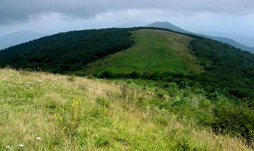
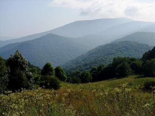
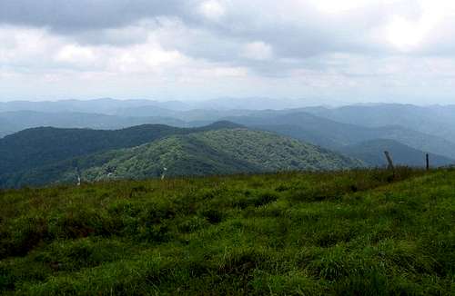
Monarch of the Bald Mountains, Big Bald offers one of the most outstanding panoramic vistas in the eastern United States. This peak - the 29th highest in Tennessee* - is the loftiest point on the Appalachian Trail between the Great Smoky Mountains and Roan High Knob.
As its name suggests, this mountain has a broad grassy summit. A gravel road ascends the northwest slopes, ending in a dirt cul-de-sac. The proximity of the mountain to resorts and cabins in North Carolina make it a semi-popular destination for adventurous motorists, mountain bikers and hikers. On weekends it is not uncommon to find a few people lounging about on the summit. Big Bald is a worthy destination with stunning views when the weather permits.
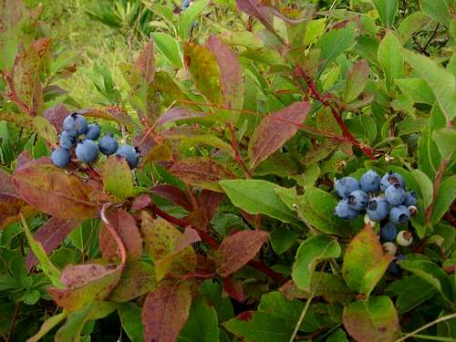
Blueberry bushes grow in thickets on the southeastern slopes and about the upper slopes of Big Bald's neighbor, 5514' Big Stamp.
Getting There
Tennessee
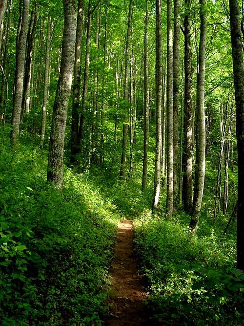
From Erwin drive south on Interstate 26 (highway 23/19W) for 7 miles until the highway splits. Follow Highway 19W east for 4 miles and cross the North Carolina border. 1 mile over the border you will find parking at the Appalachian Trail crossing. Hike southwest 6.8 miles to the summit.
OR
From Interstate 26 (Exit 18) in Erwin drive south on Interstate 26 for 20.3 miles. Take Highway 23 North for 3.1 miles to the Appalachian Trail pullout on the left side of the road, just before the Interstate 26 overpass. Take the AT NW for 5.8 miles to the summit.
North Carolina
From Asheville, take Interstate 26 north to Highway 23 North (to Faust). Take 23 to the Appalachian Trail parking lot just before the Interstate 26 overpass. Hike NW 5.8 miles to the summit.

Red Tape
No permits required to access the area or to camp. Private property bounds much of the trail to the north and south of the mountain.

Camping
Campsites are located along the Appalachian Trail at various points. Most sites are little more than a fire ring and a flat space.
Weather
Weather Report for Beech Mountain, NC. Conditions similar to Big Bald.