
|
|
Mountain/Rock |
|---|---|
|
|
35.15900°N / 83.028°W |
|
|
4200 ft / 1280 m |
|
|
Overview
Big Green Mountain is the larger of the two plutons at the center of Panthertown Valley. Separated by a high elevation bog from its sister peak, Little Green Mountain, Big Green has some truly impressive rock faces and stands in stark contrast above the level floor of the valley. Surrounded by wetlands, girdled by streams, home to a number of falls, and clothed in forests of hardwoods and pines, it's a gem in western North Carolina. Greenland Creek Falls.
While slightly higher than its sister peak, Little Green, Big Green does not have quite so many large and impressive rock walls. Most of the mountain is clothed in second growth hardwoods, and there are only a few good spots around the summit for unobstructed views.
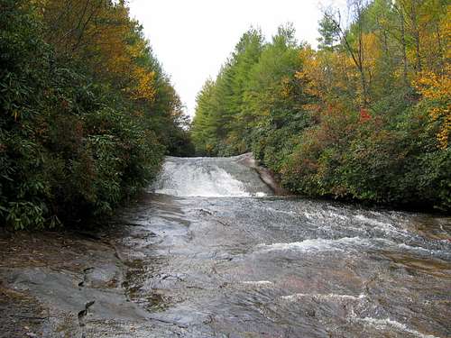 Granny Burrel Falls.
 |  |  |
Getting There
There are two trailheads for access to Panthertown Valley. I used the Cold Mountain Gap Trailhead, since the Salt Rock Gap Trailhead had been washed out due to flooding from Hurricanes Ivan and Frances.From Brevard: Take 64 W to 281 North. Follow 281 for about .8 mile (8/10) to Cold Mountain Road (SR 1301). Go 5.8 miles to a sharp left turn and drive down about one tenth mile to the trailhead.
THERE IS NO "OFFICIAL" TRAIL SYSTEM IN PANTHERTOWN VALLEY. THE VALLEY IS LITERALLY CRISSCROSSED WITH DOZENS, IF NOT HUNDREDS, OF TRAILS. TO KEEP FROM GETTING YOUR ASS LOST, BUY THE KORNEGAY MAP HERE
 |  |  |
Red Tape
Panthertown Valley has no fees whatsoever and, as far as I know, is completely unregulated. Pack it in, pack it out. Hoist your food (prime bear habitat). Just be courteous. Lots of free fun to be had exploring the wilds of Panthertown. |  |  |
When To Climb
 Good granite.
 | 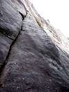 |  |
Camping
 This A-frame shelter makes a good base camp.
I would not recommend camping in low areas near creeks or bogs. I do see campsites in such areas, but flash floods are a real danger.
 |  |  |
Mountain Conditions
Check the weather for Cashiers or Highlands. Highlands might actually be more accurate for Panthertown, as they are roughly the same elevation and only a few miles distant (even though Cashiers is closer). |  | 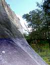 |
External Links
- National Forest Panthertown Valley Trail Project.
The Panthertown Valley proposed trail project. (As yet uninitiated.)