...mouse click to enlarge...
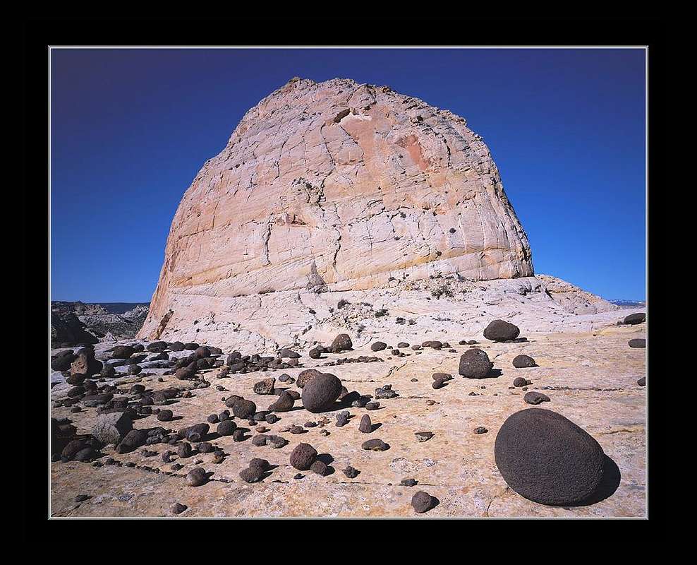
I exposed this
4x5 transparency sheet of Provia 100F film through my 90mm Caltar lens on Wednesday May 20, 2005. There are many impressive unnamed domes in
Capitol Reef National Park, although most are difficult to approach much less visible, due the considerable vertical sandstone rock often blocking approaches. I had noted this particular dome on a topographic map well away from any trails, that we approached with our big cameras via a class 3 route up a narrow slot.
This light pastel
Navaho Sandstone was deposited over a wide region from blowing sand during desert conditions about 200 million years ago during the
Triassic Period. At the right edge skyline, one can see white snow atop the volcanic 11,000 plus foot
Aquarius Plateau twenty miles west. During glacial periods of the past recent few million years,
black basalt rock was carried down in this direction by ice and
Fremont River flow coming to rest often as rounded black balls over much of the Fremont River canyon within Capitol Reef.
The image is available on my below home page gallery as a 29.6x37.6 inch Lightjet fine art print. For additional information on this image see
link.
David Senesac
http://www.davidsenesac.com


Comments
Post a Comment