
|
|
Mountain/Rock |
|---|---|
|
|
43.31400°N / 71.116°W |
|
|
1357 ft / 414 m |
|
|
Overview
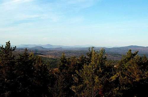
Blue Job Mountain has arguably the best view in Southern New Hampshire. It is because of the view, which spans from Mt. Washington to the north, Mt. Monadnock to the west and Atlantic Ocean to the east that make Blue Job Mountain a must to summit. Though not a an open summit like Cardigan or Monadnock, the short trip up to the top of the fire tower gives amazing views.
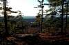
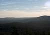
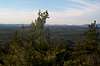
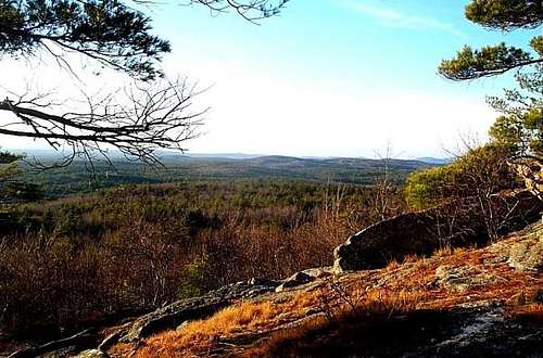 From the summit of Blue Job Mountain
There are two routes to the summit and they both start from the same parking area. The fire road goes up the west side of Blue Job Mountain. The road runs through a number of of open fields which provide good views of the south and the west. The Blue Job Mountain Trail takes off from the parking area and travels the eastern face of the summit. This side is more forested with the best view on the way up is just below the summit with a semi-open view off to the east.
Is there common for this summit to be crowded due to the ease of the hike. If you want to avoid the crowds hike this mountain in either early spring or late fall.
 |
 |
 |
 |
 |
Getting There
VIA FIRE ROAD OR BLUE JOB MOUNTAIN TRAILHEAD: From 202A head north on First Crown Point Road (Left if coming from Strafford, Right if coming from Rochester). Take First Crown Point Road 5.3 miles north. The trailhead parking area will be on your right just beyond the height of land. It is marked by a spray painted sign.
Red Tape
There is no Red Tape.
When To Climb
Blue Job Mountain can be climbed at any time of the year. However snowshoes may be recommend for any winter ascents.
Camping
Blue Job is very short loop hike of 1.0 mile, therefore camping is not nesseccary. There were though no signs prohibiting camping, however due to high traffic I wouldn't recommend it.
Mountain Conditions
http://hikenh.netfirms.com/TDBlueJb.htm
Summit Picture Log
Post your summit mugshot here.
EastKing - Jan 16, 2006 5:30 am - Hasn't voted
Untitled CommentThank you for the update. I have to head up there soon.
vleuchter - Aug 22, 2005 8:53 am - Hasn't voted
Untitled CommentBring along some containers to pick blueberries. If the warden isn't too busy, maybe he'll show the kids how he detects fires from the observation tower.
royswkr - Jan 15, 2006 4:42 pm - Hasn't voted
Untitled CommentThe landowner no longer allows hiking up the jeep road through the blueberry fields, and the state has built a new parking lot about .1 miles to the N (with huge sign and street light) and new W loop trail.
See the AMC SNH Trail Guide or the web site listed under "conditions" for more specific info. This info is also posted at the site but fading in the sun.
Still a great hike, but a little longer.
EastKing - Jan 16, 2006 5:30 am - Hasn't voted
Untitled CommentThank you for the update. I have to head up there soon.
Emtellez - Jul 9, 2012 9:49 am - Hasn't voted
GPS CoordinatesThe parking area is a bit confusing to find. Here are the coordinates: N43° 19.715' W 071° 07.364' Hope this helps!
Nigel Jones - Mar 12, 2015 8:27 am - Voted 8/10
WinterWent for a walk up the hill yesterday great views from the top trip spoiled slightly by the amount of dog poo on the lower reaches of the hill come on dog owners bag it