Toggle navigation
Mountains
Routes
Images
Trip Reports
Forum
What's New
People
Areas & Ranges
Articles
Trailheads
Canyons
Huts & Campgrounds
Albums
Logistical Centers
Fact Sheets
Lists
Custom Objects
Gear
Plans & Partners
WELCOME TO SUMMITPOST
SIGN IN
REGISTER
Brec de Chambeyron
Additional Parents
Image
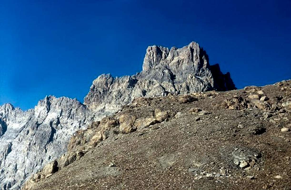
Brec de Chambeyron east side...
View High-Resolution Image
Brec de Chambeyron east side...
Brec de Chambeyron east side taken from Gypière pass on the French/Italian border. Highest part of normal route is visible here (the last chimney) Photo credit Yves Masselot
« PREV
NEXT »
om
on
Aug 19, 2005 8:53 am
Comments & voting
Other parents
Lat/Lon:
44.52870°N / 6.85310°E
Image ID:
121250
1785 Hits
71.06
% Score
1
Votes
Log in to vote
Comments
No comments posted yet.
to post!
Don't have an account?
Brec de Chambeyron
(Mountain/Rock)
« PREV
Viewing
#13 of 17
GALLERY
NEXT »
om's Image Gallery
« PREV
Viewing
#11796 of 18822
GALLERY
NEXT »
.Ubaye mountains, Y pictures
(Album)
Loading....
×
You need to login in order to vote!
User Name
Password
Remember me
Forgot your password?
Log me out when I close my browser.
Keep me logged in all the time.
sign in as a user
Don't have an account?
Register now for FREE
Rating available
Suggested routes for you
People who climb the same things as you
Comments Available
Create Albums
Register Here


