
|
|
Custom Object |
|---|---|
|
|
43.82610°N / 111.784°W |
|
|
Personal Page |
Overview
This page used to be a photo but I switched it over to avoid the what's new page. It just has random stuff.Webcams
Various useful webcams in the area include:Idaho
- Lookout Cam, Sun Valley Ski Resort, located at just under 10,000 feet. Facing toward the Pioneers, with the Boulders on the left.
- Borah Peak, which is at gibbrown.com. Just a simple small image from their cabin, but gives a good general idea of conditions.
- Mount Jefferson of the Centennial Mountains, from Island Park.
Wyoming
- Rendevous Mountain at approximately 10,500 feet, facing south. Time lapse at Zeitcam.com
- Teton Cam from the west.
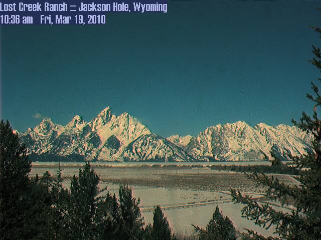
- Lost Creek Ranch, Tetons from the east.
- Pinedale Area Webcams includes cams for the east side of the Wyoming Range, the Gros Ventre, and the Wind Rivers.
Weather
 Arco
Arco Rexburg
 Wilson
Graphical Forecast - Northern Rockies
Current Modeled Snow Depth - Idaho, Western Wyoming, SW Montana
Recent US Lightning Strikes
Snow Depth
Map Resources
Topographic
Digital Raster Graphics
Idaho - Idaho Dept of Lands
Wyoming - Wyoming Geographic Information Advisory Council
Quadrangle Browsing - Quad Finder - State Quad Indexes
Digital Elevation Models
Idaho
Wyoming
Imagery
Idaho NAIP 2004 1m color aerial
Utah NAIP 1m color aerial
Wyoming... in process summer 2006
Other states are available in recent NAIP imagery, but many are for a fee.
Ask.com maps uses NAIP imagery for its high resolution aerial imagery.
Auxiliary Information
Idaho Department of Lands Viewer - allows layering of land management information with topographic maps. While one cannot find private land ownership infomation directly, I've found that water rights use can be helpful in tracking down landowners.
Montana Cadatral Mapping Program - perhaps the best state website in tracking down landowners.
Other
BackcountryMaps.com
GPS Visualizer - Topo overlays for Google Earth
Project
Interests that may turn into projects include Wind River, Absaroka, Salmon River, and Idaho 10k+.Wind River Reservation Boundaries for Google Earth.
Wind River Relief Map
Absaroka Panorama
PR Overview
Puerto Rico is a rugged island on the north side of the Caribbean. It is furthest east of the Greater Antilles, an island group that includes Cuba, Jamaica, and Hispaniola. It is just west of the Virgin Islands.
The island is roughly 100 miles long and 35 miles wide, about the size of the Wind River Range in Wyoming. Although the island is small, it has a population of 4 million and a population density higher than all U.S. states but New Jersey and Rhode Island. Despite that, it still has a dramatic landscape on the interior of the island.
Puerto Rico is a good introduction to travel in Latin America because of less culture shock, fewer unpleasant travel experiences, and a lack of red tape. for citizens of the U.S. Since Puerto Rico is a United States territory there is no need for a passport or to pass through customs for American citizens to travel there.
Read more about Puerto Rico on Wikipedia.
Puerto Rico's Highest | ||||
|---|---|---|---|---|
| Name | Elevation (ft) | County | Quadrangle | Topozone |
| Cerro de Punta | 4356 | Ponce | Jayuya | Map |
| Monte Jayuya | 4251 | Jayuya | Jayuya | Map |
| Cerro Rosa | 4144 | Ciales | Jayuya | Map |
| Piedra Blanca | 4042 | Jayuya | Jayuya | Map |
| Cerro Maravillas | 3960 | Jayuya | Jayuya | Map |
| Monte Guilarte | 3934 | Adjuntas | Monte Guilarte | Map |
| Los Tres Picachos | 3894 | Jayuya | Jayuya | Map |
| Cerro Saliente | 3845 | Jayuya | Jayuya | Map |
| Monte Membrillo | 3579 | Yauco | Monte Guilarte | Map |
| Cerro El Bolo | 3527 | Villalba | Orocovis | Map |
| El Toro | 3474 | Las Piedras | El Yunque | Map |
| Cerro Doña Juana | 3471 | Orocovis | Orocovis | Map |
| El Yunque | 3461 | Rio Grande | El Yunque | Map |
| Pico del Este | 3409 | Ceiba | El Yunque | Map |
| Cerro Vaquiña | 3369 | Adjuntas | Monte Guilarte | Map |
| Cerro Garrote | 3356 | Penuelas | Adjuntas | Map |
| Pico del Oeste | 3340 | Ceiba | El Yunque | Map |
| El Cacique | 3327 | Rio Grande | El Yunque | Map |
| Cerrote de Peñuelas | 3307 | Penuelas | Penuelas | Map |
| Cerro El Gigante | 3176 | Adjuntas | Adjuntas | Map |
| Cerro Morales | 3127 | Utuado | Adjuntas | Map |
El Yunque
RainCordillera Central
PeaksView Larger Map
Carst Country
ClimbGetting Around
Weather and Climate
Rain