
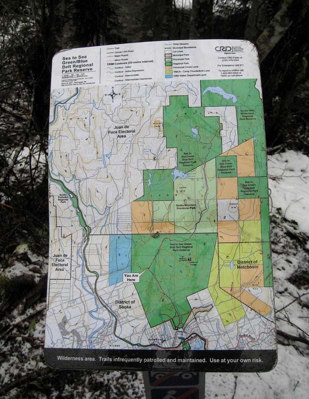
Briefly Lived Manuel Quimper Trail Map
A sign installed by the CRD at a point about 35 minutes up the Manuel Quimper approach road from the Harbour View parking lot. Lasted from January-March 2008 before vandals destroyed it! At least it lives on in SummitPost.
Shows trails throughout the Sooke Hills Regional Park as well as district and administrative borders. Take the trails as drawn with a large pinch of salt. After a recent conversation with a CRD crew working on maintenance of upper Harbour View Road, the trails shown may be part of the CRD's plans to open up the park.


