Car to Car: 3.5 hours, 7:30 am - 11 am. Larger or inexperienced groups would likely take more time.
Equipment: 60m & 10m ropes, 100’ webbing,
Route: Approach Via Plug Hat - Descend Main Fork- Ascend South Fork- Exit Via Plug Hat
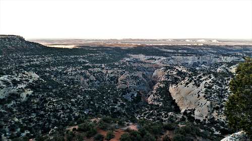
Approach: We decided to attempt a hybrid of the previously listed Grand Tour which includes both the main and south fork. We parked at Plug Hat and descended the rim to the entrance of the South Fork. From that point we did not descend the South Fork, but continued east toward the top of the Main Fork. We intentionally stayed above or south of the ridge (has red dirt at its base) to avoid entering the wrong canyon south of the Main Fork. This path made it really easy to enter the Main Fork of the canyon in the same spot if you were approaching from the old jeep route. From car to canyon entrance was under 1 hour.
View from the approach
Main Fork
Down Climbs: Canyon starts with some bushwacking (glad I was wearing pants), and a couple of short down climbs.
The second down climb
1st Rappel: This rappel looked like it could have been down climbed if not for the awkward and committing start. We made the judgment call to use our short 30 foot rope double stranded to descend over the lip and down 15 feet then easily down climb the remaining. Setting up the full rappel would be the safer and easier option for most groups.
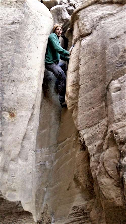
3rd Down Climb: This has the option of being down climbed, or bypassed on a small ledge to the left. In my opinion I’m not sure why you would choose the bypass (unless avoiding water/mud that can collect at the bottom) because it still requires some down climbing. If you struggle with this obstacle you might want to reconsider if your planning on ascending or descending the south fork, which has many similar obstacles.
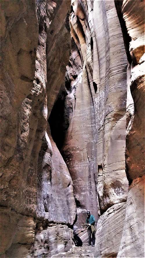
2nd Rappel: The Magic Chamber rappel is a neat, but short section. There were no longer any logs hanging in the canyon, but several large chock stones remained about 15 feet out from the starting ledge. Be sure to bring plenty of webbing, the anchor for this rappel is a long way from the lip. Luckily it checked out during our trip.
Bottom of The Magic Chamber
Confluence: Shortly after descending the Magic Chamber the canyon connects with the South Fork. We missed the turn and descended a quarter of the South Fork exit before we realized we had gone to far. The turn off it not obvious.
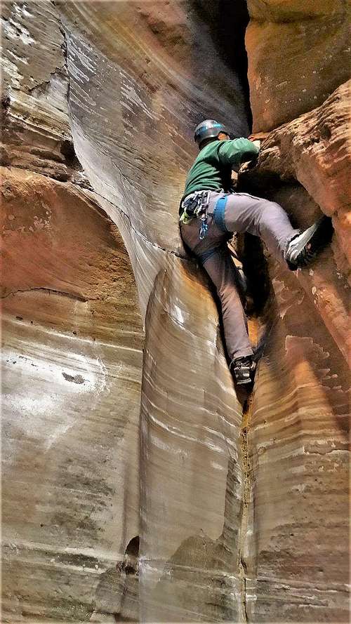
South Fork: This is where things get delicious. The South Fork immediately starts with a climb. The first obstacle would be another good time to evaluate your plans. You can always retreat and descend down and out of the South Fork if you meet an obstacle you cannot climb. If you find yourself struggling with the first task, you will likely struggle to reach the top of the canyon. Most climbs are under 15 feet, but require competent climbing skills without any protecting (no good placements for trad gear that we saw) albeit never very high off the ground. Penalty points would likely be broken limbs, but unlikely a more serious injury. Of the half dozen climbs the last was the only one that required us to stop and make a plan. The walls under this section were too far apart to stem, and there were no great hand or foot holds on either side. It was recommended that we use a partner assist to overcome this obstacle. However we found that the walls narrow about 15’ down canyon. Using this narrowing we were able to stem up and over towards the top. The same could be done in reverse if descending the South Fork.
Return: Once at the top of the south fork we returned the way we approached back to the Plug Hat parking lot.
First Climb of the South Fork
Overall: I would agree with Scott this is not in itself a destination canyon. However this is a great half day adventure if your already in the area. The route we took was only 3 miles compared to the old grand tour route of 5.5 miles, and you only miss the south fork exit and the loop back to the Main Fork. I can live with that. If you and your team are experienced canyoneers with confident climbing skills I would recommend the route we took.