
-
 25048 Hits
-
 82.48% Score
-
 15 Votes
|
|
Mountain/Rock |
|---|---|
|
|
33.23030°N / 112.2281°W |
|
|
4119 ft / 1255 m |
|
|
Overview
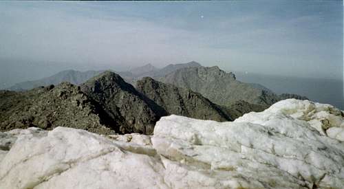
Butterfly Peak 4119'Quartz Peak 4,052'
The Sierra Estrella’s are the sharp range that’s lies south of Phoenix and south of South Mountain. Many postcards of downtown Phoenix have the Sierra Estrella’s as the backdrop. This range dramatically rises out of the desert floor. The Gila River (usually dry) runs along the base of these mountains and is the low point of the Phoenix area, being just under 1,000 feet elevation. Montezuma Peak is possibly the the highest named point of this range with an elevation of 4,354 feet, rising nearly 3,400 feet from the Gila river. The actual high point an unnamed peak at 4,512' on the west end of the range. This peak is known as Sierra Estrella. Quartz Peak and Butterfly Mountain are nearly dead center in this range.
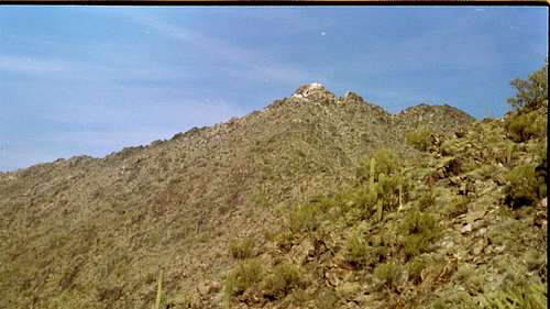
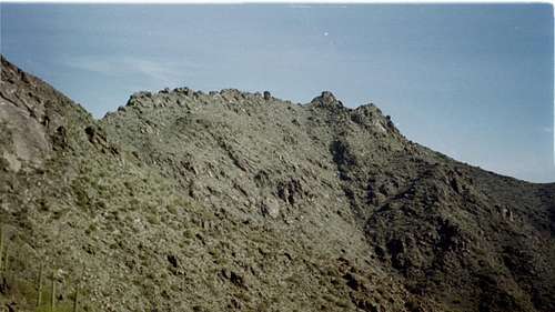
The Quartz Peak Trail is the only trail in this range, thus making Quartz Peak the only mountain with a trail leading to the top. The trail starts on the opposite side of the range from Phoenix. The starting elevation is at 1,555 feet. The Quartz Peak trail starts up a spur ridge then connects to the main ridge and follows it to the summit. The final 1/4-mile or more is a short easy scramble to get to the white-capped quartz summit.
This trail is steep and provides an excellent workout. Round trip may only take about 3-4 hours, but driving to the trail head is a long drive, making this almost an all day journey.
Quartz Peak is a satellite Peak of Butterfly Mountain, rising about 275 feet from the saddle. From Quartz Peak, Butterfly Peak is a short hike to its summit. I have never done Butterfly Peak, so I don’t know how difficult it is. Looking at Butterfly’s summit, it looks like it could be a scramble. Quartz Peak is the summit most people hike up to. Butterfly Mtn is rarely ever summited.
mstender - Dec 22, 2014 10:39 pm - Voted 10/10
Road conditionsUpdate as of 12-22-14: I drove in from the South. The turnoff is at mile marker 35 on Hwy 238. This road was in extremely poor condition,very rocky and washed out after the recent rains, in particular the first 5 miles. It's about 10 miles to the turnoff to the trailhead. It took me 2 hours to get there!You will need high clearance 4WD for this road. On my way back I used the route described here (turning North) and the road was in much better condition, just a bit sandy and with a couple of minor wash crossings. However, there is a road closure at the Riggs/Bullard intersection due to a washed out bridge. I chose to ignore it and you have to drive through a wash to continue which should be no problem unless you are in a little sports sedan. I found the roads approaching from the North to be in MUCH better condition and will never use the Southern route again as I was lucky not to get stuck or tear up my rig.