
|
|
Mountain/Rock |
|---|---|
|
|
32.81390°N / 111.7095°W |
|
|
Pinal |
|
|
Hiking |
|
|
Spring, Fall, Winter |
|
|
2350 ft / 716 m |
|
|
Overview
The Casa Grande Mountains are a small range situated south of where Interstate-8 and Insterate-10 meet, partially within the city of Casa Grande. The range is less than four miles long, with a summit at 2,350 feet, and a prominence of 868 feet. Some of the range is enclosed within the Casa Grande Mountains Park and some is within the Casa Grande Military Reservation. However, there is full access to the summit.
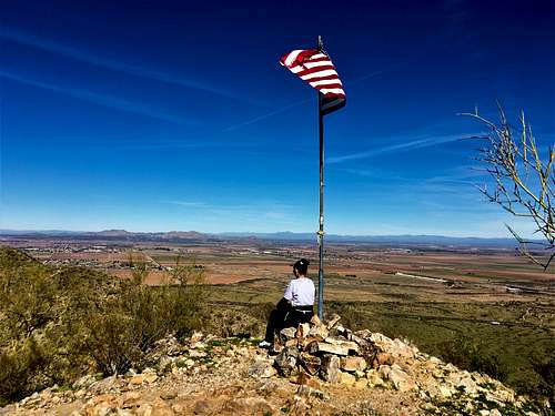
There is a decent network of trails including one that crosses the ridge and leads to the top, which is marked with an American flag.
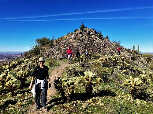
Because the range is rather isolated from other neighbors, there are widespread views in all directions. Walking the ridge is great because you have these wonderful views for the majority of the hike.
Be aware that you will hear gun shots from the nearby shooting range. They should be easy to tune out. The area is rather popular despite being far from Phoenix and Tucson. However. It is probably popular because it is an easy hike to do in between the two major cities.
The Casa Grande Mountains are best hiked between November and March. However, it would be fine to hike here in the morning of April or May or October. Avoid the area from June through September due to the extreme heat. If hiking at times above 70 degrees, watch out for rattlesnakes. The trail is pretty solid for most of the hike, so you should be okay. But, be aware of their likely presence.
Getting There
The Casa Grande Mountains are about 50 miles south of downtown Phoenix by car. They are actually south of the town of Casa Grande, separated by a couple miles of farmland as of January 2020 (who knows if it gets built out over time). The primary access point is Hanna Road.
Take I-10 to I-8 West – and then take I-8 West for a little over three miles to Trekel Road. Go south on Trekel Road for a half a mile and turn left on Hanna Road. Drive about three-quarters of a mile to the obvious trailhead.
You’ll see other apparent trailheads on the south side of the range. The main one is accessed via dirt roads, and don’t directly access the main ridge. There is also a shooting range on the southwest side. The trailhead noted above is the best access point.
Route Information
There are two options from the trailhead. The primary option is just to head straight up Hanna Road from the trailhead to the towers. The road becomes paved and you reach the towers in a little over a mile after gaining 680’. Pass by the towers and take the trail that heads uphill and crosses the ridgeline.
You can also look for a trail on the right, about 1/3rd of a mile up from the trailhead. The trail snakes up the mountainside and hits the main trail about 200 yards up.
Note that both of these options are very steep. For the road, although you only gain 680’ in just over a mile, there is a section where you gain 400 feet in about four-tenths of a mile.
The good news is that once on the main trail on the ridge, it is much easier. There are some ups and downs, but not any major steepness.
Once on the main ridge, just keep going until you reach the main summit, which has an American flag and a summit register. You can actually continue for another three-quarters of a mile or so along the ridge line to gain distance. It is easy for trail-running.
From the Hanna Road trailhead, it is about 1.7 miles and 1,000’ of total elevation gain to the summit.
Red Tape
There is no red tape of note for this hike.
Scott Surgent Trip Report
Scott Surgent's trip report is also an excellent resource for this hike: