Page Type Page Type: Mountain/Rock
Location Lat/Lon: 47.41945°N / 120.35827°W
Additional Information County: Chelan
Activities Activities: Hiking
Seasons Season: Spring, Summer, Fall, Winter
Additional Information Elevation: 1756 ft / 535 m
Sign the Climber's Log

Overview

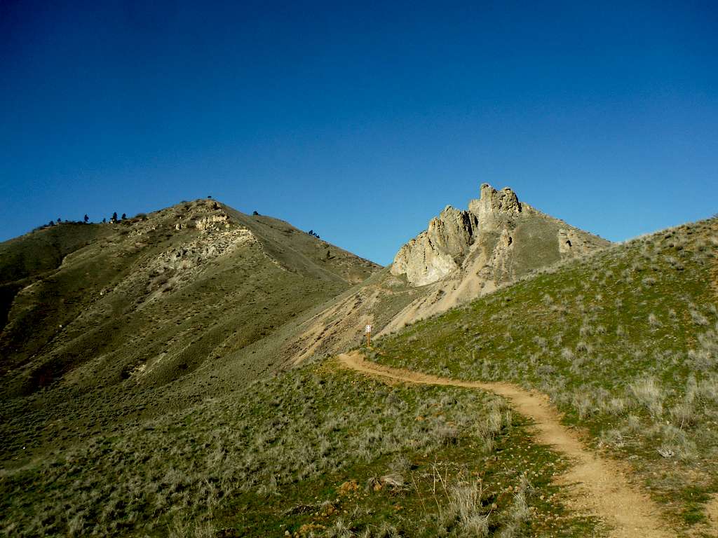
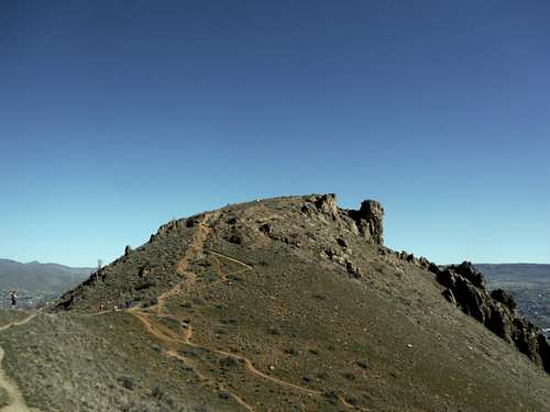
Good shot of both Castle Rock and Chopper

Castle Rock has been an icon to the Wenatchee area for a long time. This scenic group of rocks stands tall as the western border of Wenatchee. The rocks from solid and extremely scenic and leaves a visual impression to all viewers from the south, the west and the east. One would think that they are closer to Phoenix then to Seattle by the type of terrain that these rock represent. These rocks are located in a near desert environment in which little rain does fall on this great feature. What rain does fall tends to make the trail very muddy which could cause rapid erosion to the trails in the near future.   

Castle Rock from on the way up Chopper
Castle Rock from on the way up Chopper (3/8/15)


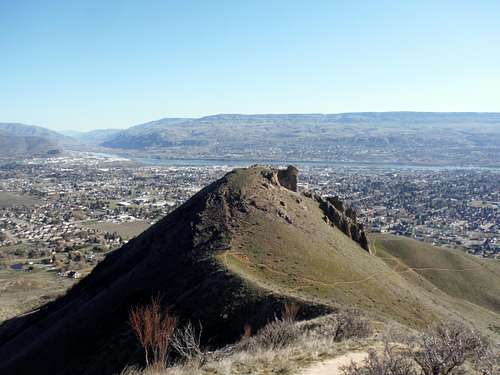
Unfortunately because the rock was on private property, access to it has been questionable and hikes up to the summit have not been very common. This issue changed when in 2014 the city of Wenatchee made a deal with the private land owner to build a small trailhead off of Castlerock Road and build more organized section of trails to the summit. Because of the new trailhead Castle Rock has now become very popular and for good reason. Despite having under 100' of prominence this peak has an excellent view of downtown Wenatchee. In late April and early May this peak is also home to good views of wild flowers which brings many visitors to it's slope. There are a large trail network of newer trails on the eastern side of Castle Rock that leave from the Castle Rock trailhead. One from the parking lot can make the summit in easily under an hour because the elevation gain from the trailhead to the summit is only 600 feet. 


The heart of Wenatchee
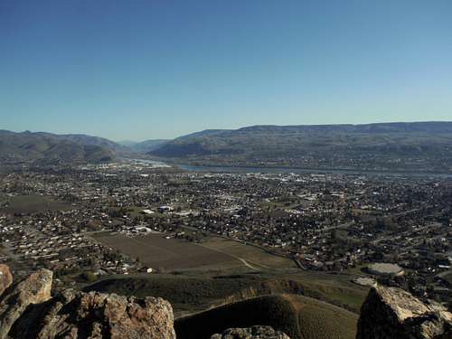
Looking into Wenatchee (3/8/15)
Looking into Wenatchee from Catle Rock
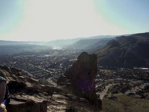
Looking into southern Wenatchee and the south part of Castle Rock(3/8/15)


It should be noted that most people who go to Castle Rock stop as Castle Rock. There are a few more hardy hikers and peakbaggers that then continue to Chopper Peak. If one does make sure that the trail is not snow-covered or muddy because neighboring Chopper Peak can become somewhat dangerous if one is not ready for the conditions. 

Chopper Peak
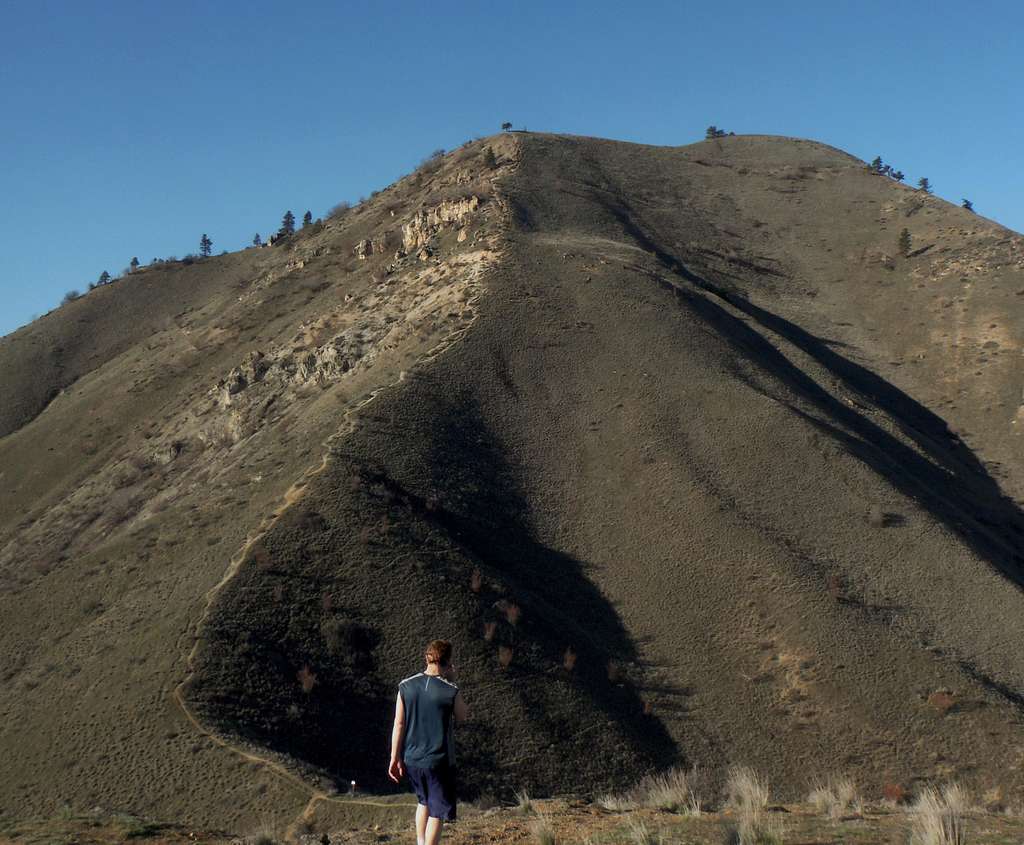
Make sure you know the conditions before continuing up Chopper Peak (3/8/15)

Getting There

The Castle Rock Trailhead is located in the western section of the city of Wenatchee. From Miller Road, one of the main roads in Wenatchee look for Castlerock road and then head west all of the way to the base of the mountain. There is a small parking area there with a nice place to sit there. .

Route

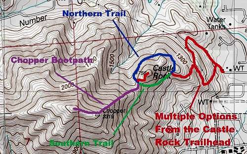
Map of the route up Castle Rock

Castle Rock has multiple options to the summit from the trail. On the lower slope these trails can be confusing so follow the maps that are on each intersection. Once you pass by this section of trails you will go to the southeastern base of Castle Rock. You will run into the intersection between the northern way around Castle Rock and the southern way up Castle Rock. The southern trail is better due to it being a little less exposed and a better run out. The northern trail as iffy footing in spots and in one section as a drop-off in which one would be in trouble if they continued to roll down the slope. Because this is private property it is recommended that you stay on the trail to prevent any erosion that comes from going off-trail. The last hundred feet to the summit has some poor footing. There is now a new switchback on the final leg. Please use it because the more direct way is very eroded. All of this is subject to change as this area continues to develop as a hiking destination.     

The last bit of trail to the summit
The last bit of trail to the summit (3/8/15)

Red Tape

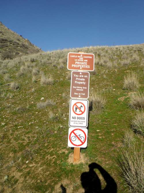
Please follow the sign

This is private property. NO DOGS OR OVERNIGHT CAMPING IS ALLOWED. Parking is from dawn to dusk..

When to Climb

You can hike here at any time however just be prepared in winter for icy conditions and muddy conditions after a rare rainstorm.

Camping

CAMPING IS PROHIBITED!!.

External Links

New link to trail building at Castle Rock.


Related 

Friends

Related objects are relevant to each other in some way, but they don't form a parent/child relationship. Also, they don't necessarily share the same parent.