Toggle navigation
Mountains
Routes
Images
Trip Reports
Forum
What's New
People
Areas & Ranges
Articles
Trailheads
Canyons
Huts & Campgrounds
Albums
Logistical Centers
Fact Sheets
Lists
Custom Objects
Gear
Plans & Partners
WELCOME TO SUMMITPOST
SIGN IN
REGISTER
Cathedral Peak
Additional Parents
Image
Cathedral Peak Route
View High-Resolution Image
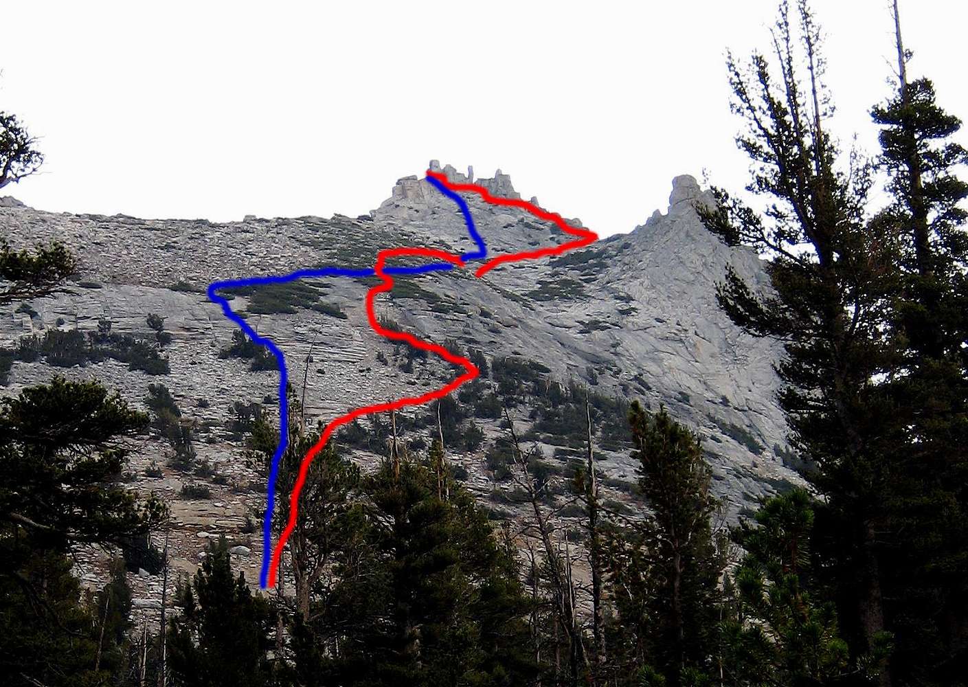
Cathedral Peak Route
Ascent (red) and descent (blue) routes of Cathedral Peak on 10 September 2007. Picture was taken from the point where we left the John Muir Trail and went cross country to the peak. Eichorn Pinnacle is on the right side of the image.
« PREV
NEXT »
alex
on
Oct 9, 2007 12:30 am
Comments & voting
Other parents
Lat/Lon:
37.84780°N / 119.4047°W
Image Type(s):
Informational
Image ID:
345548
3551 Hits
71.06
% Score
1
Votes
Log in to vote
Comments
No comments posted yet.
to post!
Don't have an account?
Cathedral Peak
(Mountain/Rock)
« PREV
Viewing
#219 of 244
GALLERY
NEXT »
alex's Image Gallery
« PREV
Viewing
#29 of 37
GALLERY
NEXT »
×
You need to login in order to vote!
User Name
Password
Remember me
Forgot your password?
Log me out when I close my browser.
Keep me logged in all the time.
sign in as a user
Don't have an account?
Register now for FREE
Rating available
Suggested routes for you
People who climb the same things as you
Comments Available
Create Albums
Register Here


