
|
|
Mountain/Rock |
|---|---|
|
|
45.61370°N / 116.3534°W |
|
|
5304 ft / 1617 m |
|
|
Overview
This mountain is one of many points in the Salmon River Canyon that while not high in elevation compared to the neighboring Seven Devils or Salmon River Mountains, are prominently separated and have a significant vertical rise above the canyon bottoms. Some of these summits offer a wide variety of experiences ranging from easy hikes, to difficult scrambles to technical rock.Center Ridge has 604 feet of prominence and rises 3,750 feet above the Salmon River to the east. Unlike the other secondary points and ridges in the vicinity, it is actually higher in elevation than the primary Salmon/Snake divide where the two connect. Reaching the summit from Center Ridge Saddle via the Crooked Road (road 672) is a simple one mile hike on trail 105 or an unofficial ATV trial on the ridge. Overall, it’s a fairly unexciting mountain, but there are still some interesting things to see here.
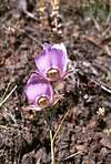
The south side of the mountain is dominated by Canyon Grassland habitats and open Ponderosa pine savannas. An interesting vegetative component is the Mountain Mahogany at the summit. This large shrub is common at the lower elevations along the Salmon River, but generally does not occur at the summit elevation in this region. The north side of the mountain is covered with a much moister and dense grand fir forest. Though road access is close on the 672 road, the ridge is otherwise roadless except for a lower road far to the east of the summit that passes through private land and is not open to the public. The area supports a large mule deer population, but these must share their habitat with cows part of the summer. Watch your step.
These canyon grasslands are important ecologically for big game winter range and unusual vegetative communities, which have been largely displaced by invasive weeds, especially below approximately 5,000 feet in elevation. Several endemic and rare plant species can be found in this area, but very little of the native grassland habitat remains. The open Ponderosa pine/savanna vegetative communities that also occur here are greatly reduced due to decades of fire suppression that eliminated the natural disturbance necessary to maintain them. As a result tree density is much greater in some areas than normal and some areas of grassland are converting to forests. The natural species composition has also been changed. The local Forest Service unit has plans to implement controlled prescribed fires to reduce the unnatural fuels accumulation, restore natural forest community structure and return to a more historic fire regime interval. Unfortunately the implementation of this sound, common sense management is facing a stiff challenge from uninformed, but powerful environmental groups.
Due to the local arid climate and the open south facing slopes, this mountain can get very hot during the summer so take care to bring plenty of water and be prepared for high temperatures and solar exposure.
 |  |  |  |
Getting There
At mile mark 222.2 on Highway 95, turn west on Old Highway 95, which is marked with a sign to Pittsburg Landing. Go 0.9 mile and merge left on Canfield road and cross the bridge over the Salmon River. Immediately on the west side of the bridge, turn left on the Deer Creek road (rd 493). Follow the signs to Pittsburg Landing. Continue for 7.1 miles and turn left on the Crooked road (672), which is marked by a sign for Cow Creek Saddle. Continue for 12.2 miles to Center Ridge Saddle.On the south side of the cattle guard, get on the four-wheeler track and follow it along the ridgeline to the top. The map shows a trail (105) that follows the beginning of this track, but leaves the ridge and cuts across the slope at the saddle east of the first ridge high point. One could choose to follow this designated trail, and then cut straight up the slope from below the high point.
A much more challenging hike would be from the Salmon River, but one would have to cross the river then have a steep, rocky and hot climb up an expanse of private ground.
 |  |  |  |
Red Tape
None.When To Climb
This area is generally free of snow from late spring until late October or early November. In the winter the main access road is open to snowmobiles.Camping
There are no developed or designated campgrounds nearby, but there is some dispersed camping along road 672. Potential spots include Hornet Springs near Mud Springs Ridge, and Iron Phone Junction further south on road 672. There are also places along the 420 road a few miles from Center Ridge Saddle on the west side of the Salmon/Snake divide.There is a small camping area at the Snake River trailhead at Pittsburg Landing in the bottom of Hells Canyon. Follow the directions given in the Overview section, but instead of turning off on road 672, continue on the 493 road over the Salmon/Snake divide and down into Hells Canyon to the end of the road at Pittsburg Landing. This is one of only two places the bottom of Hells Canyon can be reached by road.
Mountain Conditions
Contact the Salmon River Ranger District of the Nez Perce National Forest for local information and current conditions.Salmon River Ranger District
Slate Creek Ranger Station
HC 01, Box 70
Whitebird, ID 83554
(208)839-2211
FAX:(208)839-2730
NOAA Forecast