
-
 17773 Hits
-
 81.84% Score
-
 14 Votes
|
|
Mountain/Rock |
|---|---|
|
|
49.50095°N / 125.49489°W |
|
|
Hiking |
|
|
Spring, Summer, Fall, Winter |
|
|
5387 ft / 1642 m |
|
|
Overview
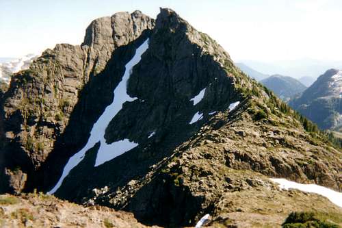 Central Crags summit from the top of Flower Ridge Central Crags summit from the top of Flower Ridge |
Flower Ridge is also a popular winter/spring destination on skis or snowshoes.
The area is of significant historical interest to Island climbers. After enjoying success on the first ascent of Crown Mountain, the 1910 BC Government sponsored expedition to the interior of Vancouver Island carried on south down Buttle Lake, travelled up the Price Creek Valley below Flower Ridge, over Price Pass and thence down to Great Central Lake. From there they were able to arrange transport down the lake to Port Alberni. The success of this expedition led to the establishment one year later of Strathcona Provincial Park, the first such park in Canada. For more information on the 1910 expedition have a look at this excellent account.
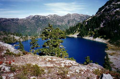
Cream Lake with Flower Ridge beyond
Getting There
Vancouver Island can be reached by air from Vancouver to Victoria, Nanaimo or Campbell River and by ferry from Port Angeles to Victoria on The Coho and on BC Ferries from Vancouver to Victoria or Nanaimo. Public transport on the Island is notoriously poor and anyone arriving by air would be advised to rent a car.Access in this case is all on paved roads and, therefore, fine with a normal sedan.
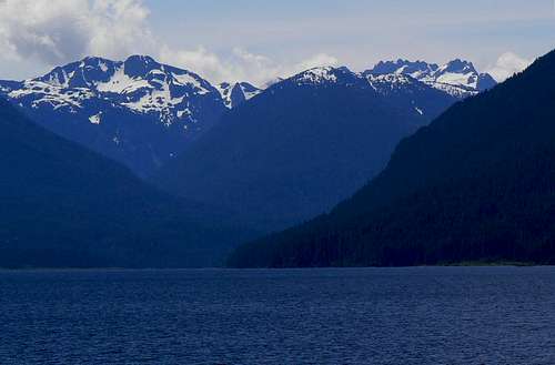
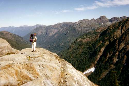
Central Crags (l), Flower Ridge (c) and Mt Septimus (r) on the approach down Buttle Lake.
From Campbell River, at the end of the Inland Island Highway 19, take highway 28 west towards Gold River. After approximately 30km the road meets Upper Campbell Lake with the first views over the mountains and after 47km you will enter Strathcona Park at Elk Portal. Exactly 1km further on highway 28 makes a right turn over the bridge at Buttle Narrows. Ignore the turn and carry straight on down the paved Buttle Lake Parkway (also known as Westmin Mine Road). This runs south down the east shore the whole length of the lake and offers ever improving views. At 74.5km pass the entrance to Parks’ Ralph River Campground on the right and 3.7km thereafter pull into the signed parking lot for Flower Ridge on the left.
The Route
From the parking lot at ~300m elevation walk 100m south on the road, across the road bridge over Henshaw Creek and find the well marked trail head.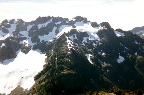 Mts Rousseau and Septimus |
To the east in the distance are Mts Harmston, Argus and the Red Pillar. To the west and no more than 2km away is the imposing Rousseau/Septimus massif. Below Price Pass to the south is Margaret Lake and beyond that in the distance, Great Central Lake. Perhaps the most rewarding view is to the north where you can see almost every step of your upward route from Buttle Lake.
 Henshaw Creek valley | 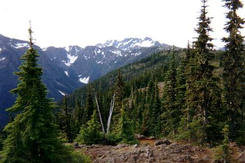 Central Crags from ~ 6km | 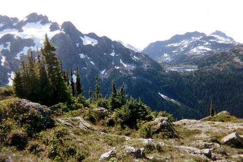 Cream Lake from Flower Ridge | 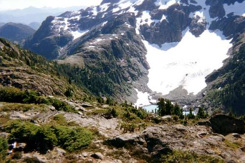 Price Pass |
From Central Crags:
1. Descend the way you came up. Or
2. Drop down onto Price Pass and turn north down to the glacial lake (Green Lake) you can see below you from Flower Ridge. Prepare yourself for the joys of an intimate encounter with devils club and slide alder prior to a B4 bushwack down Price Creek to its confluence with Cream Creek. There used to be a well made trail from this point – known locally as “Cream Junction” - back to Westmin Rd but Parks no longer maintain it and it’s fast falling into disrepair. It’s 5km on the road from the old Price Creek trailhead back to your car. Or
3. Carry on east or west on the high ridge tours described in the introduction.
Red Tape
None. You are outside the designated core area of Strathcona Park.Be aware that BC Parks does not operate an intentions system. Make sure, therefore, that you have left a detailed trip plan with someone responsible. Parks and the appropriate SAR agency will respond in an emergency but it is up to you to have the mechanism in place that will initiate the call-out process if it becomes necessary.
Camping
Excellent camping is available by the tarns on the open ridge after you reach the 1400m level. Camp on already cleared spots and try to make as little impact as possible.Fires are strictly prohibited, so you must pack a stove. Bear and cougar frequent the mountains and forests of Vancouver Island, so proper back country methods – hanging food bags out of reach, cleaning up all cooking scraps, good toilet practice etc – are essential. Giardia is well documented throughout Strathcona Park, so boil or treat all water.
Additional information and links
Strathcona Provincial ParkClosest point weather forecast
Additional Information
The correct map for this trip is the government topographical map sheet 92 F/12, “Buttle Lake”. Advance copies can be ordered on-line from the on-line map centre. Copies are usually readily available in good bookstores and outdoor stores throughout the Island.
Suggested Reading:
Beyond Nootka – A Historical Perspective of Vancouver Island Mountains, Lindsay Elms, Misthorn Press, 1996, ISBN 0-919537-29-4 and/or visit Beyond Nootka
Island Alpine – A Guide to The Mountains of Strathcona Park and Vancouver Island, Philip Stone, Wild Isle Publications, 2003, ISBN 0-9680766-5-3 and/or visit Island Alpine Climbing Guide
An excellent source for descriptions of the many high ridge routes in Strathcona Park can be found in Hiking Trails III - Northern Vancouver Island