
|
|
Mountain/Rock |
|---|---|
|
|
28.07301°S / 68.97814°W |
|
|
Mountaineering, Scrambling |
|
|
Summer |
|
|
21116 ft / 6436 m |
|
|
Overview
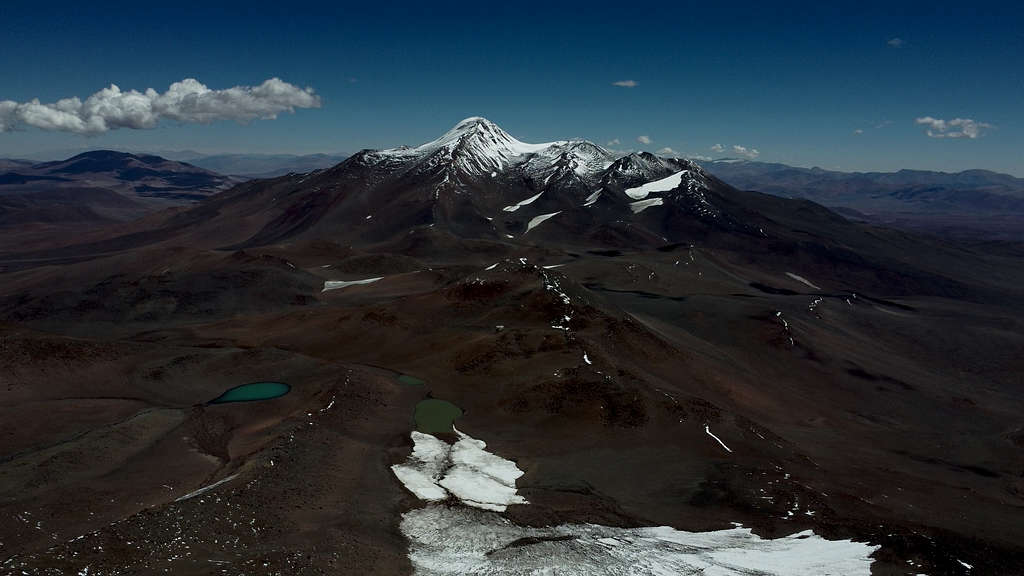
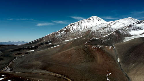
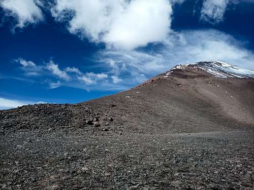
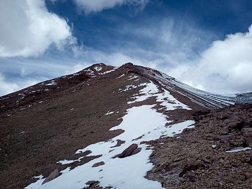
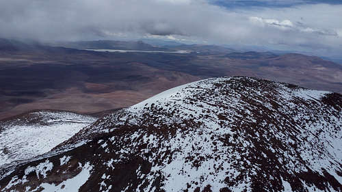
Cerro Veladero is one of the higher summits surrounding the Corona del Inca caldera in Argentina. While presenting minimal technical challenges, climbing this peak involves high altitude, remote travel, and potentially extreme weather. The mountain offers a typical mix of terrain types for the region, including solid rock, scree, lava boulders, and varying snow cover depending on season and weather.
As is the case for several high peaks in the Puna de Atacama, Veladero has Inca-era ruins at its summit. This peak has great views of the caldera and other mountains to the north.
Getting There
From Argentina, the Corona Del Inca area can be accessed by RN-76 north of Villa Union. The main access is on a prominent 4WD trail leading north from the road about 12 km west of Laguna Brava. There are several refugios along the road.
It is also possible to access Veladero from Copiapó in Chile. Following C-33 and C-35 south, one can then take C-459 to the international border at Paso Pircas Negras. The Argentinian border control outpost is immediately south of Veladero; one can continue by 4WD on north-south trails either east or west of the summit, or on foot or by MTB along a more direct approach. It should be noted that this border crossing has relatively low usage (e.g. a small fraction of the traffic through Paso San Francisco). The pass is closed off-season, and may occasionally be closed for indeterminate lengths of time even during the summer.
Many base camp options are viable on all sides of the peak, and a high camp at the 5300 MASL col with Cerro Baboso is convenient for both summits. This can be reached on foot from the east or west. To climb the south face, a 4WD trail departs RN-76 approximately 19 km west of LAguna Brava, and leads directly north towards the summit.
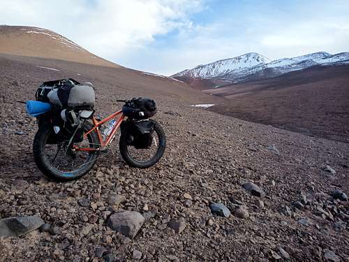
At least one expedition (see links at bottom of page) has approached Veladero by MTB from the north, including passing over the east edge of the Pissis Massif. While technically feasible, this is only a realistic option as part of a broader peak-bagging journey; if Veladero is the primary objective, both the approach and exit will be from the south.
Routes
Northeast Ridge
From the col with Cerro Baboso, the obvious route follows the prominent northeast ridge. This moderate scramble includes sections of scree and hard rock, but potentially less snow than some other lines. Crampons may or may not be desirable. This route is at worst grade 3 scrambling, and through most of the climb less severe even than that.
A descent to the col can be made via the ridge, with options at several altitudes to divert to skier's left onto a large scree face for faster and smoother travel.
From the col, attaining the summit requires an altitude gain of approximately 1100 m with horizontal travel of 10 km round-trip. A summit bid should accordingly take 4-7 hours depending on pace, with an additional 1-2 hours for descent.
Red Tape
Depending on the direction of access and mode of travel, registration and a nominal fee may be required at the entrance to the Corona Del Inca area. If traveling without a guide or especially if self-propelled (e.g. on a bicycle), evidence of high-altitude experience may be requested by local officials to demonstrate one's competence for traveling at high altitude.
Aside from the above, no permits are required.
When to Climb
The normal climbing season is November through March. Although temperatures and wind speeds are generally more moderate during this interval, it can still be very cold and windy.
Winter ascents are certainly possible with patience and warm clothing, but will likely be arduous and unpleasant. Off-season access by motor vehicle from Argentina may be difficult or impossible depending on snow conditions, and the border crossing from Paso Pircas Negras is not open in the winter.
Camping
Camping is permitted throughout the area. Water can often be found in diurnal streams down to 4500 MASL. Depending on the time of year and weather history, snowfields may begin at a similar altitude or else only start well above the col.
Camps should be situated to provide some shelter from the prevailing winds, which are out of the northwest.
External Links
John Biggar's page: http://www.andes.org.uk/peak-info-6000/veladero-info.asp
Pikes on Bikes - Puna 9 expedition: https://pikesonbikes.com/puna-9-bonete-veladero/