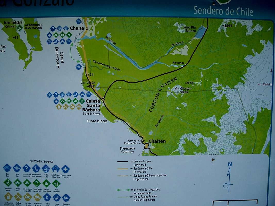
Old map of the roads and facilities in the area; note the positions particularly of Chaitén, Santa Barbara and the volcano. Note that the road running east from Santa Barbara is (or was when I was there in Jan 2009) cut immediately north of the volcano over a section of perhaps 500 m. Other than that it's easily navigable. This picture was taken by the beach at Santa Barbara.


