
|
|
Mountain/Rock |
|---|---|
|
|
44.60930°N / 123.2841°W |
|
|
Benton |
|
|
Hiking |
|
|
Spring, Summer, Fall, Winter |
|
|
850 ft / 259 m |
|
|
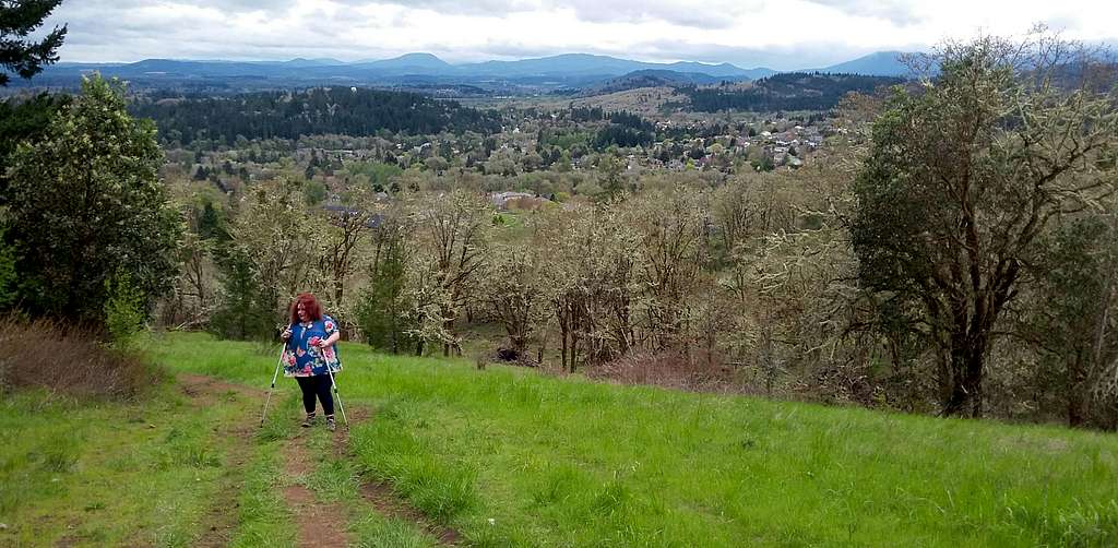
Overview
The western view
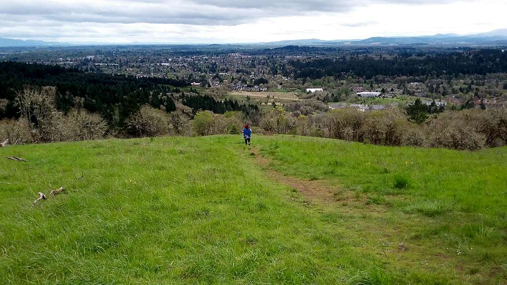
BearQueen heading down
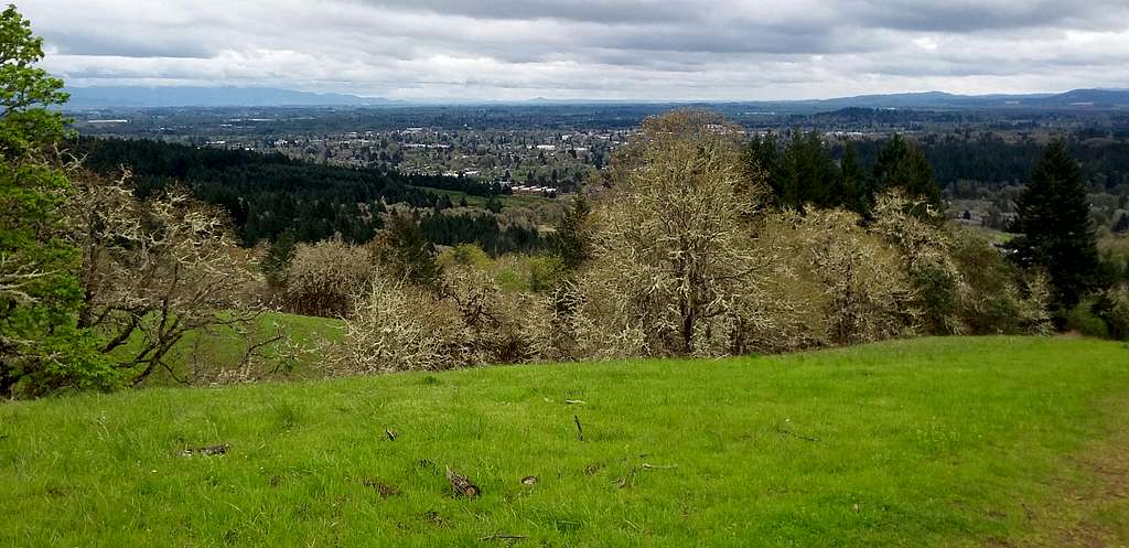
It should be noted that I have not found any literature stating that this is the official name of the hill or that there is an official name for this very hill. Instead it is the signature summit in the very large city park located in the northern park of Corvallis. A 1.5 mile, 375 foot elevation gain loop walk/hike can get you to the summit of this very hill or you can take a more direct route which may take you only one mile. Please don't just run up and down because you want to spend some time and enjoy the views on the way up and down. The details may sound lame until you experience the jaw dropping scenery from this peak. There is a good view from almost at the start of the parking lot that goes all the way to the summit of this hill. At time this little hill can have a 180 panorama of anywhere from Eugene to the southeast, downtown Corvallis to the south and Marys Peak and the Coast Range to the west.
Storm heading over Mary's Peak
There is a summit plaque which is set as a memorial to Charles Pitton Ross which is located on the western overlook just down the hill from the true summit. There are also a number of other memorials and bench areas throughout the ridge. Almost all the benches have great views of either the Coast Range to the west or towards Corvallis to the south. The true summit is marked my a unique looking tree and at least when I was there a odd looking and potentially illegal fire pit on the summit. There is a view even on the summit though it is not as dramatic as many of the other views throughout the park.
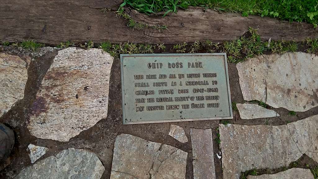
Memorial to Charles Pitton Ross
Getting There
CHIP ROSS PARK FROM DOWNTOWN CORVALLIS: Take 99W north to Walnut Street. From there make a left onto Walnut Street. Go 0.6 miles west on Walnut Street and then make a right on Highland Drive. Take that road north for 0.9 miles and then make a left on Lester Street. Make a left (west) on Lester and take that all the way to the end of road and the parking area.Route
There is a partially eroded direct route here. At the time I was there (April 2017) it was eroded. The only reason I was on it was to dodge a potential storm that coming from Marys Peak once I made the summit from the western side of the loop. I defintely would not recommend that route.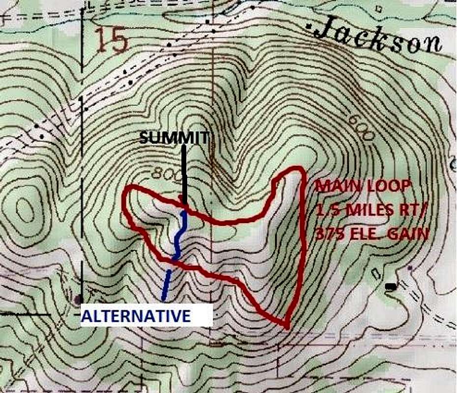
Map of the Route
Instead I would recommend the total loop trail which rises from the west and heads down from the east. It traverses the entire ridge and provides excellent views throughout the entire ridge-top traverse. Though the trail is relatively easy there are steep rises from the west and the east as it ascends the ridge. This is an open summit so the nicer the day the more stunning the views. It should be noted that even on a cloudy day like the day that BearQueen I headed up this mountain the views were great. ![The green fields]()
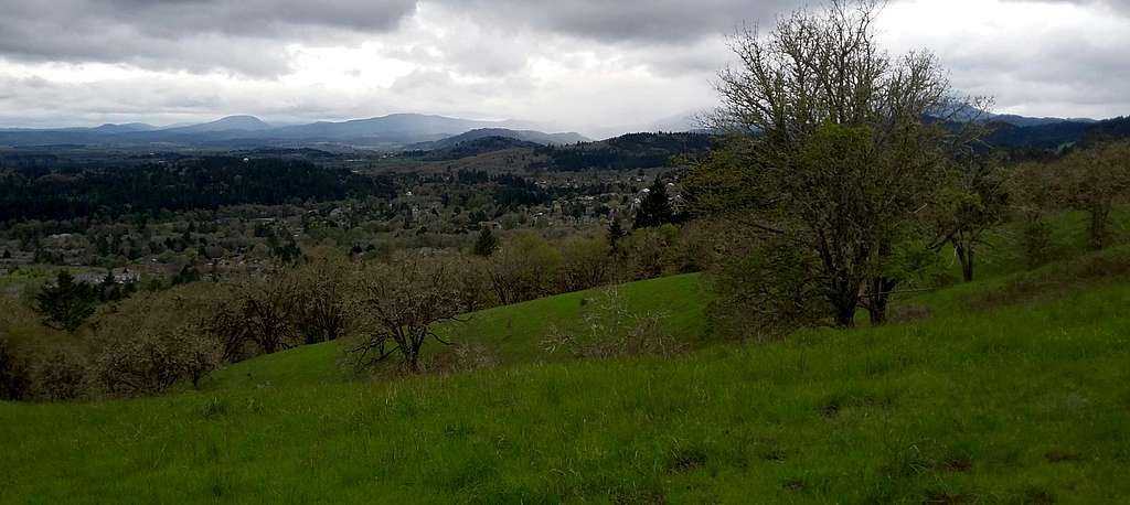
The green fields in spring. Never have I seen greener fields. Do not expect this mountain to be this green when everything drys out by August.
This is a year round park. In the rare event that there is snow on the ground one might traction devices. That problem is very rare because Corvallis rarely gets over a foot of snow in year and this peak is only 500 feet above the town. Another issue is that this trail is very muddy in both winter and spring due to the heavy rain that has fallen during the rainy season. To avaoid the mud, try hiking this trail after April. It is not a big deal but something one should note before heading into the park.
Red Tape
This park is a city park and is open from dusk to dawn year round. There are no fees for this park.When to Climb
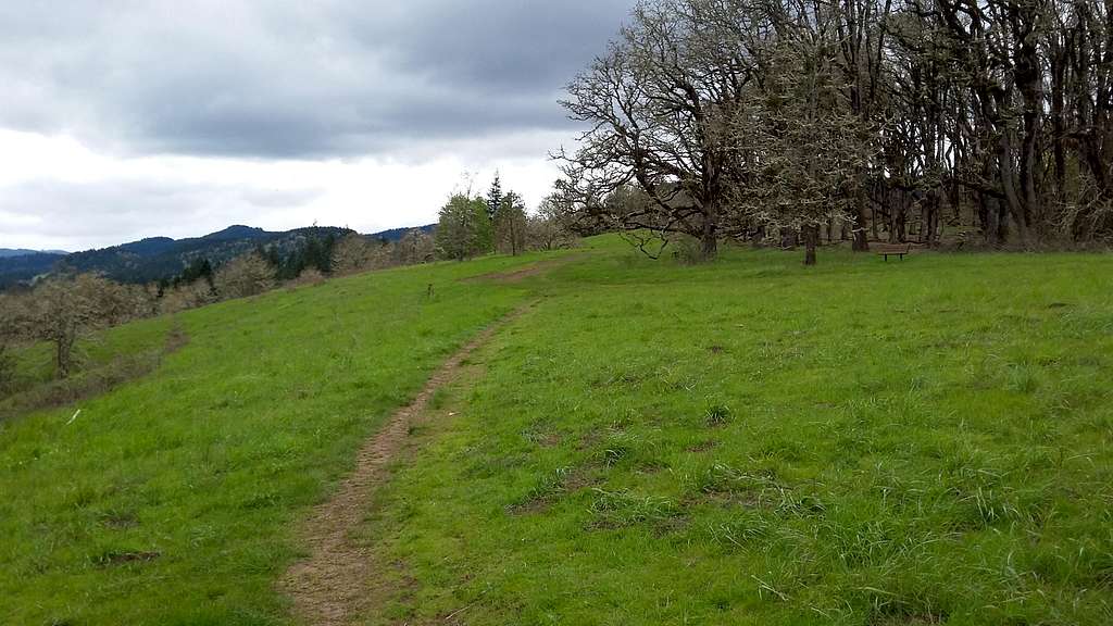
The green fields in spring. Never have I seen greener fields. Do not expect this mountain to be this green when everything drys out by August.
Corvallis in spring