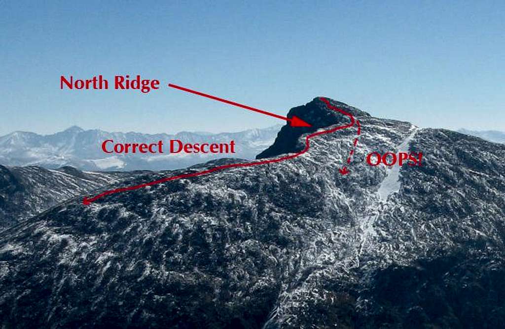
Close up of Holy Cross

Close up of Holy Cross

This is an annotated image of the upper route on Mt of the Holy Cross seen from Mt Jackson to the west. This is the area where most of the people who end up lost on Holy Cross make the mistake that gets them that way. As you can see, the top 300' of the mountain are descended to the west, then you have to turn to your right and follow the north ridge back to get the trail and ultimately the proper descent route. What people do to get lost, is miss this right turn and just keep going down straight. Hopefully seeing the terrain like this will help people avoid this mistake.
chicagotransplant
on Sep 28, 2009 6:31 pm
Image Type(s): Topo/Diagram,  Informational
Image ID: 558166

Comments

Post a Comment
Viewing: 1-2 of 2
Aaron Johnson

Aaron Johnson - Sep 30, 2009 12:15 am - Hasn't voted

Excellent post.

Thanks Mike for posting this one!

chicagotransplant

chicagotransplant - Sep 30, 2009 10:29 am - Hasn't voted

Re: Excellent post.

Thanks Aaron! Hopefully it will help people think about their descent. It was cool to finally see the "Bermuda Triangle" from across the valley, sheds some light on all the rescues back there.

Viewing: 1-2 of 2