Toggle navigation
Mountains
Routes
Images
Trip Reports
Forum
What's New
People
Areas & Ranges
Articles
Trailheads
Canyons
Huts & Campgrounds
Albums
Logistical Centers
Fact Sheets
Lists
Custom Objects
Gear
Plans & Partners
WELCOME TO SUMMITPOST
SIGN IN
REGISTER
Series of Bumps
Additional Parents
My Google Earth Images
Image
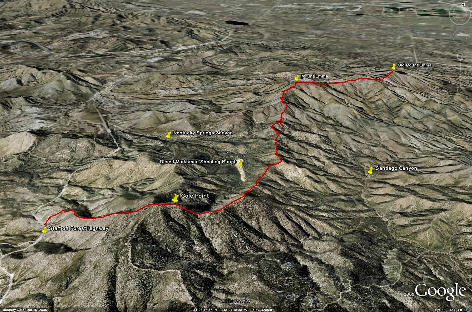
Cole Point, Mt. Emma, Old Mt. Emma - Google Earth Rendition
View High-Resolution Image
Cole Point, Mt. Emma, Old Mt. Emma - Google Earth Rendition
Google Earth rendition of the hike up Cole Point, Mount Emma, and Old Mount Emma from Angeles Forest Highway. This route totalled to 12 miles (in and out) and 6,000 feet of elevation gain.
« PREV
NEXT »
SoCalHiker
on
Apr 15, 2009 12:16 am
Comments & voting
Other parents
Image Type(s):
Topo/Diagram
Image ID:
506176
2181 Hits
72.08
% Score
2
Votes
Log in to vote
Comments
No comments posted yet.
to post!
Don't have an account?
Series of Bumps
(Trip Report)
« PREV
Viewing
#3 of 3
GALLERY
You are at
the Last
Image
SoCalHiker's Image Gallery
« PREV
Viewing
#3373 of 3483
GALLERY
NEXT »
My Google Earth Images
(Album)
Loading....
×
You need to login in order to vote!
User Name
Password
Remember me
Forgot your password?
Log me out when I close my browser.
Keep me logged in all the time.
sign in as a user
Don't have an account?
Register now for FREE
Rating available
Suggested routes for you
People who climb the same things as you
Comments Available
Create Albums
Register Here


