Toggle navigation
Mountains
Routes
Images
Trip Reports
Forum
What's New
People
Areas & Ranges
Articles
Trailheads
Canyons
Huts & Campgrounds
Albums
Logistical Centers
Fact Sheets
Lists
Custom Objects
Gear
Plans & Partners
WELCOME TO SUMMITPOST
SIGN IN
REGISTER
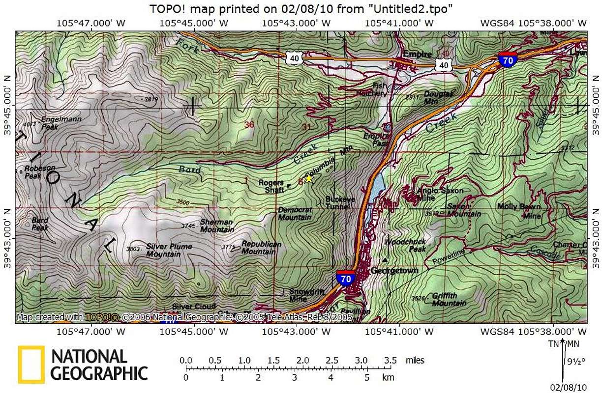
Columbia Mountain
Additional Parents
Image
Columbia Mountain_Getting There Map
View High-Resolution Image
Columbia Mountain_Getting There Map
Columbia Mountain sits two miles as the crow flies to the north-northwest of Georgetown, Colorado. It rises just one mile due-west of I-70, accessible via Exit 232 to Hwy 40 through Empire.
Feb 2010
« PREV
NEXT »
Sarah Simon
on
Feb 17, 2010 10:16 pm
Comments & voting
Other parents
Lat/Lon:
39.73140°N / 105.7126°W
Image Type(s):
Topo/Diagram
Image ID:
597917
2319 Hits
74.01
% Score
4
Votes
Log in to vote
Comments
No comments posted yet.
to post!
Don't have an account?
Columbia Mountain
(Mountain/Rock)
« PREV
Viewing
#8 of 8
GALLERY
You are at
the Last
Image
Sarah Simon's Image Gallery
« PREV
Viewing
#1659 of 5480
GALLERY
NEXT »
×
You need to login in order to vote!
User Name
Password
Remember me
Forgot your password?
Log me out when I close my browser.
Keep me logged in all the time.
sign in as a user
Don't have an account?
Register now for FREE
Rating available
Suggested routes for you
People who climb the same things as you
Comments Available
Create Albums
Register Here


