Comboé and "Becca": a Walk for an Excursion for Kids & Teens / 2

Comboé and "Becca": a Walk for an Excursion for Kids & Teens / 2

Page Type Page Type: Article
Activities Activities: Hiking

Youth Travel Overview


Reading this Article is almost Absssolutely prohibited to adults, unless accompanied by a Child or a little Boy. Why do you have for to read him this Spirit: of innocence and unawareness almost ignorance, as for those who see it for the first time the Sea or the Desert with their Waves. Here we tell of a Walk to the Sacred Comboé and an Excursion to the Mystical Becca di Nona or more simply "The Becca", as in the Ancient Times, when not were still the "Mountaineers & Climbers" and the men climbed on the Summits to be closer to Heaven and enjoy the beauty of Creation. No other purpose, as only the Children and Boys can understand and can do no other with ulterior motives and idea of possession. With this ingenuity can go through all the streets, or nearly so, and still get great pay and great satisfaction, that only Nature is able to offer, if you are able to understand her, respect and love. Even after many years, you will come back to mind the beautiful Walks and Excursions youth with the Friends, many of which today not are more or that in the Life have traveled towards other roads. Maybe towards the "Becca". I have nothing more to add ...


"Mountains are like children: they change over time. Thus were born, but then they change ...", by Antonio


La lettura di sto Articolo é quasi Assssolutamente Vietata ad adulti, se non accompagnati da un Bambino o da Ragazzino. Perchè per leggerlo bisogna aver questo Spirito: d'innocenza e d'inconsapevolezza, come per chi vede per la prima volta il Mare od il Deserto con le lor Onde. Raccontiamo d'una passeggiata al Sacro Comboé e d'una Escursione alla Mistica Becca di Nona o più semplicemente "La Becca", come ai Tempi Antichi, quando non esistevano ancora gli "Alpinisti" e gli uomini salivano alle Cime per esser più vicini al Cielo ed ammirare la bellezza del Creato. Senz'altri scopi, come soltanto i Bambini ed i Ragazzi posson capire e san fare senz'altri fini reconditi e di possesso. Con l'ingenuità bambinesca potete percorrere tutte le strade, o quasi, ottenendo sempre grandi remunerazioni e belle soddisfazioni, che soltanto la Natura é capace d'offrire, se siete capaci di capirela, rispettarla ed amarla. Così, anche dopo molti anni, vi torneranno alla mente belle Passeggiate ed Escursioni giovanili coi più cari Amici, molti dei quali oggi non ci son più o che nella Vita hanno percorso altre strade deviando dalla vostra con relativi interessi; per forse poi riincontrarsi ripercorrendo insieme qualche vecchia pista.
Magari alla "Becca". Non ho altro da aggiungere ...


" ... Comes a New Wind ... ", by Giorgio Fruttaz


Looking at an old photograph, that Time inclement stà already yellowing, come to mind many memories. Dozens and dozens of times I went to the "Becca", but what is left of all this? After having to climb everywhere, think about it, the best memories are with the excursions youth, as a group with friends or with children. No special claims. Certainly a goal always remains, but then was not as important as the fact of being together. In the company of Summit High, maybe even not too difficult. Even better, because it remains Spirit freer freeing themselves from those who are already the problems of everyday Life. Unfortunately return Faces that no longer exist, momentarily erased by the Time ... Unfortunately always inclement.


"Old Reminiscences", by Marco Cossard "Crevassino" self-timer


Guardando una vecchia fotografia ritrovata per sbaglio in un cassetto, che il Tempo inclemente stà già inesorabilmente ingiallendo, vengono alla mente molti ricordi lontani. Dozzine e dozzine di volte son andato in "Becca", ma cos'é rimasto di tutto ciò? Di tutte queste ascensioni, pericoli ed a volte immani fatiche? Dopo averla salita per ogniddove, pensandoci bene, i più bei ricordi son rivolti all'escursioni giovanili, in gruppo con gli Amici o con i Bambini. Senza particolari pretese. Certamente un obiettivo sempre persiste nell'andare, ma poi non era così tanto importante quanto il fatto di star insieme. In compagnia sull'Alte Cime, magari neppur troppo difficili. Anzi meglio, perché lo Spirito riman molto più libero affrancandosi da quelli che son già i troppi problemi della quotidianità. Purtroppo ritornano Volti che non esistono più, cancellati momentaneamente dal Tempo ... Sfortunatamente sempre inclemente.


" ... NEW Generations", by Dad Osw


If a child asks you how it gets to climb a Mountain, what do you say?
That the mountains are not made for the Children? No, because then if he asks you why you do not know what to say. So which is the best answer? Take the backpack and go, perhaps the Devil is not ugly as it is painted. Otherwise remain only Fantasies, perhaps modeled on the sand in the bed of the river, however, that not only do not solve the problem but rather makes him again more acute. Better to precede with the Action. By the sweat of the brow will understand what it means to go up a Mount. Certainly not all the mountains are also possible for the children and who thinks so commits an unforgivable mistake, because it does not take into account the possible consequences. Lately we have seen it all and more, but this is not the right way because children are children, boys will be boys and adults adults. Do not know so what to make this distinction is serious, unpleasant and incomprehensible. Mountain is beautiful, but dangerous, and most importantly, it is not something static and unchanging, because often changes its face and not only in dependence of time. It sounds obvious and instead it is not for nothing. Who does not grasp the concept not only underestimates the same, but unfortunately also those that are the realities that may occur to those who accompanied and also too often overestimates the physical-psychological ability of subject in his care. I do not say this with presumption, not only because I myself have not been exempt from the fact, but in fact I have repeatedly committed the same. Looking back in time we understand, as long as this has given us right time to reflect, observe the right things better ...


" ... Old Memories on the Baltea Sand ... ", by Osvaldinho 1965


Se un Bambino Vi chiede come si fà a scalare una Montagna, cosa rispondete?
Che le montagne non sono fatte pei Bambini? No, perché se poi lui vi chiede del perché non sapete più cosa rispondere. Allora quale é la migliore risposta? Prendere lo zaino ed andare, magari il Diavolo é men brutto di come vien dipinto. Altrimenti rimangon solo Fantasie, magari modellate sulla sabbia nel letto del Fiume che però non solo non risolvon il problema, anzi lo acuiscono ancor più. Meglio fare precedere l'Azione. Con il sudore della fronte capirà cosa vuol dir salire un Monte. Certamente non tutte le montagne sono possibili anche per i bambini e chi lo pensa commette un errore imperdonabile, perchè non tien conto delle possibili conseguenze. Ultimamente abbiamo visto di tutto e di più, ma non é questa la strada giusta perché i bambini son bambini, i ragazzi sono ragazzi e gli adulti adulti. Non sapere effettuare questa distinzione risulta cosa grave, spiacevole ed incomprensibile. La montagna é bella, ma anche pericolosa e, soprattutto, non é un qualcosa di statico ed immutabile, poiché spesso cambia il suo volto e non soltanto in dipendenza dal tempo. Sembra una cosa ovvia e scontata, invece non lo é per nulla. Chi non afferra il concetto non solo sottovaluta la stessa, ma putroppo anche le realtà che si posson manifestare per chi si accompagna ed inoltre troppo spesso sopravvaluta le capacità fisiche e psicologiche del soggetto affidatogli. Non dico questo con presunzione, poichè non solo io stesso non sono stato esente dal fatto, ma anzi ho commesso ripetutamente il medesimo. Guardando indietro nel tempo si comprende, sempre che questo ci abbia concesso di rifletter e meglio osservar le giuste cose ...


" ... Elywind on "Becca" ...", by dad


The Child and the Boy live in another dimension. A different wordl, as for the Mountains, not all are created equal. They are masters of time Future, but not in the Present and above all do not know the Past. Their experiences are limited and sometimes non-existent. For this it is important that those who guide them in the approach to the mountain knows choose for them. Many items such as Cold, Wind, the Snow, the ice, the Thunderstorm, not to mention the Landslides, Snowslides, Avalanches or simply falling rocks, here completely change or arise sudden and unexpected. You have to know their face in the best way possible, which then consists of a gradual school and never improvised. Having a natural shelter, or better a bivouac or a refuge nearby is never unwelcome thing for anyone. It is important to be able to reach him, in the shortest time possible and better. This too obvious? Not too much, because there were misfortunes just steps from the shelter when a fog prevented mocking of view and reach the same. And this also against adults, maybe experienced mountaineers. Never underestimate, never let your guard down, never think of overthrowing the mountains thinking that David strikes Goliath. The Wind is always the wind, so the Snowstorm and Blizzard and Lightning do not look at anyone, whether you're at the Mont Blanc to the Matterhorn, at the Gran Paradiso or in Becca di Nona. If wind is from 3000 metres to 3000 wind is everywhere, whether it is to 3500 equal, while almost 5000 is always Five Thousand metres.
This the right way of thinking. Everything else comes from Evil ...


" ... The Giant beaten ... David or Goliath countdown ...", by dad


Il Bambino ed il Ragazzo vivono in un'altra Dimensione
. Una mondo diverso, come per le Montagne, che non tutte nascon uguali. Son padroni del tempo Futuro, ma non del Presente e soprattutto non conoscono il Passato. Le loro esperienze son limitate ed, a volte, del tutto inesistenti. Per questo é importante che chi li guidi nell'approccio alla montagna sappia scegliere anche per loro. Molti elementi come il Freddo, il Vento, la Neve, il Ghiaccio, il Temporale, per non parlare di Frane, Slavine, Valanghe o semplicemente caduta di pietre, qui cambian del tutto o sorgon improvvisi ed inaspettati. Bisogna saper affrontare loro nel modo migliore possibile, che poi consiste in una scuola graduale e mai improvvisata. Aver un punto di riparo, meglio un bivacco od un rifugio nelle vicinanze non é mai cosa sgradita a nessuno. L'importante risulta poterci arrivare, nel più breve e migliore tempo possibile. Anche questo scontato? Non troppo, poiché si son registrate disgrazie a due passi dal rifugio quando una nebbia beffarda impediva di vederlo e raggiungere. E questo pur nei confronti d'adulti, magari alpinisti esperti con anni d'esperienze. Mai sottovalutare, mai abbassare la guardia, mai pensare di rovesciar Montagne pensando d'essere Davide che abbatte Golia. Il Vento é sempre il vento, così la Bufera e la Tormenta ed il Fulmine non guarda in faccia nessuno, sia che siate al Monte Bianco al Cervino, al Gran Paradiso od alla "Becca". Se é vento da 3000 metri é vento da 3000 metri dappertutto, se é da 3500 uguale, se da quasi 5000 sempre Cinquemila metri é.
Questo il giusto modo di pensare. Tutto il resto viene dal Maligno ...


Neighbor the Bivouac

For this very reason, we reversed the Pages. Before the second, which leads back to the suggestions mentioned above; then follow the one addressed to a "quieter" walk in the Sacred Comboé Walloon, which, alas, are "profaning" doing there get a farm dirt road that, in our humble opinion, one of defacing utime picturesque spots still exist in the Valley Aosta. But first things first, and we'll talk in due course. Returning instead to the foregoing, we start with the ascension to suggest "Becca" going from Colle Carrel where, since July 1984, has been placed a beautiful bivouac sheet with six beds. Incidentally this was also the way of the first mountaineeers in 1832 when Captain Alberto Casalegno, Chief Officer of Surveyors of His Majesty of Savoy, King of Piedmont and Sardinia (Kingdom of the Two Sardegne), had first climbed the Becca di Nona; a first logically statistic or mountaineering note, since it was already known from the year 1223 with the name of Chantel de Glariesi or Glariety. Surely already visited by Shepherds that, in his spare time, became Hunters in the property of the Bishop of Aosta that since Comboé reached the Berio Chamosser or Mont Chamosier, current Monte Emilius. Through this pathway were carried accomplished even the first winter ascents December 20th, 1889 by Emilio A. Martelli and Silvio Miglietti with the Guide Valtournanche J.B. Aymonod and March 19th, 1928 by the large party of A. Crétier with F. David, A. Deffeyes, G. Lamastra, B. Ollietti, G. Perolino and L. Pession, by ski from Comboé Alp.


"Federigo Zullo Bivouac (2907m) at Carrel Hill", by Antonio


Per questo preciso motivo abbiamo invertito le Pagine. Prima la 2, che riconduce ai suggerimenti sopra citati; poi seguirà la 1 rivolta ad una "più tranquilla" passeggiata nel Sacro Vallone di Comboé, che, ahimé, stanno "profanando" facendovi arrivare una strada poderale tale da, a nostro modesto avviso, deturpare uno degli utimi angoli pittoreschi ancora esistenti in Valle di Aosta. Ma andiamo con ordine e ne riparleremo a tempo debito. Ritornando invece a quanto sopra espresso, iniziamo con il suggerire l'ascensione alla "Becca" passando dal Colle Carrel dove, dal Luglio del 1984, é stato posizionato un bel bivacco in lamiera con sei posti letto. Daltronde questa era stata anche la via dei primi salitori quando nel 1832 il Capitano Alberto Casalegno, Capo Ufficiale dei Topografi di Sua Maestà di Savoia, Re del Piemonte e della Sardegna (Regno delle due Sardegne), aveva per primo salito la Becca di Nona; una prima logicamente statistica se non alpinistica, poiché la medesima era già conosciuta dall'Anno 1223 con il nome di Chantel de Glariesi o Glariety. Sicuramente già visitata dagli Alpigiani che, a tempo perso, diventavano Cacciatori nella proprietà del Vescovo di Aosta che dal Comboè raggiungeva il cosiddetto Berrio Chamosser o Mont Chamosier, attuale Emilius. Tramite questa via vennero compiute compiute anche le prime salite invernali il 20 Dicembre 1889 e il 19 Marzo 1928.


" ... ALARM & ARMEDS! ... ", by Old Osw


Going from Comboé (2114m; + little Chapel and private Shelter) or, for locals, Combuì, still owned by the Priory of Sant'Orso, after a long flight path n° 18 reaches a large grassy-stony plateau-highland called Plan Valé (2316-2379 metres, perimeter ruins by an old alp; also this was the ancient name of Mount Emilius called Pic du Valé), where we do not know if that name is pointing to the little walloon (see also Pas du Valaisan on superior part of Arbolle Walloon) above or to an unlikely colonization of inhabitants coming from the Swiss Valais. Crossed from West to the East this great tableland, which runs from the top looking like the skeleton of a huge dinosaur, you reach a subsequent ramp, where beside which in late spring crashing valanches coming from the overlying Mont Ròss de Comboé and homonymous hill. This is a place to go with caution in this season, at least until it has dropped the avalanche largest (generally between late May and mid-June). The path then reaches at a large boulder squared, said Gros Scez also Le Grand Sex or Le Grand Sax (2526m; Big Stone) and immediately below the junction 2609 metres; leaving left the path n° 18 that goes up to "Becca", climb instead on the walloon floor through the trail n° 18A, renovated since 1984. The same, at least in the upper parts, is again collapsed in some places, because of avalanches spring. However without problems, with snaking hairpin bends always most narrow, you reach the bivouac, being careful at the end to the possibility of stones falling from the Northwest Ridge Mont Ròss (E/F; 2h'00/2h'30 from Comboé Shelter or Alp; to avoid this route in case of high snow and not yet well-transformed).


"Over Carrel Hill (2916m) near Federigo Zullo Bivouac ", by Dad


Salendo dal Comboé o, per i locali, Combuì, ancora oggi di proprietà del Priorato di Sant'Orso, dopo una dura rampa il sentiero n° 18 raggiunge un grande pianoro erboso-detritico detto di Plan Valè (2316-2379 metri, rovine perimetrali d'un antica alpe; anche questo era l'antico nome del Monte Emilius chiamato Pic du Valè), dove non sappiamo se questo toponimo fosse rivolto al valloncello (vedi anche Pas du Valaisan sopra Arbolle) soprastante od ad una alquanto improbabile colonizzazione di abitanti che arrivavano dal Vallese svizzero. Attraversato da Ovest ad Est questo grande altipiano, che si snoda guardando dall'alto come lo scheletro d'un enorme dinosauro, si raggiunge una successiva rampa, dove affianco alla quale in tarda primavera s'infrangono le valanghe provenienti dai sovrastanti Mont Ròss de Comboé ed omonimo colle. Questo é posto da percorrere con prudenza in questa stagione, almeno fino a che non é scesa quella più grande (in genere tra fine Maggio e metà di Giugno). Il sentiero giunge quindi presso un grande masso squadrato, detto Gros Scez oppure Le Grand Sex o Sax (2526 m; Gran Sasso) e subito appresso al bivio 2609 metri; lasciando a sinistra la mulattiera che sale alla Becca, si sale invece sul fondovallone tramite il sentiero n° 18A, ristrutturato dal 1984. Lo stesso, almeno nelle parti superiori, é nuovamente franato in alcuni tratti, sempre a causa delle slavine primaverili. Senza problema, serpeggiando con tornanti sempre più stretti, si raggiunge il bivacco, facendo attenzione nel finale a possibilità di cadute di pietre dalla Cresta Nordovest del Mont Ròss (E/F; 2h'00/2h'30 dal Comboé; da evitarsi questo percorso in caso di neve alta e non ancora ben trasformata).


Then we go to in "Becca"


" ... On Becca ...", by Osw


By the Federigo Camp Zullo (2907m), all that remains is to follow the easy Crest East-southeast, which divides the small basin in the North, where it was restored the old Haunt of Gamekeepers Baron Beck Peckoz Gressoney at a small lake (2873m), from the steep and grassy-rocky slope facing Southeast over the footpath to here below. I went down to the real short Colle Carrel (2916m) a few feet lower hovers on the right (North) to track a small rocky ridge shaped like a hand reaching traditional Summit. From here begins the climb through a small path, after about fifty metres, reaches a tiny promontory from which you can get a great echo that comes from the North Wall of Emilius. It continues on the same which soon turns into a thin track reaching a stretch of rocks very broken. Knowing look, between the same or just above there is a fresh spring in the rock with the water that comes from the upper snowfield at the junction with the trail that goes up the Slope South-southwest; if you have not already taken the Pond Peckoz, should refuel otherwise you will not find more. Dubbed these rocks on the right path becomes landslide reaching the junction of the above; by a final diagonal to the right, followed by a couple of bends, past the pitiful remains of the ancient Pavillon Budden you reach the statue of the Madonna or Traditional Summit. The real is a few feet above the left and you reach passing a short rocky stretch (E/F; 0h'45/1h'00 from the bivouac; 3h'00/3h'30 from Comboé). This itinerary is very suitable for all the childrens.
The Excursion is very scenic and you can see the Matterhorn in the Northeast, while to the South we La Grivola and the entire Massif of Gran Paradiso.


"Becca from Federigo Bivouac by East-southeast Crest", by Osw


Dal Bivacco Federigo (2907 m)
, non rimane che seguire la facile Cresta Est-sudest, che divide il piccolo bacino a Settentrione, dove é stato ristrutturato il vecchio rifugio dei Guardiacaccia del Barone Gressonaro Beck Peckoz presso un laghetto (2873 m), dal ripido ed erboso-roccioso Versante Sudest rivolto sopra il sentiero sin qui seguito. Scesi in breve al vero Colle Carrel di qualche metro più basso s'aggira sulla destra (Nord) per una traccia una crestina rocciosa a forma di mano raggiungendo il tradizionale (2916 m); da qui inizia la salita tramite un sentierino che, dopo una cinquantina di metri, raggiunge un minuscolo promontorio dal quale si può ottenere uno eccezionale eco proveniente dalla Parete Nord dello Emilius. Si continua sul medesimo che ben presto si trasforma in un'esile traccia raggiungendo un tratto di rocce molto rotte. Sapendo cercare, tra le medesime od appena al di sopra esiste una fresca sorgente nella roccia con l'acqua che proviene dal nevaio superiore all'incrocio con la mulattiera del Versante Sud-sudovest; se non l'avete già presa al Laghetto Peckoz, conviene fare rifornimento altrimenti non ne troverete più. Doppiate sulla destra queste roccette il sentiero diventa franoso raggiungendo l'incrocio di cui sopra; con un ultimo diagonale sulla destra, seguito da un paio di tornanti, passando accanto ai miseri resti del Pavillon Budden a pochi metri dalla Vetta ,si raggiunge la statua della Madonna o Sommità Tradizionale. La vera é qualche metro sopra a sinistra e si raggiunge superando un breve tratto roccioso (E/F; 0h'45/1h'00 dal bivacco; 3h'00/3h'30 da Comboé). Questa via risulta molto adatta anche pei bambini, con le precisazioni sopra esternate in caso di forte innevamento.
Escursione molto panoramica consente a Nordest la vista sul Cervino, mentre a Mezzogiorno abbiamo l'intero Gruppo del Gran Paradiso e La Grivola.


" ... Cocca Colla ...", by B&W Dad


When you came in the Pano Peak admired in silence.
Should be the children, on their own initiative, asking questions in front of all those glittering Summit, which from here unfold all around 360°. Do not disturb their curiosity with scholarly enumerations and specifications; be concise and synthetic instead and let this shoots more and more. Not pose other questions if do not insist. So much for their the names Aig. Noire, Talèfre, Triolet, Velan, Combin and Matterhorn, and La Grivola The Herbetet are completely gibberish. Most use of the term Alps or, if they are a little bigger, differentiated mountains for color: Mont Blanc, Monte Rosa (Pink); no Red because it is too small and not even because Verte is so far away that you can see and even then, being too white, only creates very confusion. Gran Paradiso instead always goes well, there a few steps behind him with that big blue sky above glaciers twinkling lights that give just the idea and impression of ​​the Great Heaven. Tribulation? Never mind, for heaven's sake! Are already satisfied and, perhaps tired and fatigued, have simply thirst and hunger. Someone also want to take a nap. Well, supervised because only in North and East precipitate walls and the danger is always present because children are unpredictable and fast. There, a few steps away from you, and will surely remain fascinated by the great Wall.
Ah, if you have not already done so, please listen to them down the Echo; be impressed and you will make a stunning success. Wizard "speaks" to Mounts ...


"... Council of War ...", by Oswdad


Quando siete giunti in Vetta ammirate il Panorama in silenzio. Debbon essere i bambini, di lor iniziativa, a far domande di fronte a tutte quelle Vette scintillanti, che da qui si dispiegano tutt'attorno a 360°. Non turbate la loro curiosità con dotte elencazioni e specificazioni; siate invece sintetici e concisi e lasciate che questa germogli sempre di più. Se non pongono altre domande non insistete. Tanto per loro Aiguille Noire, Talèfre, Triolet, Velan, Combin e Cervino, La Grivola e L'Herbetet sono parole senza senso alcuno. Che noia! Al massimo usate il termine di Alpi o, se son un pò più grandicelli, differenziate le montagne pel colore: Monte Bianco, Monte Rosa; Rosso no perché é troppo piccolo e Verte neppure perché é così lontana che neppur si vede e poi, essendo anche lei bianca, crea solo confusione. Gran Paradiso invece và sempre bene, lì a due passi dietro le spalle con quel grande cielo azzurro sopra ghiacciai più scintillanti che luminosi che dan proprio l'idea del Paradiso. Tribolazione? Lasciate stare, per carità! Son già soddisfatti e, magari stanchi ed affaticati, hanno semplicemente sete e fame. Qualcuno desidera anche far un sonnellino. Bene, vigilate soltanto perché a Nord ed ad Est precipitano grandi pareti ed il pericolo é sempre presente, ché i bambini son imprevedibili ed alquanto svelti. Lì, a due passi da voi, mentre resteranno sicuramente affascinati dalla grande Parete dello Emilius.
Ah, se non l'avete ancor fatto, in discesa fate lor ascoltar l'Eco; resteranno stupefatti e voi farete un figurone. Come Gran Mago che "parla" alle Montagne ...


"On Becca di Nona (3142m) by Federigo Bivouac", by Osw


One Way Alternative & another Adventurous


"From Comboè to Plan Valé & Becca di Nona", by Osw


But there is another ascent route suitable for children. Along the South-southwest Slope goes fact the old mule track built to carry with mules the Statue of Madonna. Built in Alessandria (Piedmont), the same, dismantled into several pieces of bronze, was welded to the Summit and inaugurated, on the initiative of Lawyer Jean Baptiste Gal, September 12th, 1892, as shown in "M.V.D.A.", page 485. High 5 metres, the installation of the statue of the Virgin, turned over the City of Aosta and to the entire Valley, completed an Epic Exploration of which had reached its peak with the publication of "Les Alpes Pennines dans un jour, soit panorama Boréal de la Becca de Nona ", published by Canon Georges Carrel (* Chatillon 1800 - Aosta + 1870), a true Pioneer of this mountain as well as Founder and Chairman of the Section of C.A.I. Aosta since 1867, the second in Italy after Turin in 1866. He was dedicated to the name of this mountain with baptism made September 19th, 1878; but the choice was not a success, while remains linked his name to the nearby Carrel Hill. Since then it became progressively more and more used to the convenience of the path and the total lack of objective dangers, while the traditional way through the hill was abandoned and if anything carried out downhill, especially for refueling water at the Pond Peckoz. This at least until July 1984, when the positioning of the bivouac perverting the values again and the fashionable path. This route was traveled in winter, December 23, 1977, by osvaldo Cardellina and Camillo Roberto Ferronato departing from Pila and climb in the day. Presents no difficulty, but with the snow completely different matter; especially in late spring when with the snowfields very hardened lead to the crossing of several more and more steep channels. From personal experience also made with four children and no rope but shaking hands with one another, this choice in such circumstances is to be avoided as very risky. With the summer season, however, everything changes and the ascension becomes safe, maybe in a little boring and even less panoramic, because you always turn your back to the valley (which great heat with the sun!) and not much admires. Let's see it briefly: from the junction 2609 metres above Gros Scez leaving the right path that climbs the Col Carrel and camp, climb instead on the left leaving the bottom of the valley through the trail n° 18. Doubled to left (West) the small grassy-rocky promontory above, continue to the first section on the left through the same little steep switchbacks. then the trail gradually moves to the Northwest, and passed several couloirs, passes at the "Cave of Providence", where momentarily back in the opposite direction. Recovery in the first direction, past a series of rocks shattered with many points collapsed, especially in the steeper sections, then gradually head towards the sparsely accentuated South Edge until you reach a balcony on the same, from which you start to see the Northern Wall of Emilius. With tight hairpin bends and steep you reach the junction, above a rounded shoulder where you can admire the Basin Pila, with the small trail n° 18A, which rises from the camp and by the preceding route on Summit (E/F; 2h'30/3h'00 from Comboé; 4h'00/4h'30 from Pila; 6h'00 7h'00 from the bottom or from the various intermediate points of departure along the Regional Road in asphalt towards Pila-Resort).


"First on "Becca" by Pian Felina, 1964", by Dario Cardellina


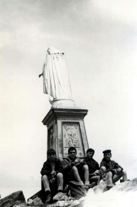
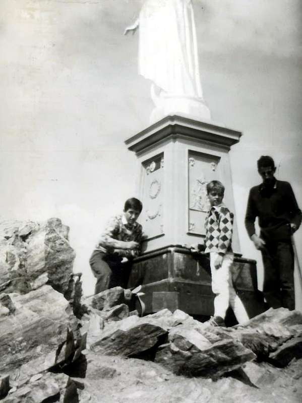
Ma esiste anche un'altra via di salita adatta ai bambini. Lungo il Versante Sud-sudovest sale infatti la vecchia mulattiera costruita per trasportare coi muli la Statua della Madonna. Costruita in Alessandria, la stessa, smontata in vari pezzi di bronzo, venne saldata sulla Sommità ed inaugurata, su iniziativa dell'Avvocato Jean Baptiste Gal, il 12 di Settembre 1892, come risulta in "M. V.D.A.", pagina 485. Alta 5 metri, la posa di questa statua della Vergine, rivolta sopra la Città di Aosta ed a tutta la Valle, completava un'Epopea Esplorativa, che aveva raggiunto il suo apice con la pubblicazione di "Les Alpes Pennines dans un jour, soit panorama boréal de la Becca de Nona", pubblicata da parte del Canonico Georges Carrel (* Chatillon 1800 - + Aosta 1870), vero Pioniere 
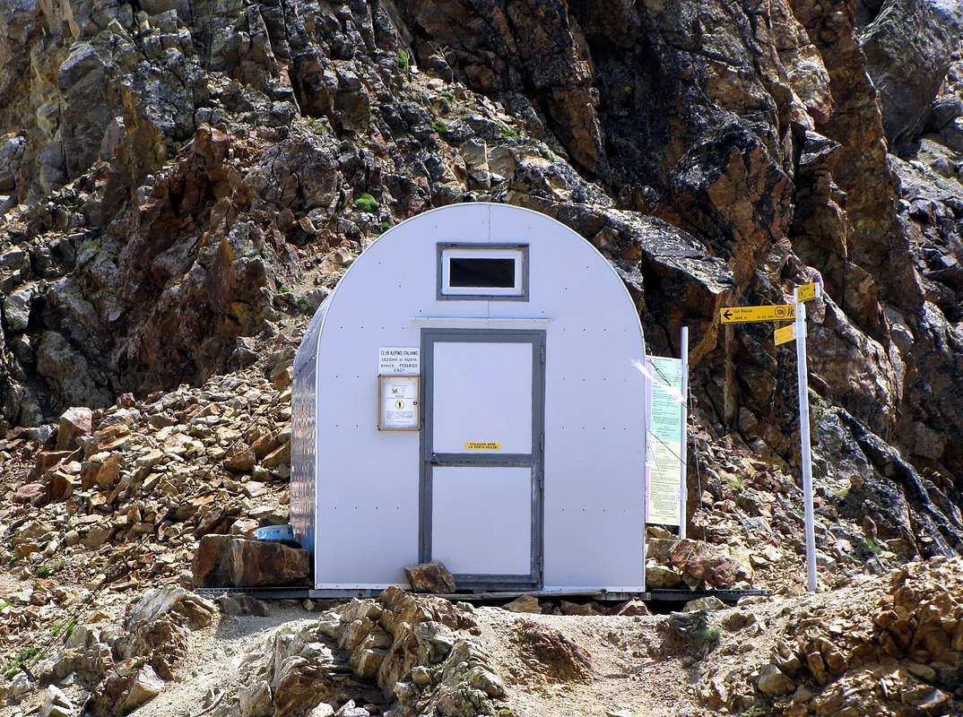
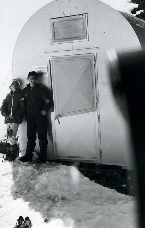
di questa montagna nonché Fondatore e Presidente della Sezione del C.A.I. di Aosta dal 1867, la seconda in Italia dopo Torino 1866. A lui venne dedicato il nome della montagna con battesimo effettuato il 19 Settembre 1878; la scelta però non ebbe successo, mentre rimane legato il suo nome al vicino Colle Carrel. Da allora questa divenne progressivamente la via più utilizzata per la comodità del sentiero e la totale mancanza di pericoli oggettivi, mentre la tradizionale dal colle andava in disuso e semmai percorsa in discesa, soprattutto per far rifornimento d'acqua presso il Laghetto Peckoz. Questo almeno fino a Luglio 1984, quando il posizionamento del bivacco sovvertiva nuovamente i valori, nonché la moda di percorso. Questa via veniva percorsa anche in inverno, il 23 Dicembre 1977, da parte di osvaldo Cardellina e Camillo Roberto Ferronato con partenza da Pila e salita in giornata. Non presenta alcuna difficoltà, ma con la neve il discorso cambia completamente; soprattutto a fine primavera quando nevati con neve molto indurita conducono all'attraversamento dei vari canaloni. Per esperienza personale fatta anche con quattro bambini e senza corda ma dandosi la mano l'un con l'altro, questa scelta in siffatte condizioni é assolutamente da evitarsi poiché molto rischiosa. Con la bella stagione invece tutto cambia e l'ascensione diventa sicura, forse un pò noiosa ed ancor meno panoramica, poiché si volgon sempre le spalle a valle (che calura col sole!) e non molto s'ammira. Vediamola brevemente: dal bivio 2609 metri sopra Gros Scez lasciando a destra il sentiero che sale al Colle Carrel e bivacco, si va invece sulla sinistra abbandonando il fondo vallone tramite il sentiero n° 18. Doppiato a sinistra (Ovest) il soprastante piccolo promontorio erboso-roccioso, si prosegue pel primo tratto sulla sinistra del medesimo tramite tornanti poco ripidi. Quindi progressivamente la mulattiera si porta a Nordovest e, superati vari canaloni, passa presso la "Grotta della Provvidenza", dove momentaneamente ritorna nel senso opposto. Ripresa la prima direzione, oltrepassa una serie di rocce in frantumi con molti punti franati, soprattutto nei tratti più ripidi, per poi progressivamente dirigersi verso il poco accentuato Spigolo Sud sino a raggiungere un balcone sul medesimo, dal quale s'inizia ad ammirare la Parete Nord dell'Emilius. Con tornanti più stretti e ripidi si raggiunge la congiunzione, sopra una spalla arrotondata dalla quale s'ammira la Conca di Pila, con il sentierino n° 18A, che sale dal bivacco e con la via precedente alla Sommità (E/F; 2h'30/3h'00 dal Comboé; 4h'00/4h'30 da Pila; 6h'00/7h'00 da fondovalle o dai punti intermedi di partenza).

The last via treated is more adventurous, but it is more suited to Boys than to Childrens. But just because it must be "adventurous" we'll talk quickly by making a small hatch of the route to be followed in order not to deprive the pleasure of "Discovery", because this must be the goal for guys who since 13 until 16 years. It is not difficult, but it forces you to "discover" the way to go and to start to use your head. Alone. We have to go in "Becca" going from wild Arpisson Walloon said by the Hunters "Lo Cordagnì", at the foot of the two namesakes glaciers under the North Wall and passing through the "Sources of Emilius". A nice puzzle! We only some small suggestion, after you have to fend for themselves. You have to reach the Walloon of Arpisson or downhill from the "Becca" to the North-northeast, passing near the Glacier Western Arpisson, but without crossing him as we did as kids in 1965, or uphill, starting from the Regional Road to Pila or even by the valley floor from Pollein, Roulaz, Alto Felina, Creton, Felina or Pont Suaz. Arriving on the Pasture of Reverier Dessous (1042m) you reach the Bridge Rongachet (1100 metres about), over the Torrent de Comboé, and the next eponymous village (you can get here with a steep asphalted road that starts from the Village of Chenaux, Pollein). You have to reach the three Pastures of Martsaouchy d'en Bas, du Meitin, Damon (1330m, 1362m, 1420m about), passing through the Alps Gorettaz and Barma. Here ends the farm dirt road which in time replaced the trail. Looking up you see the beautiful waterfall Arpisson and the North Wall Emilius with its characteristic "cannon" in pointing to the Black Triangle. The problem is that now you have to enter the walloon, but the Torrent Arpisson totally bar the way. Must necessarily go somewhere else, otherwise it is impossible to continue. Are you still missing more than 1700 metres to reach the "Becca", which is hidden by a forest-rocky promontory at the end of his "Crestone North-northeast". We help: you have to go to the ruins of ancient Alp Plan Croix (1745m) on the same, before veering in the direction of the two Southeast Alps Arpisson Lower and Upper (1951 m, 2010 m), under the moraines that descend by Emilius with its gurgling Springs. Take Paper, Compass or orient yourself with the sun or the bark of trees. Do not give up, because the goal is not that far away and unreachable!
Oh, remember that you have to go in a landslide before crossing an old wooden aqueduct, hard to see why suspended over the trees of Forest ...


"Becca to Emilius Sources, 1965", by Ilario Antonio Garzotto


L'ultima via trattata é più Avventurosa, epperciò risulta più adatta a ragazzi che a bambini. Ma proprio perché deve essere "Avventurosa" ne parliamo rapidamente effettuando un piccolo tratteggio dell'itinerario da seguire, onde non privare del piacere della "Scoperta", perché questo deve essere l'obiettivo per ragazzi che vanno dai 13 ai 16 anni. Non é difficile, ma obbliga a "scoprir" la strada da percorrere ed ad iniziare ad usare la testolina. Da soli. Dobbiamo andare in "Becca" passando dal selvaggio Vallone dell'Arpisson detto dai Cacciatori "Lo Cordagnì", ai piedi dei due omonimi ghiacciai sotto la Parete Nord e transitando per le "Sorgenti dell'Emilius". Un bel rompicapo! Vi diamo solo qualche piccolo suggerimento, poi arrangiatevi. Dovete raggiungere il Vallone dell'Arpisson o in discesa dalla "Becca" verso Nord-nordest, passando presso il Ghiacciaio Occidentale di Arpisson, ma senza attraversarlo come abbiamo fatto noi da ragazzi nel 1965, oppure in salita partendo dalla Strada Regionale per Pila od addirittura dal fondo valle da Pollein oppure nel Comune limitrofo di Charvensod dalle Frazioni di Roulaz, Alto Felina, Creton, Felina o dal Pont Suaz. Raggiunto l'Alpeggio di Reverier Dessous (1042 m) raggiungete il Ponte di Rongachet (1100 metri circa), sopra il Torrent de Comboé, ed il successivo e vicino omonimo villaggio (si può qui arrivare con una ripida strada in asfalto che parte dalla Frazione di Chenaux, Pollein). Dovete raggiungere i tre alpeggi di Martsaouchy d'en Bas, du Meitin e Damon (1330 metri circa, 1362m, 1420m circa), passando per le Alpi di Gorettaz in basso e di Barma (1089 m, 1255 m) più verso Occidente. Qui termina la strada poderale che nel tempo ha sostituito l'antico sentiero. Guardando in alto vedete la bella Cascata di Arpisson e la Parete Nord dell'Emilius con il suo caratteristico "cannone" in punta al Triangolo Nero. Il problema consiste nel fatto che adesso dovete entrare nel vallone, ma il Torrent d'Arpisson vi sbarra totalmente la strada. Bisogna obbligatoriamente passare da un'altra parte, altrimenti é impossibile continuare. Vi mancano ancora più di 1700 metri per raggiungere la "Becca", nascosta da un promontorio boschivo-roccioso al termine del suo "Crestone Nord-nordest". Vi aiuto: dovete passare per l'antica Alpe diroccata di Plan Croix (1745 m) sul promontorio, per poi volgere a Sudest in direzione delle Alpi d'Arpisson Inferiore e Superiore (1951 m, 2010 m), sotto le morene che scendon dall'Emilius colle gorgoglianti Sorgenti. Per giunger sin qui il sentiero esiste ed é anche molto bello ed avventuroso: con un pò d'impegno trovatelo. Prendete Carta e Bussola, oppure orientatevi col sole od osservate lo stato della corteccia degli alberi. Mi raccomando, non arrendetevi assolutamente!
Ah, ricordatevi che dovete passare presso una frana prima di oltrepassare un vecchio acquedotto in legno, difficile da vedere perché sospeso sulla Foresta ...


"OK Guys" now you are Ours ..., by emilius


Comments

No comments posted yet.