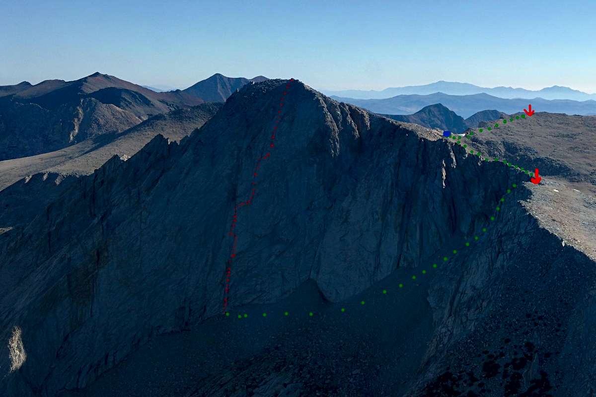
Mt Conness SW face (5.10c), approximate route in red. In green you can see the approach/descent after you go over the "notch" to the summit plateau. We left our backpacks at the blue dot and racked up there. (Photo taken from the air, above Young Lakes)
