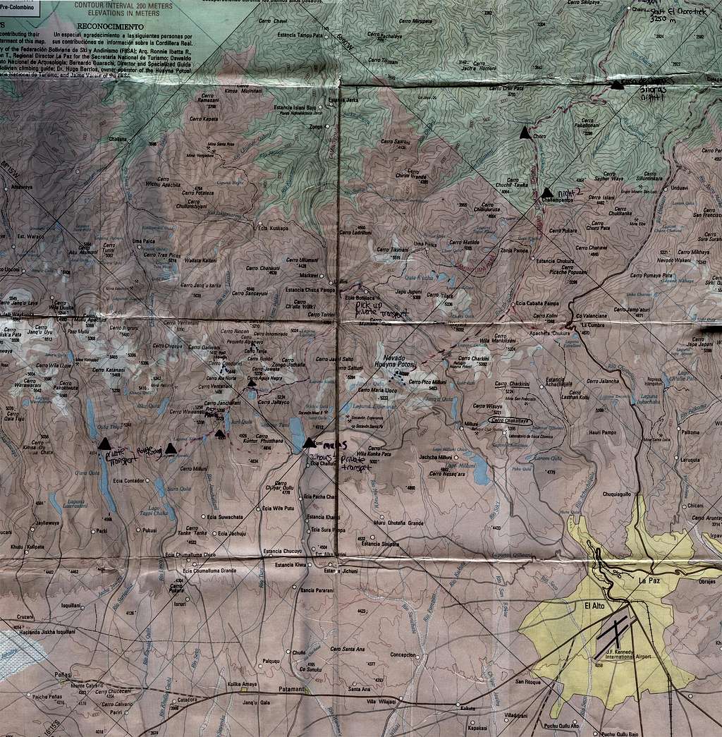
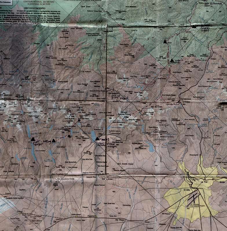
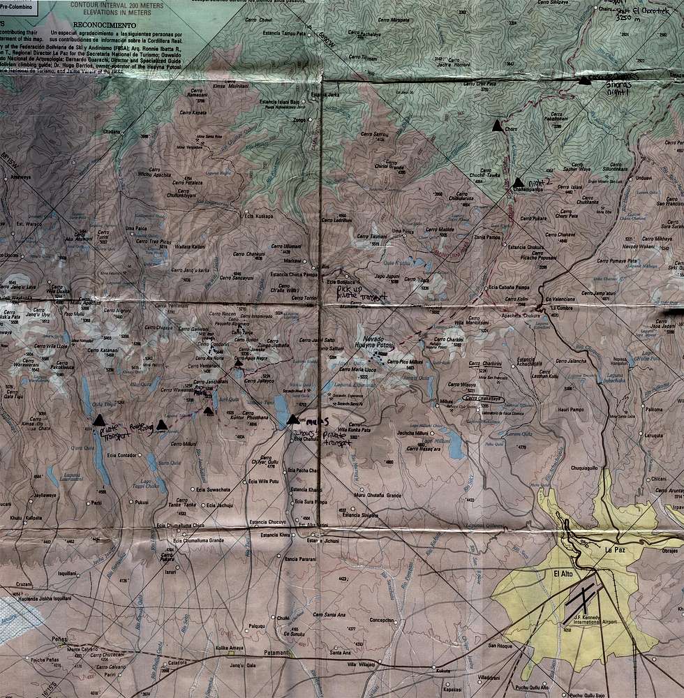
Cordillera Real Topographical Map, Bolivia
This map shows a section of Bolivia's Cordillera Real. I have also uploaded a cropped version of this map, showing only the hiking and climbing around the Condoriri Base Camp.
The urban area of La Paz is visible in the lower-right hand corner of the map (shown in yellow). You can also clearly see the camps that we used during our trek (purple triangles) as well as the mountains we climbed (purple dots forming an upward pointing arrow). The pink dotted line is a very rough representation of the trail, which in actuality follows the contour lines a lot more closely. Don't let the proximity of these peaks to La Paz fool you, once you leave the yellow area of La Paz, all the roads are dirt. Notice the hand written note that says that it took us 2 1/2 hour to get from Tuni to La Paz in private transport.
This map also shows the camps that are commonly used for the Choro Trek, a popular 2-5 day trek close to La Paz. Look for the hand written note that says "start of the Choro Trek" in the upper-right hand corner of the map. While this camp is typically the end of the Choro Trek, doing the trek in reverse would serve as great acclimatization before heading into bigger mountains.
The scale of this map is 1:135,000. It is only intended as a rough guide to the area, not a detailed hiking or climbing map.


