
|
|
Mountain/Rock |
|---|---|
|
|
33.96350°N / 111.47264°W |
|
|
Maricopa |
|
|
Hiking |
|
|
Spring, Fall, Winter |
|
|
5610 ft / 1710 m |
|
|
Overview
Cornucopia Ridge is located across the Beeline Highway from Mount Ord and is fairly accessible from the Phoenix metro area, particularly from Scottsdale and Fountain Hills. It is in the extreme northeast corner of Maricopa County and nearly 60 miles drive from downtown Phoenix.
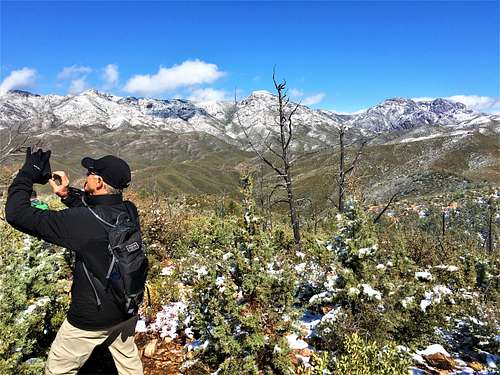
Roads lead all the way to the summit due to a history of mining in the area. Cornucopia Ridge has approximately 300’ of prominence (Lists of John lists 310’ and Peakbagger lists at least 290’). Although the prominence isn’t significant, the summit is situated in a central location in the range, so the views are spectacular.
The only thing that jars people about this hike is the requirement to descend nearly 500’ from the Forest Road 201; which requires re-ascending that nearly 500’ to the road on the return. Ultimately though, it isn’t that difficult.
If driving up the Forest Road 201, one can hike Cornucopia Ridge, Pine Butte, and Mount Peeley in one day if so inclined. That would make for a long day, but it is doable if starting from the closest points on the road. A 4WD is necessary for that adventure. However, a day hike to Cornucopia Ridge does not require 4WD if parking at the starting point noted below.
Cornucopia Ridge is best hiked outside of summer months. October through April are recommended months. The best times are probably late February into mid-April and late October through November.
Getting There
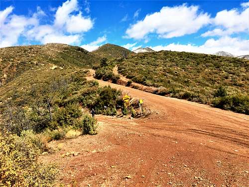
Cornucopia Ridge is accessed from off the Beeline Highway. The entrance road is right across from the road to Mount Ord. It is over 30 miles from the junction with Shea Blvd and Highway 87 in Fountain Hills to the turn-off to Forest Road 626, which is paved. Take the paved road for 1.2 miles until you see a dirt road on the right. This is FS Road 201. Take it for 1.2 miles. This road is absolutely fine for 2WD. There is space for parking on the right after 1.2 miles after which the road gets noticeably rougher. While 2WD could probably make it further up the road in good conditions, we found this to be a good starting point for Cornucopia Ridge.
Route
Take Forest Road 201 for 2 ¼ miles and there is a sign on the left for a road descending into the canyon below. Take this road for 2/3rds of a mile as it descends nearly 500’. Take a right at the bottom and follow for 75 yards. Then take a left, and the road heads back uphill.
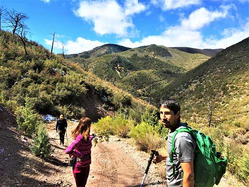
From the bottom of the canyon it is about 2 miles to the summit. Ignore side roads and take roads that ascend. Before the summit is reached, there is a wide-open spot with excellent views. Four roads connect into this wide-open spot. Take the road obviously heading up towards the summit, which is 0.4 miles away. The road ascends up to a hill, and then descends, before re-ascending 150’ in the final 0.2 miles.
The total elevation gain one-way is 2,000’ in 5 miles. It is possible to drive up to the turn-off area and cut the one way distance to about 1,170’ and 2.75 miles one way. The road down to the canyon and up to the summit are ATV roads and not suitable for 4WD.
Regardless of the starting point, hikers need to re-ascend back to Forest Road 201 on the return.
Red Tape
Forest closures may occur during fire season. Please check out https://www.fs.usda.gov/alerts/tonto/alerts-notices
External Links
Scott Surgent Trip Report: http://surgent.net/highpoints/az/mobile/cornucopia_m.html