Welcome to SP!  -   
 
  MbPost.com -- It's SP for Mountain Biking!
Areas & Ranges·Mountains & Rocks·Routes·Images·Articles·Trip Reports·Gear·Other·People·Plans & Partners·What's New·Forum

Cow Benchmark Route

 
[ Sizes: Orig | Med | Small | Thumb ]
Cow Benchmark Route
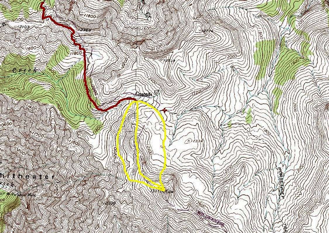
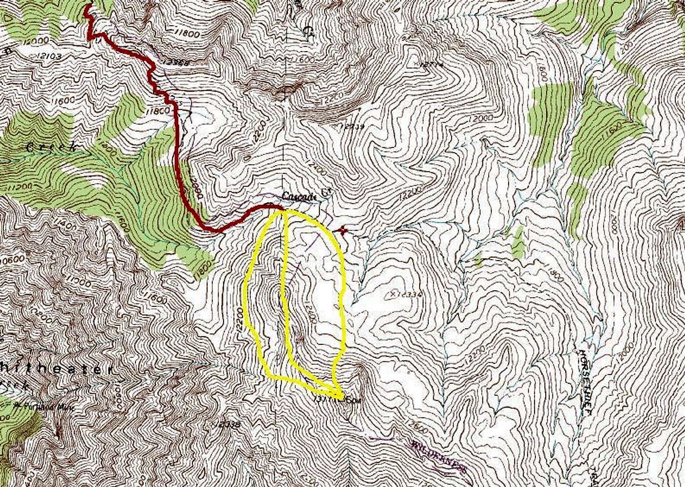
The lower part of this trail is not included in the map. The red starts from near Bridge of Heaven and looses elevation to near the base. Once near the base there are three options depicted by yellow. The center line, involves a loose ridge that will increase the difficulty.


Comments

No comments posted yet.


Sign in to post!

Don't have an account? Register now.


Rate This Image
Current Score: 0

Log In To Vote
 Cow Benchmark (Mountain/Rock)

Looking down to Ouray
« PREV

Viewing
#10 of 10
GALLERY

You are at
the Last
Image

 ktimm's Image Gallery

Guero Route
« PREV

Viewing
#154 of 156
GALLERY
The West Elks from Gunnison Gorge Rim
NEXT »
Image Data

ktimmSubmitted by ktimm
on Nov 6, 2007 7:19 pm

Image ID: 354017
Hits: 492 

Lat/Lon: 38.02010°N / 107.6205°W


"Silence is the virtue of fools."   --Sir Francis Bacon   

© 2006-2012 SummitPost.org. All Rights Reserved.