
|
|
Mountain/Rock |
|---|---|
|
|
33.98960°N / 112.484°W |
|
|
Yavapai |
|
|
Spring, Fall, Winter |
|
|
4565 ft / 1391 m |
|
|
Overview
Crater BM (aka Buckthorn Mountains West) is the highest summit in the Buckhorn Mountains about 14 miles east of Wickenburg. This area has a few striking summits, including Crater BM, Red Picacho, White Picacho, and Pt. 4210 (not prominent). A trail passes to the right under Pt. 4210 along the route to Crater BM.
A road which later becomes a trail leads up to just below Peak 4378 which is 1 mile southwest of Crater BM as the crow flies. This is the southwest ridge of Crater BM.
It is relatively easy to go up and down Peak 4378, which will only add about 15 minutes to the hike. When continuing to Crater BM, there is no trail to the summit. However, if following the most logical path and studying maps, unpleasant bushwhacking can be reduced and be quite manageable. Ultimately, the best ascent route and descent route involves starting and ending along the road/trail.
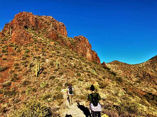
There are gorgeous rocks along the lower slopes, and mining activity is seen along the drive to the starting point. There’s lots of cactus, so long pants are recommended. It is best to hike here during the winter months – December through early March.
Getting There
From the Phoenix metro area, take Carefree Highway (74) for roughly 29 miles from the I-17 and turn right on Castle Hot Springs Road. Take Castle Hot Springs Road for about 11.5 miles and park on the roadside. There is a road going to the left that leads up the hillside and eventually becomes a trail.
Bring a satellite map as a guide to avoid missing the entrance off of Castle Hot Springs Road.
Route
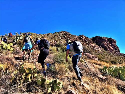
The road starts at 33.95926, -112.4842. On December 4, 2021, we noticed that about 100 yards up, the road seemed to peter out as if it had been washed out and is now overgrown. However, we crossed through some brush and after about 40 yards, the road returned. About 220 yards from Castle Hot Springs Road, you’ll need to turn to the left. Another road goes steeply uphill and eventually becomes a trail. The trail soon reaches an overlook of Pt. 4210 then descends and re-ascends to just below this striking precipice.
After about 2.2 miles, the trail reaches the base of Peak 4378. If wanting to hike to the summit (recommended) it is about 120’ above the trail in 150 yards of distance.
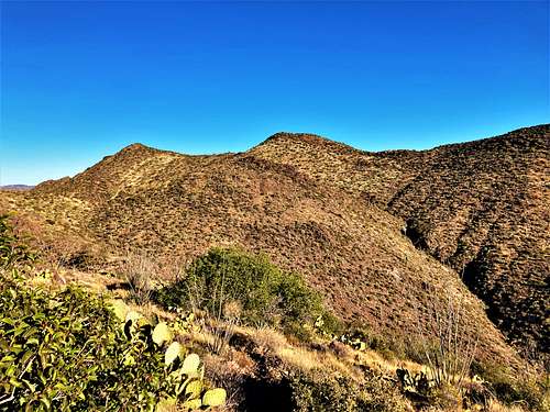
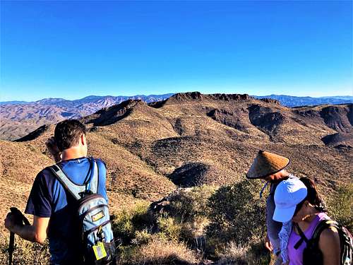
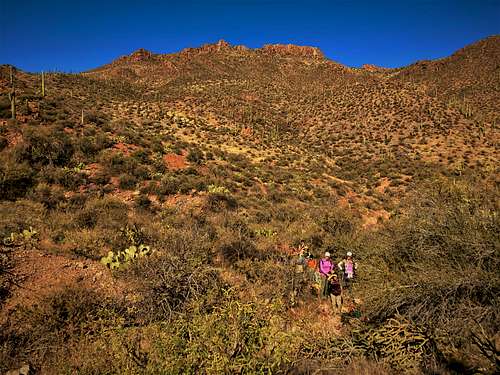
Once on top, there is an excellent view of the route ahead to Crater BM.
Once on the summit of Peak 4378, descend back to the trail. It is best not to continue to the saddle directly from the summit of Peak 4378, because it gets kind of nasty on the steep descent off the summit ridge.
Once back on the trail below Peak 4378, continue on the trail for only a short distance before it veers off to the left. Get off the trail at this point and hug the left side of Peak 4378, which is off-trail bushwhacking, for about a quarter mile. Fortunately, this is mostly a gentle descent. Once at the saddle, the ridge leading to Crater BM goes up and down. There is a temptation to hug the side. Initially, however, it is best to just go up to the ridgetop. Once on the first ridgetop mini-summit, now you can kind of hug the side for the next half a mile, not needing to reach the tops of any of the mini-summits. Then you will be at the base of the final mini-summit prior to the actual summit.
You don’t need to reach the mini-summit but it is best to stay high. Gain at least 200’ and then stay even which will lead to the saddle between the final mini-summit and the actual summit. Once at that saddle it is a rocky 250’ up to the true summit. It is easier on the way up then on the way down.
The summit is reached about 3.9 miles from the start of the road (a little over 4 miles if adding Peak 4378). The best way to descend is back the way you came. There are options to hike down another way, but those are quite complicated and require a good satellite map and GPS with waypoints. We ended up on a route down that gave us the gorgeous view below, but was quite overgrown and had ups and downs to get back to the road.
Elevation gain one way is about 2,030’ if just hiking Crater BM, and 2,150’ if adding Peak 4378. However, on the way back you’ll add another nearly 750’.
If feeling adventurous, Pt. 4210 can be climbed by adding 250’ and less than a quarter mile round trip. It’s steep and likely difficult Class III.
Red Tape
There is no red tape of note. Most of the land is managed by the BLM, with some scattering of private land, but not on the mountain. Avoid the road during monsoon or rainy conditions when flash floods may occur. Typically, this occurs during summer when folks should avoid this area anyway.
External Links
Castle Hot Springs Road: https://www.alltrails.com/explore/trail/us/arizona/castle-hot-springs-road
Trip Report on Hike AZ (note the loop route shown was quite overgrown and is not recommended, but there are great photos and information. We also found the distance reported in the trip report to be understated): https://hikearizona.com/decoder.php?ZTN=19032