Toggle navigation
Mountains
Routes
Images
Trip Reports
Forum
What's New
People
Areas & Ranges
Articles
Trailheads
Canyons
Huts & Campgrounds
Albums
Logistical Centers
Fact Sheets
Lists
Custom Objects
Gear
Plans & Partners
WELCOME TO SUMMITPOST
SIGN IN
REGISTER
Crater Lake National Park
Additional Parents
Image
Crater Lake digital elevation...
View High-Resolution Image
Crater Lake digital elevation...
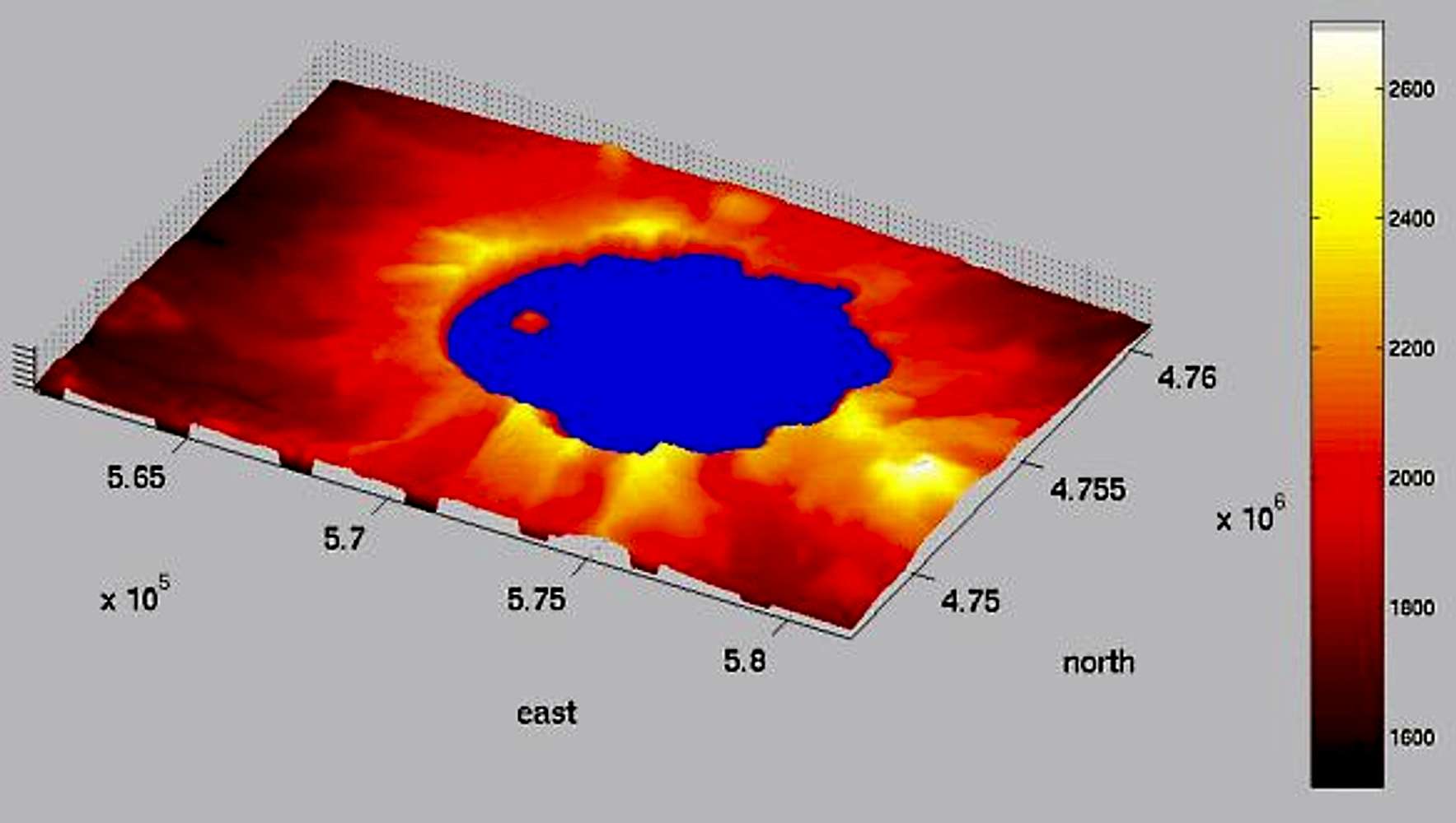
Crater Lake digital elevation map, composited from the two 7.5-minute USGS quads that cover Crater Lake Caldera. Elevations in meters, (x,y) coordinates are on the UTM grid. (map made by Morgan Brown, 1999)
« PREV
NEXT »
mpbro
on
Dec 16, 2002 11:17 am
Comments & voting
Other parents
Lat/Lon:
42.90000°N / 122.1°W
Image ID:
14992
1769 Hits
72.05
% Score
2
Votes
Log in to vote
Comments
No comments posted yet.
to post!
Don't have an account?
Crater Lake National Park
(Area/Range)
« PREV
Viewing
#149 of 204
GALLERY
NEXT »
mpbro's Image Gallery
« PREV
Viewing
#214 of 305
GALLERY
NEXT »
×
You need to login in order to vote!
User Name
Password
Remember me
Forgot your password?
Log me out when I close my browser.
Keep me logged in all the time.
sign in as a user
Don't have an account?
Register now for FREE
Rating available
Suggested routes for you
People who climb the same things as you
Comments Available
Create Albums
Register Here


