Toggle navigation
Mountains
Routes
Images
Trip Reports
Forum
What's New
People
Areas & Ranges
Articles
Trailheads
Canyons
Huts & Campgrounds
Albums
Logistical Centers
Fact Sheets
Lists
Custom Objects
Gear
Plans & Partners
WELCOME TO SUMMITPOST
SIGN IN
REGISTER
UN 13117 "Cupid"
Additional Parents
Image
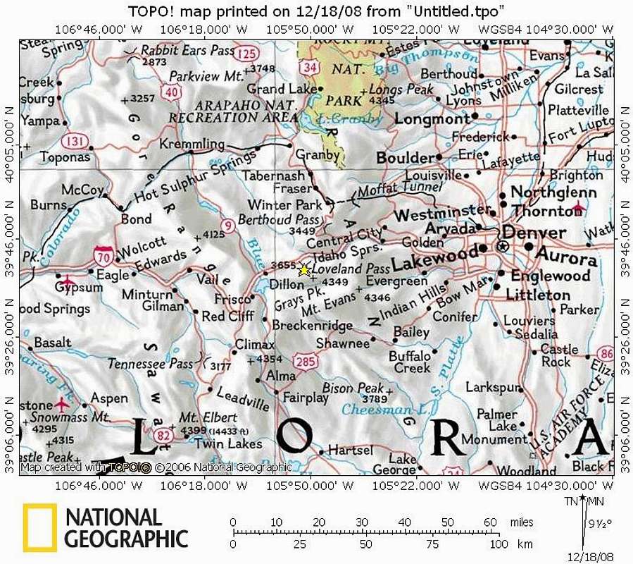
Cupid Area Map
View High-Resolution Image
Cupid Area Map
Cupid sits on the Continental Divide about 65 miles west of Denver via I-70 near Loveland and Arapahoe Basin ski areas. As the crow flies, the peak is just over a mile southeast of the 11,990 ft. summit of Loveland Pass.
Map built: 18 Dec 08
« PREV
NEXT »
Sarah Simon
on
Dec 19, 2008 9:57 am
Comments & voting
Other parents
Lat/Lon:
39.65780°N / 105.8567°W
Image Type(s):
Topo/Diagram
Image ID:
473208
2778 Hits
71.06
% Score
1
Votes
Log in to vote
Comments
No comments posted yet.
to post!
Don't have an account?
UN 13117 "Cupid"
(Mountain/Rock)
« PREV
Viewing
#12 of 12
GALLERY
You are at
the Last
Image
Sarah Simon's Image Gallery
« PREV
Viewing
#4306 of 5480
GALLERY
NEXT »
×
You need to login in order to vote!
User Name
Password
Remember me
Forgot your password?
Log me out when I close my browser.
Keep me logged in all the time.
sign in as a user
Don't have an account?
Register now for FREE
Rating available
Suggested routes for you
People who climb the same things as you
Comments Available
Create Albums
Register Here


