
|
|
Trailhead |
|---|---|
|
|
46.05989°N / 121.97082°W |
|
|
Skamania |
|
|
Spring, Summer, Fall, Winter |
|
|
1240 ft / 378 m |
Discription
This trail provides easy access to viewpoints of Curly Creek and Miller Creek Falls. This is a barrier-free trail.Roundtrip: 1.0 miles
From the parking lot, follow the trail west and you will soon come to Curly Creek Falls where a waterfall plummets from beneath two rock arches. This may be one of the most unusual waterfalls in the Northwest. At low water, a third rock arch can be seen in the bed of Curly Creek. Continuing westward, the trail soon leads to the Miller Creek Falls viewpoint where a waterfall plunges over a moss and fern-laden cliff into the Lewis River.
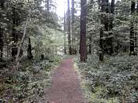 Trail towards falls
Directions
Drive north from Portland on Interstate 5 to Woodland, WA. Leave the freeway at Exit 21 and turn right on to Lewis River Rd, signed as Highway 503. Set your odometer to 0 at the freeway exit. Drive east on Highway 503 for 23 miles to the former location of Jack's Restaurant. Continue straight on Highway 503 Spur through the town of Cougar. The road changes to Forest Road 90 at the Skamania County Line. Continue east on 90 to a junction with FR 25, about 47 miles from the freeway. You'll turn right here, staying on FR 90. Cross the North Fork of the Lewis River, pass the Eagle Creek Store and continue up FR 90 into the forest. About 5 miles later, turn left on FR 9309. Follow this road for a mile to to the Curly Creek Falls Trailhead on the left.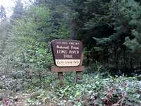 Trailhead Parking Area
Red Tape
Northwest Forest Pass required. Northwest Forest Pass
Map
 Shows road to Curly Creek Falls trailhead and trail.