Wandering through these mountains as a boy , then really poorly known to the multitude , and that only the last thirty years have seen a certain "awakening" thanks to the construction of bivouacs and refuges , I learned to appreciate the corners "secluded" and unusual views that they can offer. These places are not aimed at the
Mass , but still maintain a high degree of privacy and intimacy , so as to be transmitted from Matter Man who is able to appreciate the nuances. It is not the only place aimed at
"Elects" in Valley of Aosta (in my wandering in the mountains almost half a century I have known several others) but has the peculiarity that in two major population centers, just above their head or, if you want, immediately behind, as the City of Aosta and the District of Cogne get up and stretch mountains worthy of the legendary Klondike in the collective imagination. Pheraps, and maybe more, the emotional factor on my part be ascribed to the same bind to My First Youth. But the Second, the Third and, now, the Fourth . An unbreakable bond in time, so as to create more
Emotions with a return back in Time. The possibility of abstraction , if not in Space, at least in this. Indeed it is with some surprise when we walked up the Points, with
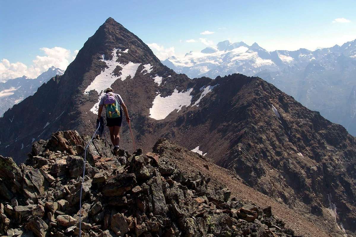
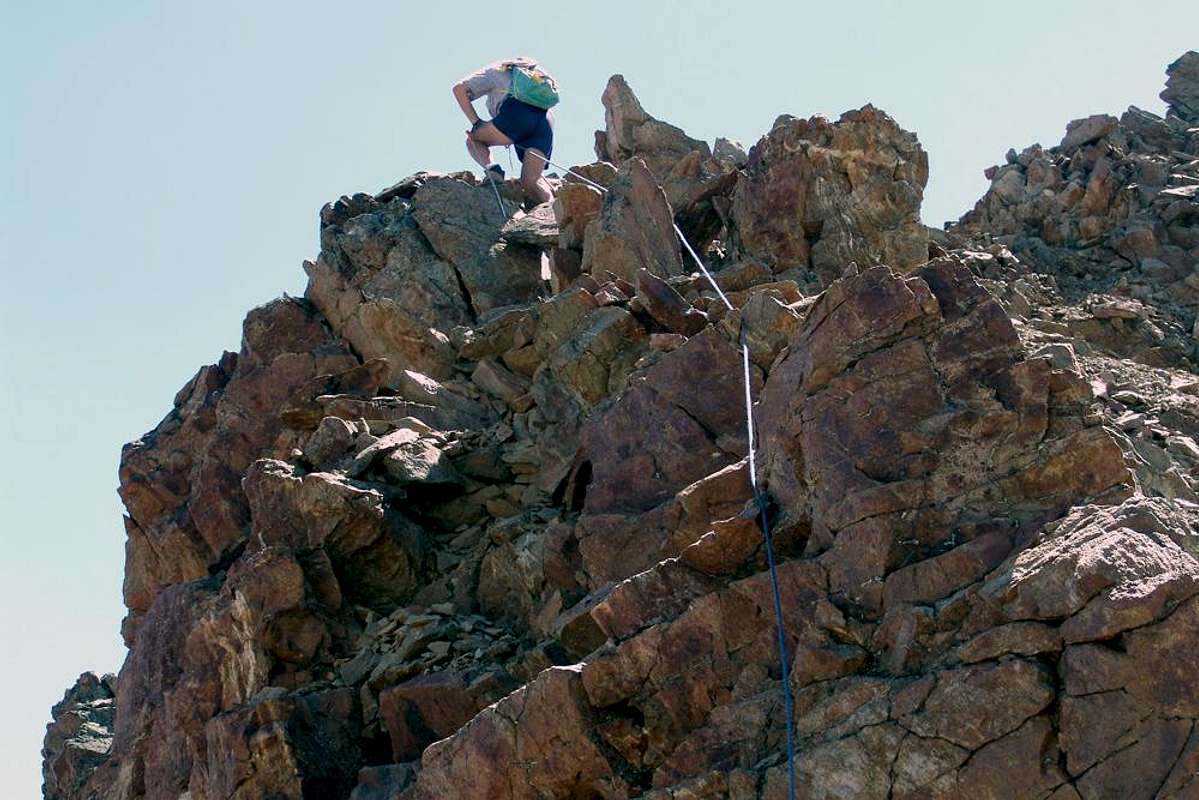
"emilius", Red of th'Emilius from Arbolle's Hill for the Northeast Ridge observe when getting off a group of C.A.I. Aosta along the same , where once you did not see anyone. In fact we had to postpone the start of the climb up to their arrival in order, to not take a stone on his head. Queuing at Punta Rossa Emilius's. Incredible! It was the first day of August 2004 and we knew it was over a
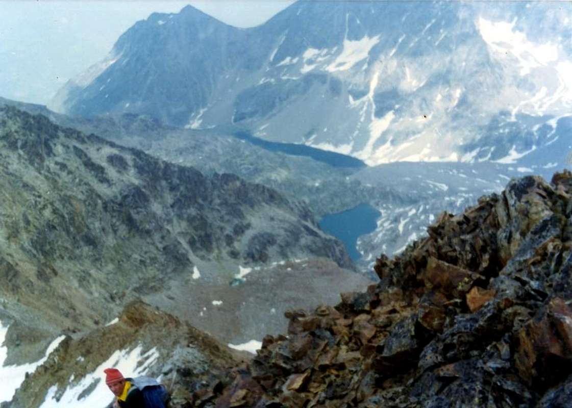
Poem. We crossed the three peaks and quietly got out of the Pass of Valaisan. Arriving at the Refuge Arbolle realized that times had changed there too. Other than miserable hut by Cetèun . Sadly we ascended to the Chamolé to return to Pila, where the great Resort we awoke from the
Dream of all. Imagine Emilio we went skiing in the Fifties , walk from Aosta and one endless descent from Point of Couiss
2663 metres, through the Leyzetta Natural Ski Run in the woods , and when any of them, that he could not go, asking:
"But how many people there? ... Oh, a Row more than twenty people!" .
Incidentally , and rightly so, are the Mountains of All ...
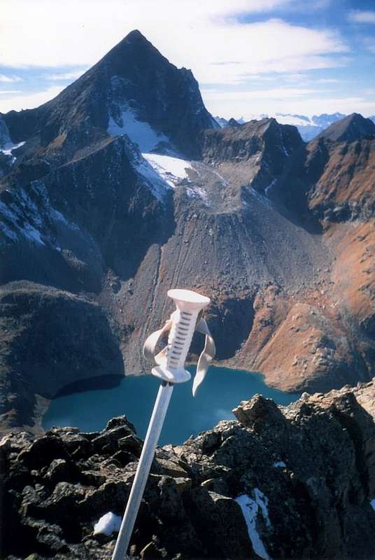
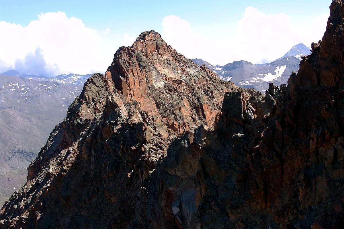
A group of roped climbers of C.A.I. Aosta in descent from East Top (3400m) through Northeast Crest to Arbolle's Pass (3154m), with Northern View, by emilius
*******
Girovagando sin da ragazzo per queste montagne, allora veramente scarsamente conosciute alla moltitudine e che soltanto nell'ultimo Trentennio han registrato un certo qual "risveglio" grazie soprattutto alla costruzione di bivacchi e rifugi, ho imparato ad apprezzarne gli angoli "appartati" e le vedute inconsuete ch'esse san offrire. Questi non sono posti rivolti alla Massa, bensì mantengon ancora un elevato grado di riservatezza ed d'intimità, tal da esser trasmesso dalla Materia all'Uomo che é capace di apprezzarne le sfumature. Non é l'unico posto rivolto ad "Eletti" in Valle d'Aosta (nel mio vagabondar per monti in quasi mezzo Secolo n'ho conosciuti diversi altri) ma presenta le peculiarità che tra due grandi centri abitati, subito sopra la loro testa o, se volete, immediatamente alle spalle, come la Città di Aosta ed il Comprensorio di Cogne si alzano e si estendono montagne degne del leggendario Klondike nell'immaginario collettivo. Forse, e forse maggiormente, il fattore affettivo da parte mia va ascritto che le stesse si legano alla mia Prima Giovinezza. Ma anche alla Seconda, alla Terza ed, ora, alla Quarta. Un legame indissolubile nel Tempo, tal da creare sempre Emozioni con un ritorno all'indietro nel Tempo. La possibilità di astrazione, se non nello Spazio, almeno in questo. Anzi é con un certo stupore quando con "emilius" abbiam salito le Punte Rossa dell'Emilius dal Col d'Arbolle per la Cresta Nordest osservare nello scendere una comitiva del C.A.I. d'Aosta lungo la medesima, ove una volta non vedevi mai anima viva. Anzi dovemmo rimandare l'inizio della salita fin al lor arrivo, onde non prendere qualche pietra in testa. Far la coda alla Punta Rossa dell'Emilius. Incredibile! Era il primo giorno d'Agosto del 2004 e capimmo ch'era finita una Poesia. Attraversammo le tre cime e silenziosamente scendemmo dal Pas du Valaisan. Arrivando al Rifugio di Arbolle comprendemmo ch'anche lì i tempi eran cambiati. Altro che misera baita del Cetèun. Mestamente risalimmo al Colle di Chamolé per rientrare a Pila, dove il grande Resort ci risvegliò del tutto dal Sogno. Immaginate l'Emilio che ci'andava a sciare negli Anni Cinquanta, a piedi da Aosta e con un'unica interminabile discesa dalla Punta del Couiss a 2663 metri, tramite la Pista Nature di Sci della Leyzetta attravers'al bosco, e quando qualcun di lor, che non aveva potuto andare, chiedeva: "Ma quanta gente c'era? ... Oh, un Casino più di venti persone!".
Daltronde, e giustamente, le Montagne son di Tutti ...
Walls, Faces & Crests of the Sourrondings
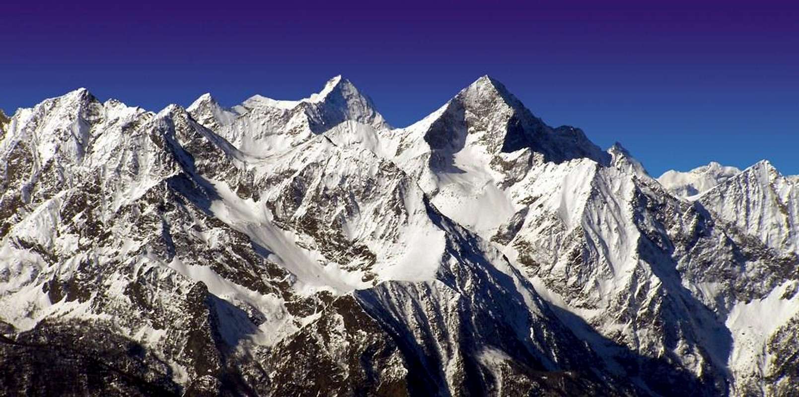
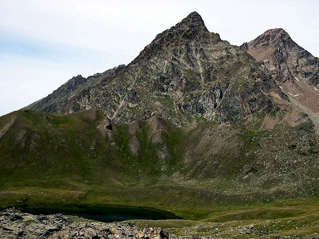
Emilius's Group & Subgroup of the Roèses (3356/7m) with Northeast & Northwest Views
*******
Tersiva Point (3512m) & Subgroup of the Roèses (3356/7m) with North-northwest View, by emilius
*******
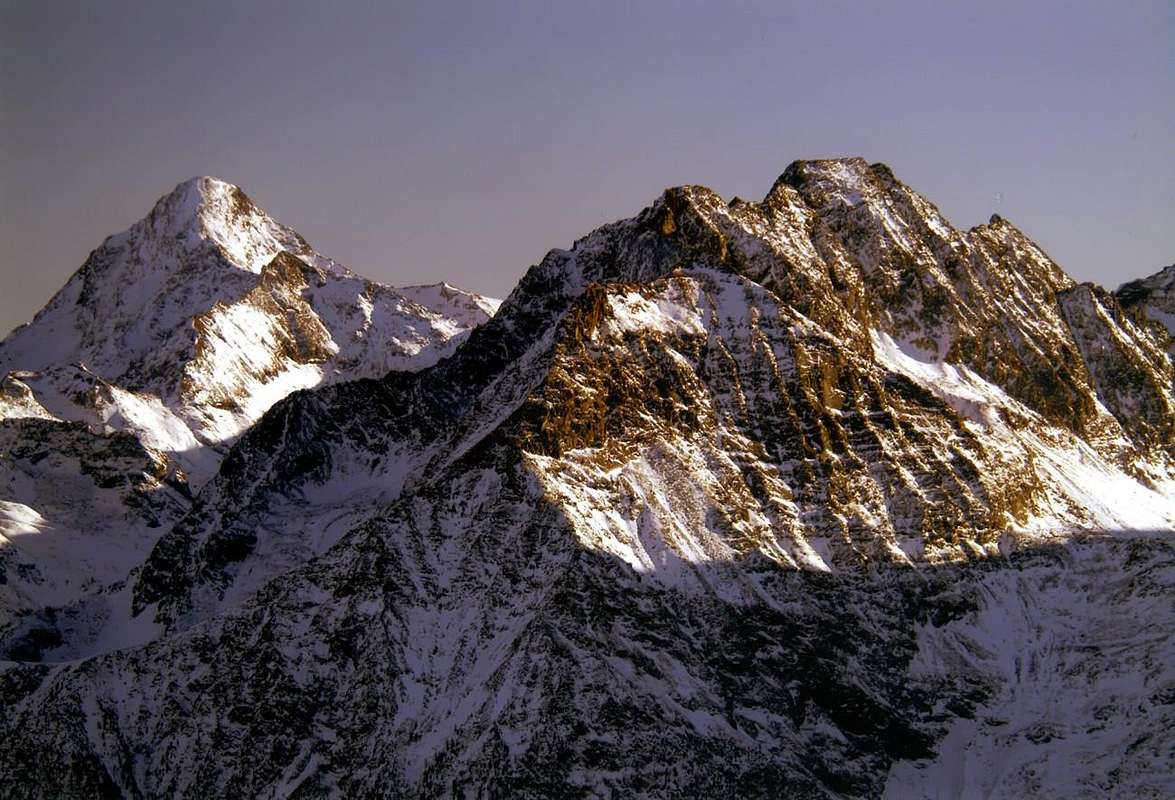
The Watershed between Laures/Arpisson Walloons from Emilius (3559m) to Becca of Seneva (3081m) with Eastern View
*******
The Walls
Grauson Tower (3233m) & Peak Garin (3461m) East-northeast and Northeast Walls, with Northeast View, by livioz
*******
Eastern Summit of Red Points (3400m) East Wall, with North View from Northeast Crest, by emilius
*******
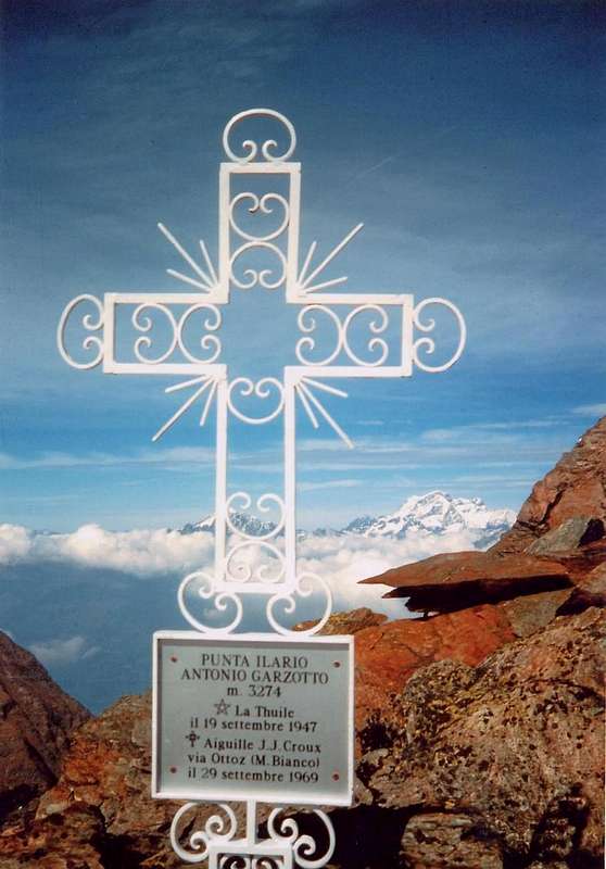
Central Summit of Red Points (about 3395m) Northern Wall, near the Top, by Ilario Antonio Garzotto
*******
Garin Peak (3461m) Northeast Wall, with North View, by Camillo Roberto Ferronato
*******
Garin Peak (3461m) South Wall, with Southern View, by Giuseppe Lamazzi
*******
The Slopes & Faces
From Emilius (3559m) to North Faces of Red Point (3401m) with Northern View
*******
Grauson Tower (3233m) South-southeast Slope (right) & Southwest Face, with Southern View, by SalVal
From the Western Slopes of Mount Raf(f)rey (3146m) to Lavodiléc Lake (2357m), with Eastern View
***
From Mount Glacier (3106m) Western, Southwestern, Southeastern and Eastern Slopes of Mount Raf(f)rey & Margheron Lake, with South-southeastern View
***
Mount Rafrey (3146m) with circular views from Northeast to East, by emilius, Salval & Antonio
***
The Ridges
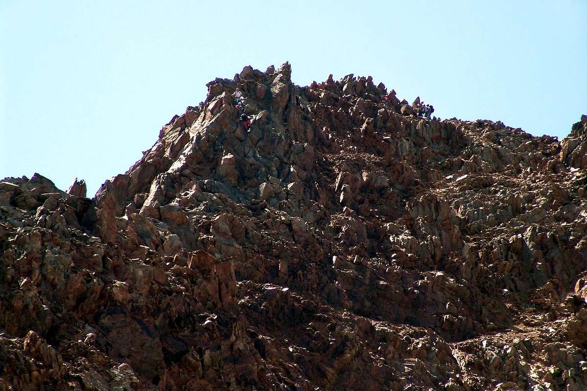
From Point of Laures (3367m) to the Summit of the Eastern Red Point (3400m), a ridge almost unknown
*******
From Arbolle Hill (3154m) to the Summit of the Eastern Red Point (3400m), through Northeast Crest or Standard Route, by emilius
*******
From Arbolle Hill (3154m) in terminal part Northeast Crest of Eastern Red Point (3400m), or from Arbolle Walloon Normal Route, by Camillo Roberto Ferronato
Becca of Salé or Salì (3137m), with South Crest or Normal Route
***
Mount Rafrey (3146m) with views from East, Northeast, North & Northwest, by emilius & SalVal
***
Buttress & Spurs
***
Garin Peak (3461m) from South on South-southwest Buttress, by emilius, Camillo Roberto Ferronato & Osw
***
Frozen Loch Points (3115m) West-northwest rocky Spur of 700 metres
***
Garin Peak (3461m) from South on South-southwest Buttress, by Camillo Roberto Ferronato & Osw
***
The two Buttress from Garin Peak (3461m) to Point Fleurie (3261m) & towards West Ridge of Grauson Tower (3233m), by Camillo Roberto Ferronato, Antonio & Osw
***
Particularities & Strangeness
Salì's Tower (3073m) in clouds & Becca of Salé (3137m), "The Cross Forgotten"
***
Salì Tower (3073m) above from left Praborna's (3128m), Vauvire (2852m), Bonplan (2664m) Points and Head of Selva Plana(2349m), N-NE Wall of Cordagnì (about 3050m) & Bec Courbo (2135/7m) from North,
Particularities by SalVal
"FORGET THE TOP Minor and UNKNOWN" / "CIME Minori DIMENTICATE e SCONOSCIUTE"
***
Ilario Antonio Garzotto Point (3273/4m) "The Cross in clouds"
***
Garin Peak (3461m) Evolution from the Sacred to the Profane of a Summit,
Particularities by Osw
***

 4218 Hits
 74.92% Score
 5 Votes