
|
|
Area/Range |
|---|---|
|
|
48.39837°N / 15.52209°E |
|
|
Hiking, Sport Climbing, Toprope |
|
|
Spring, Summer, Fall, Winter |
|
|
1083 ft / 330 m |
|
|
Overview
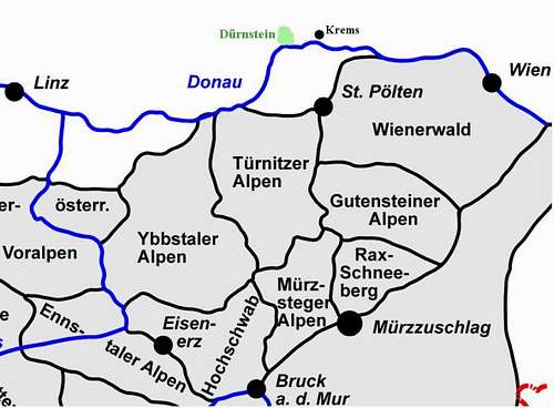
Dürnstein is situated in the Wachau. Wachau is the valley formed by the Danube river between Melk and Krems (approx. 30 km). The area was settled in prehistoric times ("Venus of Willendorf" was discovered in the Wachau).
 |
|---|
Beside Tourism the production of apricots and grapes is an important economic factor in the Wachau. In 2000 Wachau was added to the UNESCO list of world heritage sites.
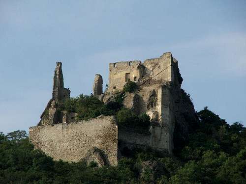 Dürnstein Ruins Dürnstein Ruins |
|---|
Beside from the monastery Dürnstein is famous for its ruins above the town, where King Richard I of England (aka Richard the Lionheart) was held captive after his crusade in from December 1192 to March 1193. The castle was destroyed in 1645.
This page covers only the following areas around Dürnstein (btw. mostly Gföhler Gneis):
- Dürnstein (around the ruins)
- Kummerstal
 Dürnstein near Spiegel Dürnstein near Spiegel |  Wachauer Grat Wachauer Grat |
|---|
There are some other climbing areas in the Wachau like:
- Weissenkirchen
- Aggstein
- St. Lorenz etc.
Getting There
By Public Tansport
from Vienna: Franz Josefs Bahnhof to Krems from St. Pölten via Krems
Train Service is only provided in summer (daily in July, August, September; in April, May, June and October: Sat + Sun + public holidays)
There is also an bus connection from Krems to Dürnstein
By Car
from Salzburg/Linz: Highway A1 (Westautobahn) to Melk, cross the river Danube and follow the road (B3) to Dürnstein
from Vienna:
- western Vienna: Highway A1 to Sankt Pölten Ost - S33 Expresswegy to Krems (crossing the river Danube) and follow the road B3 to Dürnstein
- northern Vienna: Highway A22 to Tulln - Highway S5 to Krems and road B3 to Dürnstein
from north (Czech Republic) head for Krems and follow road B3 to Dürnstein
btw. Parking is subject to charges in Dürnstein
By Ship
;-) also possible - www.donaustationen.at
Climbing, Hiking, Biking
The climbing area in Dürnstein (near the ruins) is the oldest climbing area in the Wachau. The rocks around the ruins offer climbs for beginners but also more difficult routes.
Climbing - Dürnstein
rocks up to 20m - from Dürnstein walk up to the ruins of the castle (Donauturm, Adlerfelsen, Edelweissfelsen etc.) or start at train station an walk up (Spiegel, Bettinaturm and Däumling are easy to reach from the train station)
 |  | |
|---|---|---|
 |  Dürnstein Däumling Dürnstein Däumling |  Dürnstein Ruins Dürnstein Ruins |
Climbing - Civetta, Donauuferfelsen
The area is situated between the ruin of Dürnstein and Kummerstal. In Jule 2009 the route Transamerikapfeiler at Donauuferfelsen was destroyed by a rockslide (after intense rain) in July 2009.
 Transamerikapfeiler after the rockslide Transamerikapfeiler after the rockslide |
|---|
within the scope of the cleanup some of the rock had to be blasted - video
Climbing - Kummerstal
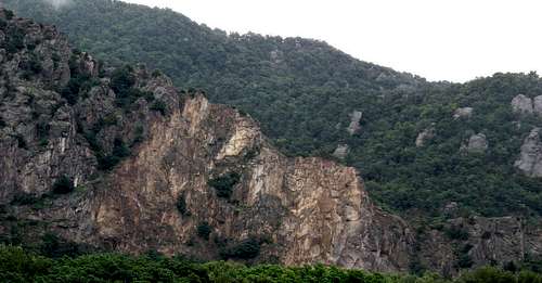
offers longer climbs (Don Bosco Grat, Wachauer Grat) follow B3 westwards to Spitz - parking approx. 250m after the tunnel; walk along the road another 500m turn right an follow a small trail up the valley to the climbs.
| Wachauer Grat and Danube |  Climbing Wachauer Grat Climbing Wachauer Grat |  Wachauer Grat Wachauer Grat |  Wachauer Grat Wachauer Grat |
|---|
Climbing - other areas/sectors
WeissenkirchenAggstein etc.
Hiking
e.g. Vogelbergsteig
Biking
Hundreds of cylist do the Donauradweg
Red Tape
Use Vogelbergssteig when descending from Wachauer Grat or Don Bosco Grat!!
no campfires, in summer also smoking is forbidden!
Camping + B&Bs
The nearest camp sites are in Krems and in Rossatz-Arnsdorf (other riverside)
check the accomodation section of www.duernstein.at for a place to stay
After a nice day climbing stop at a Heuriger (wine garden) for a glass of new wine and some good local food - check the "Heurigen Calender" section at www.duernstein.at
Links
Climbing Links - Topos
- Dürnstein Climbing (with topos) - the link www.wachauclimbing.net is dead
- Kummerstal (with topos)
- Don Bosco Grat
- Bergrettungsweg
Climbing Links - General
Climbing in Wachau (also Dürnstein) Information in German only - sorry the website www.wachauclimbing.net is no longer available
Webcams
Dürnstein Webcam
Other Links
www.duernstein.at (site also in English available)
Books
Kletterführer Dürnstein (2 books) by Peter Dunst available at Souvenirshop Blondl in Dürnstein (book 1 might be sold out)