
-
 983 Hits
-
 79.04% Score
-
 10 Votes
|
|
Mountain/Rock |
|---|---|
|
|
35.79420°N / 105.77393°W |
|
|
Hiking, Skiing |
|
|
Spring, Summer, Fall, Winter |
|
|
12320 ft / 3755 m |
|
|
Overview
Deception Peak
Elevation: 12320 ft / 3755 m
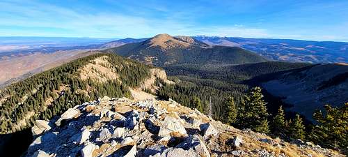
Range: Sangre de Cristo Range
Nearby peak: Lake Peak
Deception Peak can be found in Santa Fe County, northeast of Santa Fe, New Mexico. At over 12,000 feet high and more than 2,500 feet of elevation gain, it is one of the more difficult hikes in New Mexico.
 |
 |
 |
Getting There
The Winsor Trail is 9 miles long on the Pecos/Las Vegas District, is moderately difficult and receives heavy use. Its highest and lowest points are 11,000 and 8,500 feet.
Starting from Winsor Trailhead, the trail goes up the creek for approximately 1 mile and then crosses the stream. Follow the trail as it turns sharply away from the stream and climbs through the forest to Carpenter Ridge. The trail continues up the ridge through aspen groves and meadows passing the junction with Holy Ghost Trail 283. After about 6 miles, the trail crosses upper Winsor Creek and meets the Skyline Trail 251. Follow the Skyline Trail to the west for approximately 1 mile until the Winsor Trail turns off to the south. The trail arrives at Spirit Lake within about 1 mile. From there the trail is an easy mile over the ridge and continues into the Espanola District.
 |
 |
 |
Route
 |
 |
 |
Deception Peak is adjacent to the Santa Fe Ski Area (Ski Santa Fe). The hike starts the same way that a hike to Nambe Lake starts. Park in the lot at Ski Santa Fe and head over to the Winsor Trail at the northwest corner of the parking lot. From the trailhead head northeast up a series of switchbacks until you get to the Pecos Wilderness Boundary fence. Once you go through the gate at the fence you can get to Nambe Lake, Santa Fe Baldy and many other places. To get to Deception Peak you turn right at the fence and head up along the fence. Total distance to the fence is 0.8 miles
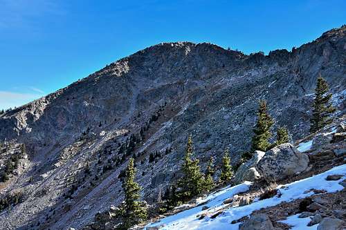
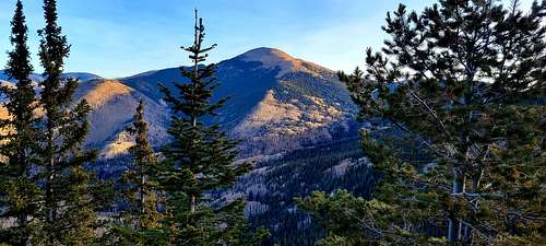
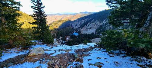
Forest service built such a long fence around the boundary of the Pecos Wilderness. Wilderness areas are supposed to be devoid of development yet the wilderness area is surrounded by a manmade fence. The initial climb is fairly gentle heading pretty much straight along the wilderness boundary fence for about 0.8 miles. The fence is lined with barbed wire and at points the trail hugs the fence, so try to avoid scratching yourself on the fence. The trail then turns to the right and head south. At the turn there is a great view spot overlooking the canyon that heads up to Nambe Lake. You’re not quite high enough yet to see Nambe Lake. From the same vantage point there are some great views of Santa Fe Baldy, a 12,621 foot peak to the northeast.
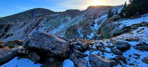
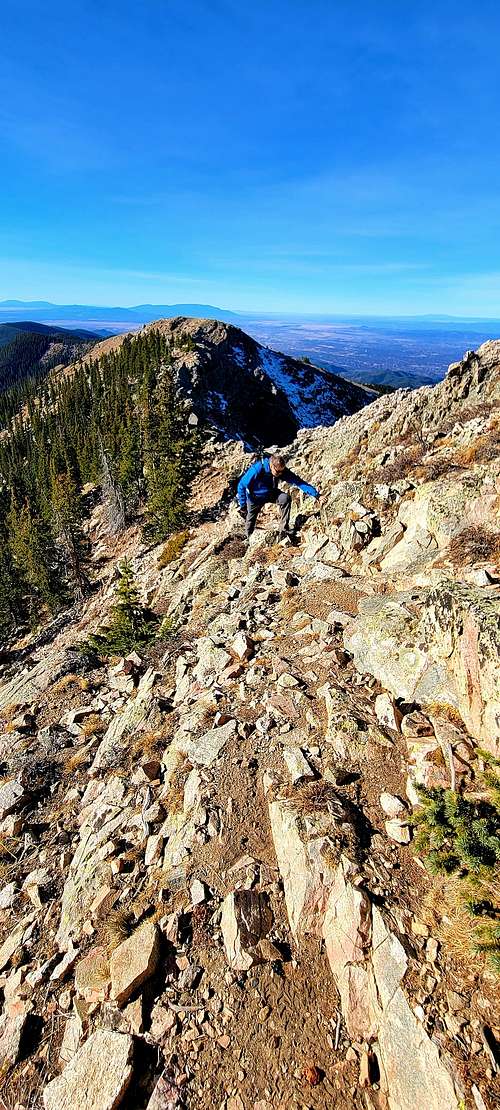
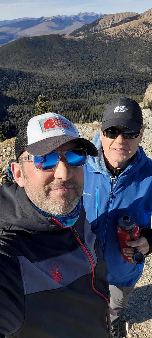
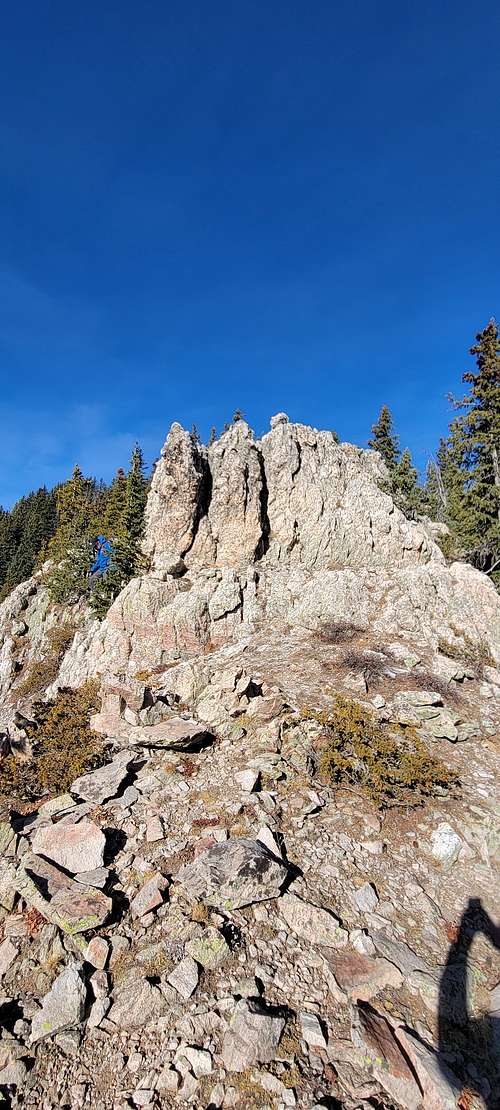
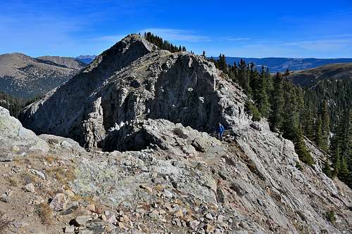
The trail is now quite a bit steeper. It also splits into multiple trails at point, but all of these trails seem to meet back up. There are two intermediate peaks that you reach during the climb. Shortly before the first peak you arrive a field of large boulders. I saw lots of Rocky Mountain Columbine in this boulder field. If you want to see the Columbine, stay it the rougher section of the boulder field. The easiest way to get through the boulder field is to stay as far to the left as possible. From the saddle between the second intermediate peak and Deception Peak, you pass the tree line and head up a steep bare slope toward a ridgeline, when you reach the ridgeline turn left and head up to the summit. The deception in the name Deception Peak is that when you reach the summit, you realize that you’re not at the highest point along the ridgeline. The highest point is Lake Peak to the northeast.
 |
 |
 |
Red Tape
|
Permit Info: |
A backcountry permit is not required to enter the Pecos Wilderness. |
|
Restrictions: |
|
|
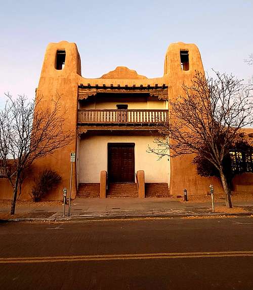
Closest Towns: |
Pecos and Santa Fe |
|
Information Center: |
Please keep your dogs on a leash for their own safety, to be courteous to other users, to respect and protect wildlife, and to protect vegetation. Dogs should always behave in a responsible manner. Your pet should always be under voice control - this means that your dog will come when called. If your dog does not come when called, you should keep your dog on a leash. And no matter where you are going, you should always bring your leash with you. |
When to Climb
Add When to Climb text here.
Camping
Santa Fe National Forest Headquarters
11 Forest Lane
Santa Fe, NM 87508
(505) 438-5300
Fire Info Hotline
(877) 971-FIRE (3473)
External Links
https://listsofjohn.com/peak/164388
https://www.peakbagger.com/peak.aspx?pid=31703
https://www.alltrails.com/trail/us/new-mexico/deception-peak
https://www.hikingproject.com/trail/7006789/ravens-ridge-to-lake-peak-loop