
|
|
Mountain/Rock |
|---|---|
|
|
34.28220°N / 112.29295°W |
|
|
Yavapai |
|
|
Hiking |
|
|
Spring, Fall, Winter |
|
|
5780 ft / 1762 m |
|
|
Overview
DeSoto Peak is located in the Bradshaw Mountains about 6 miles northeast of Crown King. DeSoto Peak rises just above the DeSoto Mine, an old copper mine that began operating in the 1870s and peaked in activity during World War I.
A dirt road leads nearly the entire way to the summit; and is popular with ATVs. The summit itself is less than 300 yards from the road and 170’ above the road. A narrow use path exists that provides easy access to the summit and avoids most of the brush.
The main road leading to the DeSoto Peak trailhead is rather easy to reach, and is 2WD accessible; although the road can get rough in spots, particularly after a storm.
DeSoto Peak really is a hidden gem, with the starting point not far from North Phoenix suburban neighborhoods – less than an hour drive from New River.
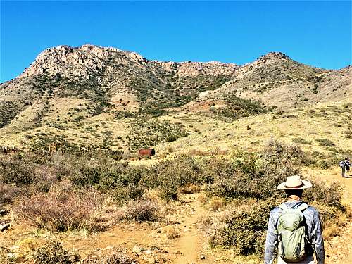
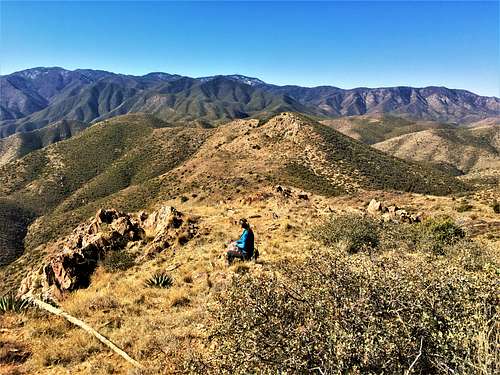
Although its prominence is only 320’, DeSoto Peak has tremendous views. If coming from the east, all of the mountains are fairly low elevation until DeSoto Peak, so it stands out. The reason for the low prominence is its connection to the ridge that connects to the higher mountains to the west rising north of Crown King.
DeSoto Peak is best hiked in February, March, October, and November. Those are the shoulder months where temperatures are ideal. Snow may fall on its slopes during December and January after a storm. Hiking it in April, early May, or late September in the morning is fine, since the only off-trail section is the last bit at the top, so you are unlikely to encounter rattlesnake danger. It is unlikely to get much above 100 degrees here in the summer.
Getting There
From the Phoenix Metro area, take I-17 to either the Bumble Bee exit or the Bloody Basin exit. They are similar drive time, and whichever is faster depends on traffic. Once off the exit, just head west and a junction will take you north through Bumble Bee, or if coming from Bloody Basin, you’ll head south from the junction. It is best to use GPS and follow directions to the small town of Cleator, which has a few homes and a small bar. Once in Cleator, the road junction is about 1 ¼ miles further west on Crown King Road. The road up to the DeSoto Mine is Forest Road 259B.
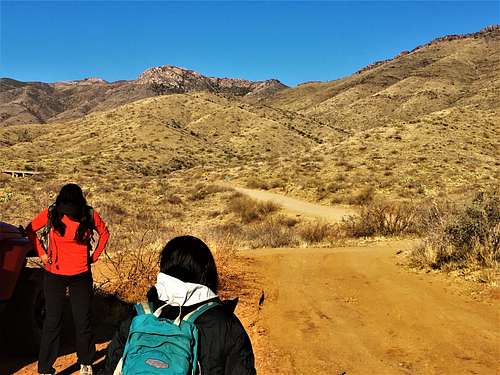
It is advisable for hikers to park on the south side of Crown King Road at the junction, where there is a trailhead parking area. The road itself is on the north side of Crown King Road, but it is rough.
Route
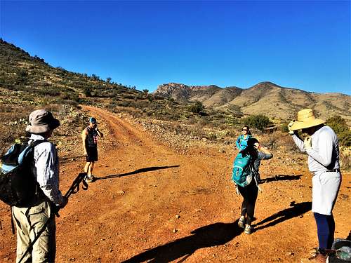
Once at the parking area, cross the road and hike the Forest 259B Road north as it curves through the mountains. DeSoto Peak comes into view as the road turns to the west.
After approximately 3 ½ miles, the mining area is reached, and the road begins to switchback up towards the ridge. After approximately 4 miles, the road takes a sharp turn to the right. After approximately 4 1/4 miles, the road switchbacks to the left. Continue for another 0.4 miles, at which point the road starts to head to the right of the summit. Get off the road at this point and bushwhack about 10’ up to the ridge.
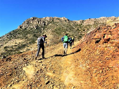
The summit is obvious at this point, but it is brushy. Fortunately, once on the ridge, there is what appears to be a faint path leading to the summit. Brush isn’t completely avoided, but it isn’t too bad. The summit is 250 yards away.
On the descent, it is possible to hike up Peak 4933, although it is pretty brushy. It is better reached from the east side. It is far easier to add Peak 4700 further east, which is just a third of a mile and 385’ off the road.
Red Tape
There is a sign on the 259B Road road from Yavapai County asking people to "Keep Out" of a small work area about a half mile up the road. Otherwise, there are no restrictions. Just stay on the road. There are no signs around the mines themselves, although the road to the summit avoids the mines. Those require a side trip.
External Links
History: https://azoffroad.net/desoto-mine
Lists of John page: https://listsofjohn.com/peak/74119