Toggle navigation
Mountains
Routes
Images
Trip Reports
Forum
What's New
People
Areas & Ranges
Articles
Trailheads
Canyons
Huts & Campgrounds
Albums
Logistical Centers
Fact Sheets
Lists
Custom Objects
Gear
Plans & Partners
WELCOME TO SUMMITPOST
SIGN IN
REGISTER
White Cap Peak
Additional Parents
Image
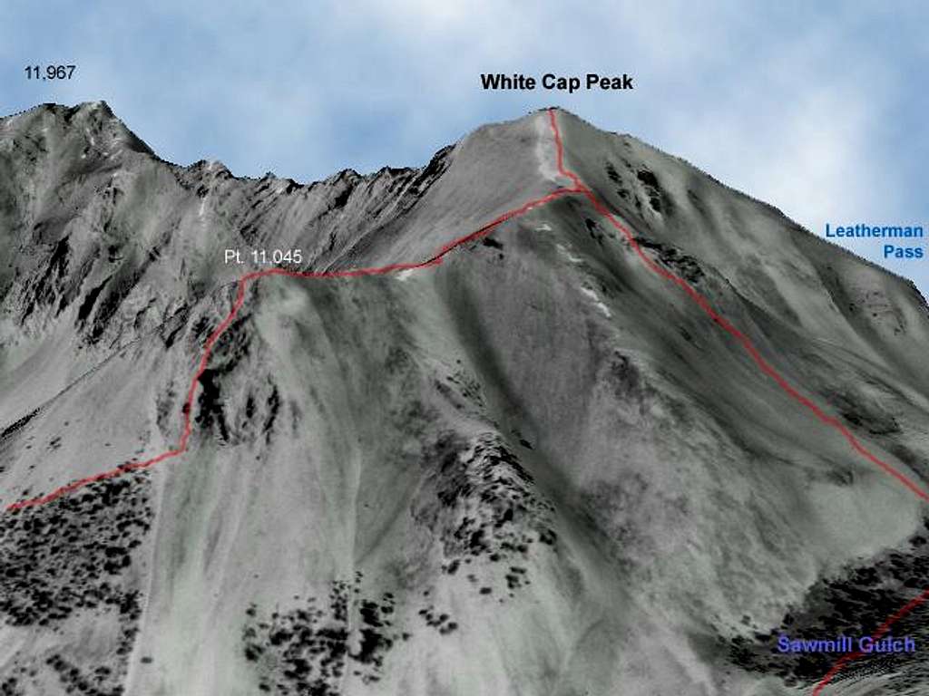
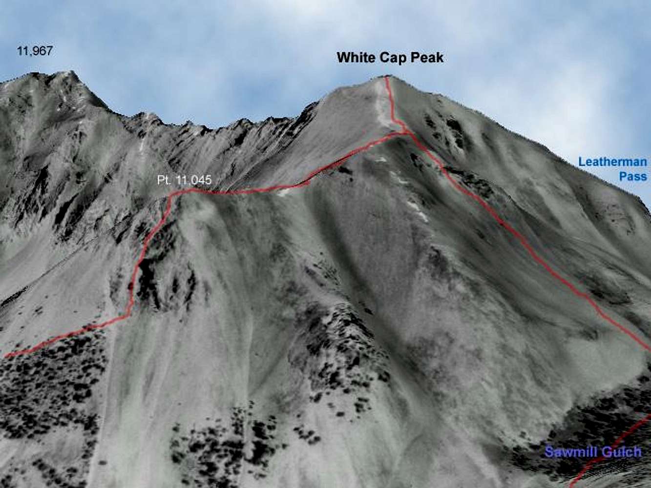
Digital Elevation Model...
View High-Resolution Image
Digital Elevation Model...
Digital Elevation Model overlayed with a USGS aerial photo showing the southwest ridge route options on White Cap Peak.
« PREV
NEXT »
brendon
on
May 4, 2005 9:55 pm
Comments & voting
Other parents
Lat/Lon:
44.08440°N / 113.7545°W
Image ID:
103741
2166 Hits
75.81
% Score
6
Votes
Log in to vote
Comments
No comments posted yet.
to post!
Don't have an account?
White Cap Peak
(Mountain/Rock)
« PREV
Viewing
#19 of 36
GALLERY
NEXT »
brendon's Image Gallery
« PREV
Viewing
#221 of 577
GALLERY
NEXT »
×
You need to login in order to vote!
User Name
Password
Remember me
Forgot your password?
Log me out when I close my browser.
Keep me logged in all the time.
sign in as a user
Don't have an account?
Register now for FREE
Rating available
Suggested routes for you
People who climb the same things as you
Comments Available
Create Albums
Register Here


