Toggle navigation
Mountains
Routes
Images
Trip Reports
Forum
What's New
People
Areas & Ranges
Articles
Trailheads
Canyons
Huts & Campgrounds
Albums
Logistical Centers
Fact Sheets
Lists
Custom Objects
Gear
Plans & Partners
WELCOME TO SUMMITPOST
SIGN IN
REGISTER
Currant Mountain
Additional Parents
Image
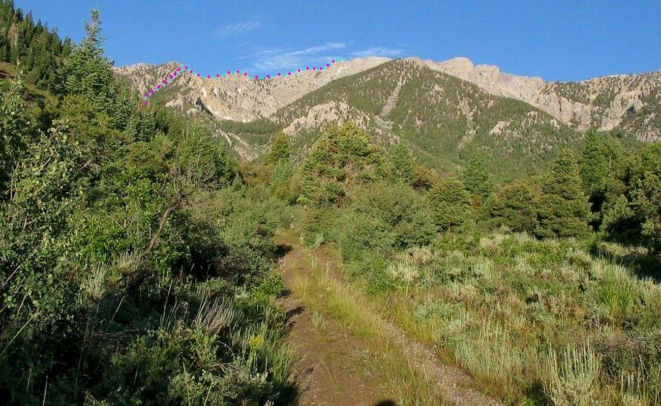
Distant View of Route
View High-Resolution Image
Distant View of Route
Here is a view SSW after one starts on the logging road. The route is indicated by magenta and blue dots.
« PREV
NEXT »
MoapaPk
on
Feb 25, 2007 3:31 am
Comments & voting
Other parents
Lat/Lon:
38.91000°N / 115.424°W
Image ID:
272868
3939 Hits
75.81
% Score
6
Votes
Log in to vote
Comments
No comments posted yet.
to post!
Don't have an account?
Currant Mountain
(Mountain/Rock)
« PREV
Viewing
#9 of 88
GALLERY
NEXT »
MoapaPk's Image Gallery
« PREV
Viewing
#146 of 537
GALLERY
NEXT »
×
You need to login in order to vote!
User Name
Password
Remember me
Forgot your password?
Log me out when I close my browser.
Keep me logged in all the time.
sign in as a user
Don't have an account?
Register now for FREE
Rating available
Suggested routes for you
People who climb the same things as you
Comments Available
Create Albums
Register Here


