
|
|
Mountain/Rock |
|---|---|
|
|
35.86720°N / 81.9144°W |
|
|
McDowell/Burke |
|
|
Hiking, Mountaineering, Trad Climbing, Sport Climbing, Toprope, Bouldering, Ice Climbing, Aid Climbing, Big Wall, Mixed, Scrambling |
|
|
Spring, Summer, Fall, Winter |
|
|
3520 ft / 1073 m |
|
|
Overview
On the downside, you can summit Dogback Mountain by auto since the Kistler Memorial Highway crosses the top. However, some of the toughest hiking trails in the southeast crawl all over the slopes of Dogback, making it one of the most challenging hiking destinations in North Carolina. Panorama.
The mountain lies on the western side of the Linville Gorge Wilderness Area and dominates that side of the gorge. The slopes are very steep, very rugged, and covered in cliffs and rock towers. Miles of the slopes are prime rock climbing territory.
In the past, there were stands of virgin forest on this side of the gorge, but a series of forest fires and the introduction of hemlock wooly adelgid has wiped out much of the old trees. The fires of 2007 were particularly hard on the forests, as they struck during a period of extreme drought and were able to burn even through areas that were normally moist and not prone to burning. The fires were so fierce and so intense that they managed to kill even the rhododendron and succeeded in consuming even down to the mineral soils. It is going to take the forests a very, very long time to recover from the fires of 2007.
Rock climbers will find plenty to keep them busy on Dogback Mountain. It's also a good place to scout the high walls on the eastern side of the gorge. In addition, the area is a scrambler's delight, especially if you know where to find the old trails that are no longer considered "official" and which are largely hidden away by tangles of new undergrowth.
For some reason that I've never quite been able to fathom, lots of people get lost in Linville Gorge. Basically, if you lose your bearings in the gorge you have four options to find your way out: north, south, east, and west. If you head directly up on the western side, you will eventually find your way to the Kistler Memorial Highway. It borders that entire side of the gorge. If you head due east on the other side, you will likewise eventually hit a road, although you might have to hike a few miles. Due south will take you out of the end of the gorge and into a private community and to the road there. Due north and you will come to the head of the gorge and the National Park offices. You have to be either in physical distress or be a complete moron to get completely lost in Linville Gorge.
 Fire ravaged slopes.
One of the most scenic trails in the entire gorge hugs the slopes of Dogback Mountain. That trail is the Rock Jock Trail. The original Rock Jock Trail was carved out of the forests by rock climbers for access to climbing and top roping. The fire of 2007 pretty much obliterated that trail and so the Forest Service and volunteers hacked out a new Rock Jock Trail. It's a bit higher on the mountain than the old trail and has fewer ups and downs and is basically a much easier hike, with less scrambling than the original version. Still, it takes you along vast cliff faces with stupendous views into the gorge and across at the peaks on the eastern side. So far, it's my favorite trail in the wilderness (but I have very little experience of the eastern side).
Getting There
 Daffodil Flats
Kistler Memorial Highway via N.C. 126 can be reached from Marion by
 Frost scorched.
The Kistler "Highway" is a bit of a play on words. It's hardly what we think of as a highway in these days. It's a gravel road and sometimes is quite a bit too much for two wheel drive, low clearance vehicles. But of late it's in decent repair and your average car should have no trouble navigating the road.
 Trail and Bushwhack Route.
Red Tape
Just wilderness rules. Linville Gorge has suffered two series of devastating fires in the past ten years, and is still in drought conditions. Obey all fire warnings and limitations set down by the Forest Service.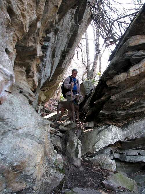 Split Rock.
Camping
The gorge is packed with great wilderness campsites.
There is a semi-developed campground at the Linville Falls section of the Blue Ridge Parkway, administered by the National Park Service.
There are also a number of private campgrounds in and around Linville Falls, NC.
 Table Rock? Yep.
External Links
Private website about Linville Gorge.North Carolina's Grand Canyon.
Linville Falls.
Linville Wilderness brochure.
Flatliners Southeast Climbing Site.
Linville Gorge.
 Pinch In.