Welcome to SP!  -   
 
  MbPost.com -- It's SP for Mountain Biking!
Areas & Ranges·Mountains & Rocks·Routes·Images·Articles·Trip Reports·Gear·Other·People·Plans & Partners·What's New·Forum

Eagle Cliff Peak Map

 
[ Sizes: Orig | Med | Small | Thumb ]
Eagle Cliff Peak Map
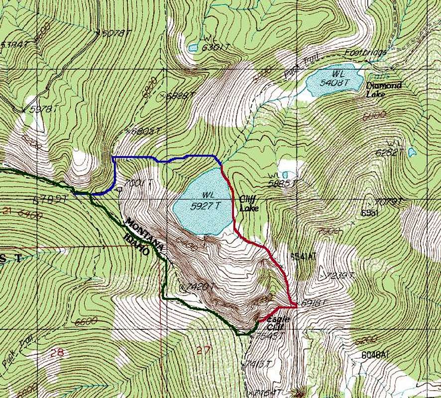
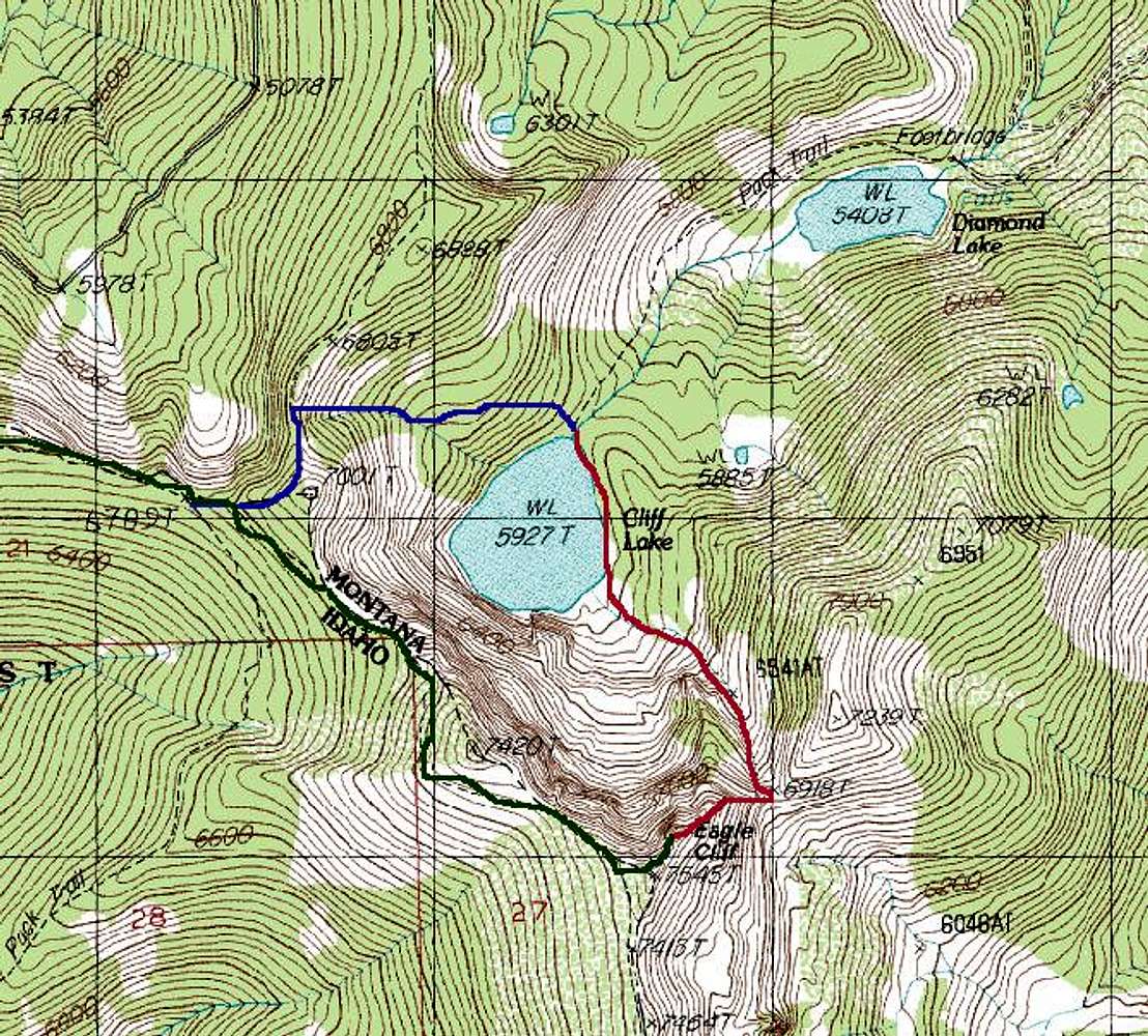
Topo Map section (Torino Quad) showing the routes to Eagle Cliff Peak. Green is the State Line Trail route, red is the NW Gully route and blue is the bushwhack descent route via the State Line and Dry Creek Divide Trails.

Graphics, Monica Spicker
23 June, 2006


Comments

No comments posted yet.


Sign in to post!

Don't have an account? Register now.


Rate This Image
Current Score: 83.88

Log In To Vote
 Eagle Cliff Peak Trailheads (Trailhead)


You are at
the First
Image

Viewing
#1 of 2
GALLERY
Eagle Cliff Peak
NEXT »

 Moni's Image Gallery

Waxensteine
« PREV

Viewing
#262 of 358
GALLERY
Fred starting to rappel off...
NEXT »


 Eagle Cliff Peak (Mountain/Rock)


Image Data

MoniSubmitted by Moni
on Jun 26, 2006 6:33 pm

Image ID: 202927
Hits: 1436 

Lat/Lon: 47.12972°N / 115.18500°E


"I always arrive late at the office, but I make up for it by leaving early."   --Charles Lamb   

© 2006-2012 SummitPost.org. All Rights Reserved.