
|
|
Mountain/Rock |
|---|---|
|
|
47.44385°N / 122.09647°W |
|
|
King |
|
|
Hiking |
|
|
Spring, Summer, Fall, Winter |
|
|
840 ft / 256 m |
|
|
Overview
Squak Mountain with East Cedar Mountain on the right side
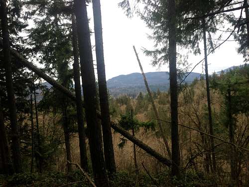
East Cedar Mountain is located on the northeast section of the Lake Desire County Park in King County. Though many people hike within hundreds of feet of the summit few ever reach the true summit of East Cedar Mountain. That is because there is no trail to the summit and one must bushwhack up to the true summit of East Cedar Mountain. This is the less traveledof the two mountains. This mountain would definitely benefit from a pavedtrail, but there is a well hidden boot-path behind the mountain from the north side.For those look for a view there is a view through the trees looking east at the Cascade Range. The view is not amazing but on a clear day you can see some mountains through the thinner woods. The top is presently littered with beer bottles and what looks to be an illegal camping area so use caution when tagging the summit.
 View of East Tiger from the summit. View of East Tiger from the summit. |  Looking at the Cascade Front. Looking at the Cascade Front. |
Getting There
From Maple Valley Highway south of 405: Take Maple Valley Highway down to 196th Avenue Southeast and turn right if you are heading north or left if from the south. Go one mile to Southeast 183rd. Take one right and then another quick right onto Spring Lake Drive. Take Spring Lake Drive about one mile to the gate where there will be some parking slots to your right.Avoid parking at the boat launch area. A Vehicle Access Permit is required there.Route
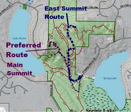
Map of the Route
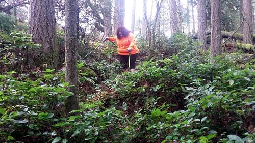
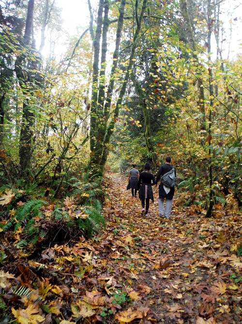
Heading up to the the base of the summit rocks here is clear the easy part of the trip. The trail are very easy to follow right up to the base of the bushwhack or scramble/bushwhack depending on which way you go. There is a hard to see boot-path from the north of summit rocks but it can be very hard to see from the trail. The footing on this boot-path can be iffy but this way would be the recommended way to get to the summit.
Heading down
There is also a harder way to reach the summit for those of you who want more of a challenge. If you go directly off the trail right at the base of the steep eastern slope there is a Class 2 scramble/bushwhack that can be quiet tough with poor footing. We thought it was the only way up. I had to literally pull my weight and my entire body weight up the rock and up the trees and the mud. I literally pulled my own body weight up on the rock and used muscles I did not even know I had due to bad shoulders from a horrible car accident I had a couple years back. Luckily we found a better way down.
 Celebrating after going up one of my more intense scrambles. We went down a far better way. Celebrating after going up one of my more intense scrambles. We went down a far better way. |  The Maane Event summits East Cedar Mountain The Maane Event summits East Cedar Mountain |
Red Tape
The park is open from dawn to dusk every day of the year.When to Climb
Fall may be the prettiest time to come here.
This mountain can be climbed at any time of the year. It is a very short hike and can be done in a short amount of time.
Camping
Ignore that there is an illegal camping area right at the summit of East Cedar Mountain because camping is prohibited on the mountain!!External Links
Links to this summit are very limited. Here is the only major one that I could find.East Cedar Mountain Peakbagger Page