Toggle navigation
Mountains
Routes
Images
Trip Reports
Forum
What's New
People
Areas & Ranges
Articles
Trailheads
Canyons
Huts & Campgrounds
Albums
Logistical Centers
Fact Sheets
Lists
Custom Objects
Gear
Plans & Partners
WELCOME TO SUMMITPOST
SIGN IN
REGISTER
Mountain Loop Highway
Additional Parents
North Cascades
Sloan Peak
Zekes Peak
Hard Pressed Success on Mount Zekes
Image
East Mountain Loop Highway
View High-Resolution Image
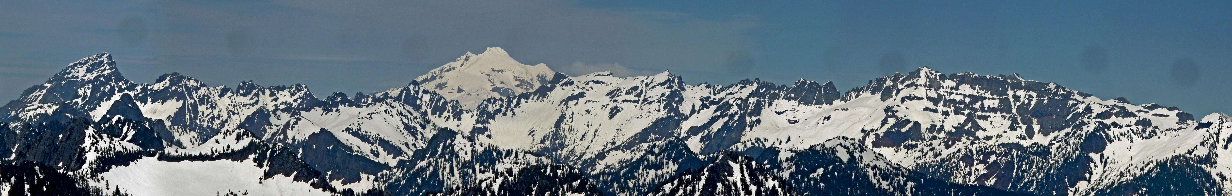
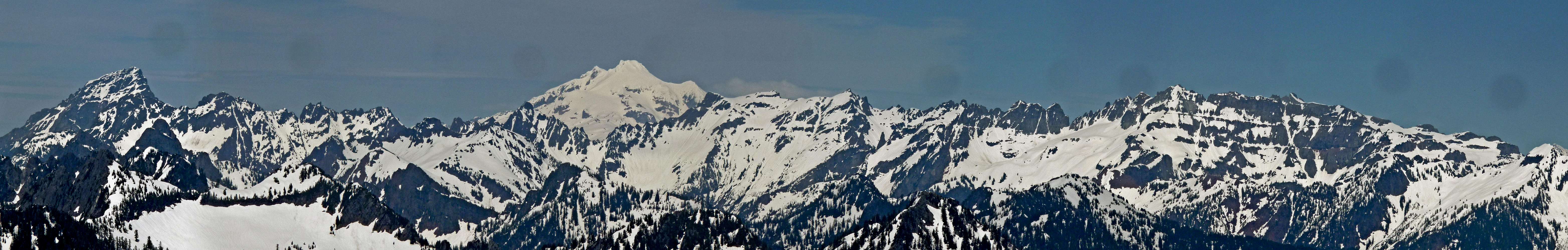
East Mountain Loop Highway
This is the Eastern Part of the Mountain Loop Highway, taken from Mount Zekes on June 21, 2011. To the left is Sloan Peak, the volcanoe near the middle is Glacier Peak, and to the right is Colubmia Peak.
« PREV
NEXT »
Josh Lewis
on
Jul 2, 2011 1:48 am
Comments & voting
Other parents
Image Type(s):
Panorama
Image ID:
726013
5849 Hits
73.06
% Score
3
Votes
Log in to vote
Comments
No comments posted yet.
to post!
Don't have an account?
North Cascades
(Area/Range)
« PREV
Viewing
#717 of 1088
GALLERY
NEXT »
Josh Lewis's Image Gallery
« PREV
Viewing
#1815 of 4303
GALLERY
NEXT »
Mountain Loop Highway
(Area/Range)
Loading....
Sloan Peak
(Mountain/Rock)
Loading....
Zekes Peak
(Mountain/Rock)
Loading....
Hard Pressed Success on Mount Zekes
(Trip Report)
Loading....
×
You need to login in order to vote!
User Name
Password
Remember me
Forgot your password?
Log me out when I close my browser.
Keep me logged in all the time.
sign in as a user
Don't have an account?
Register now for FREE
Rating available
Suggested routes for you
People who climb the same things as you
Comments Available
Create Albums
Register Here


