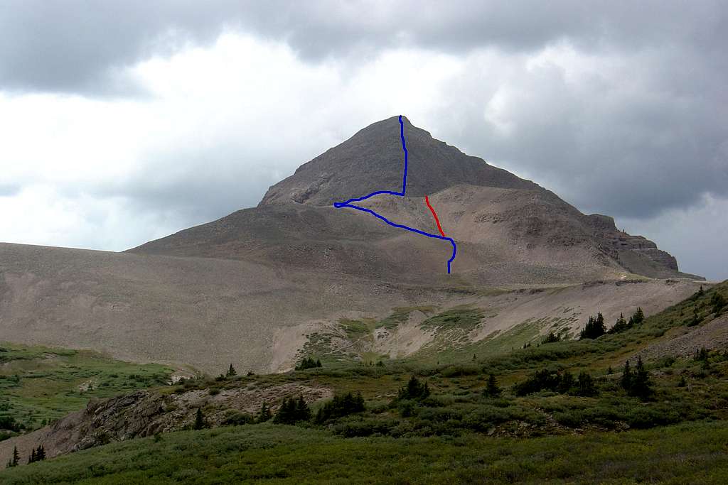
We followed the blue line to the top. From the broad saddle, there is a mildly steep scree trail that leads to a ramp, which we followed to the left (south), then back around to the northwest. There is also a scree route up the red line that has clearly been used, but it looked gruesome. All of this was relatively straightforward compared to the climb up the cone, which is very steep and loose. (August 2006)
