Welcome to SP!  -   
 
  MbPost.com -- It's SP for Mountain Biking!
Areas & Ranges·Mountains & Rocks·Routes·Images·Articles·Trip Reports·Gear·Other·People·Plans & Partners·What's New·Forum

Eastern Uinta Panorama

 
[ Sizes: Orig | Large | Med | Small | Thumb ]
Eastern Uinta Panorama
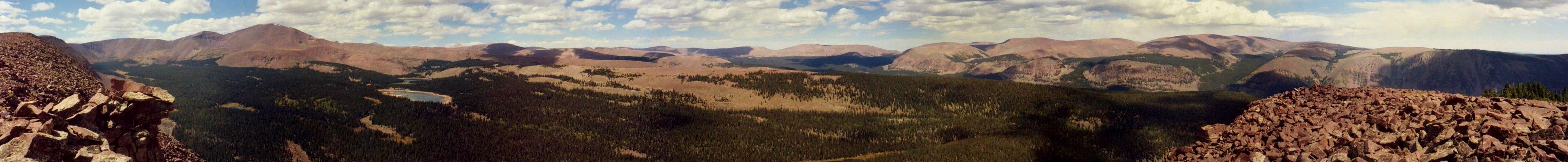
A Panorama taken from the ridge southeast of Mount Emmons (that leads to Lost Benchmark). Visible left to right: Krebs Basin, Mount Emmons, the Chain Lakes, the Uinta River Canyon and the High Bolly country looking towards Clover Benchmark. September 2004.


Comments

No comments posted yet.


Sign in to post!

Don't have an account? Register now.


Rate This Image
Current Score: 86.47

Log In To Vote
 High Bollies/Eastern Uintas (Area/Range)

Ashley Gorge
« PREV

Viewing
#7 of 15
GALLERY
Marsh Peak (north summit) to...
NEXT »

 jfrishmanIII's Image Gallery

Owachomo
« PREV

Viewing
#94 of 152
GALLERY
A-1 Peak
NEXT »


 Mount Emmons (Mountain/Rock)


Image Data

jfrishmanIIISubmitted by jfrishmanIII
on Dec 9, 2006 10:44 pm

Image ID: 250270
Hits: 1225 

Lat/Lon: 40.68689°N / 110.2327°W

Image Type(s): Panorama


"I'm a great believer in luck, and I find the harder I work the more I have of it."   --Thomas Jefferson   

© 2006-2012 SummitPost.org. All Rights Reserved.